India: Position & Physical Divisions
India's Spatial Framework & Himalayan System
Geolocation & Frontiers
Geolocation & Frontiers
| Cue Words | Notes |
|---|---|
| State the absolute latitudinal and longitudinal boundaries of India. | Spatio-Temporal Limits:
|
| Which Indian states lie on the Standard Meridian and the Tropic of Cancer? | Socio-Political Lines:
|
Himalayan Orography & Tectonic Divisions
Himalayan Orography & Tectonic Divisions
| Cue Words | Notes |
|---|---|
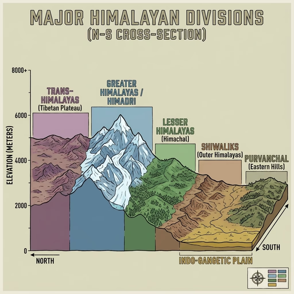
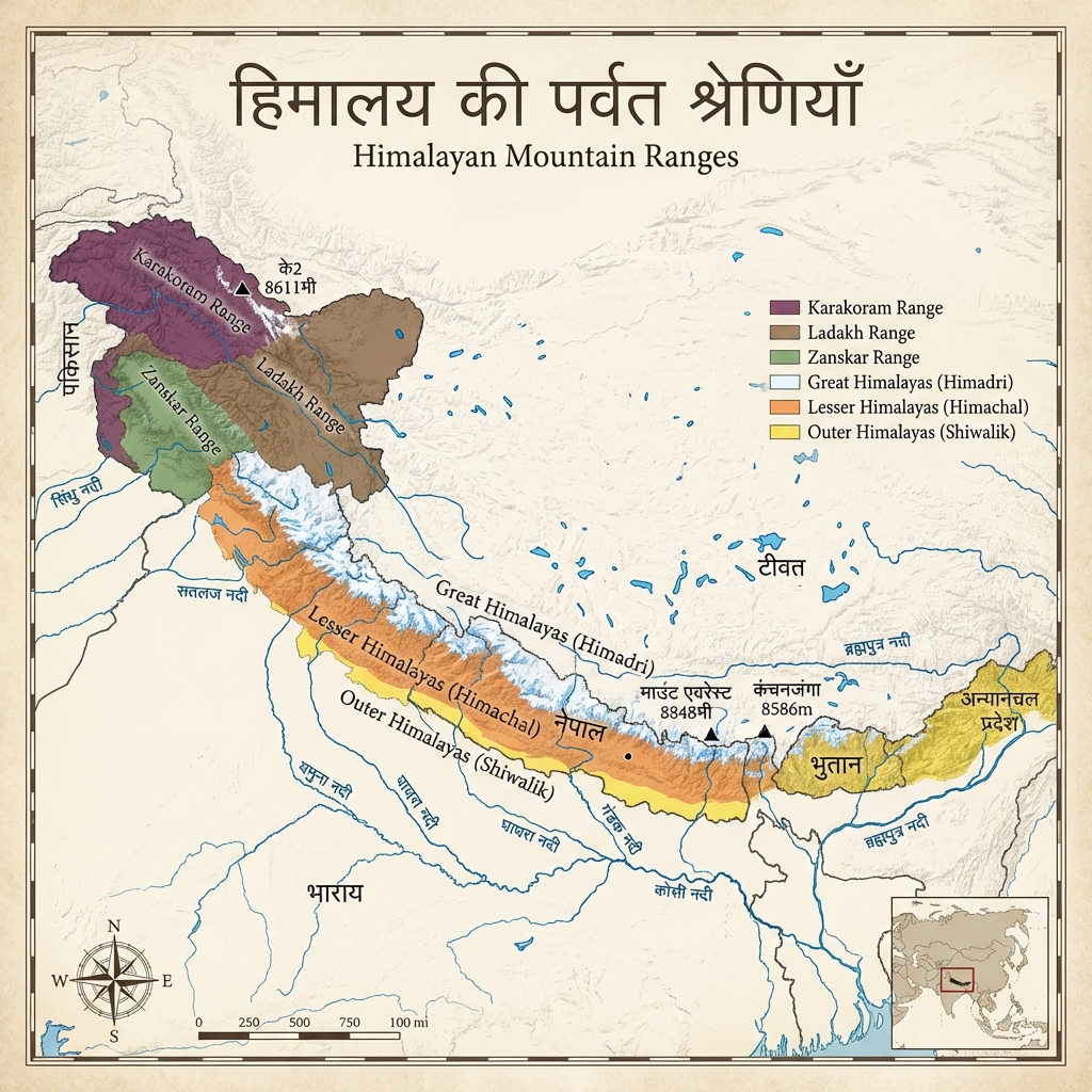
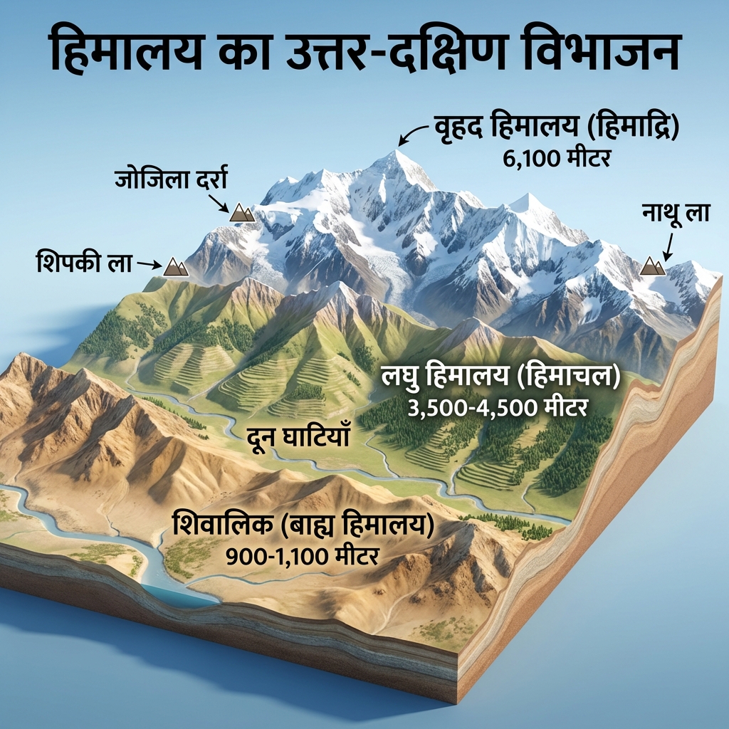
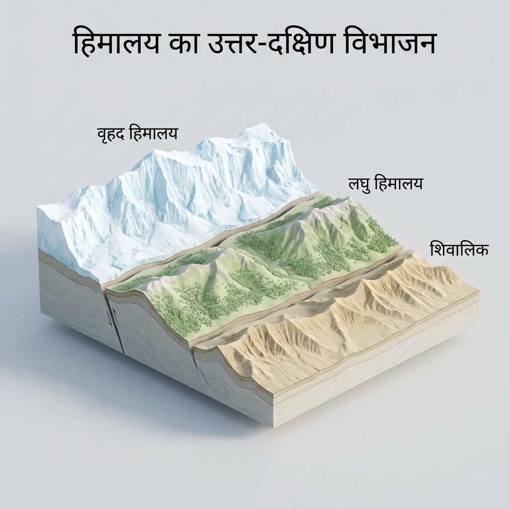
| Explain the structural characteristics of the parallel Himalayan mountain ranges. | Himalayan Ranges (North to South):
|
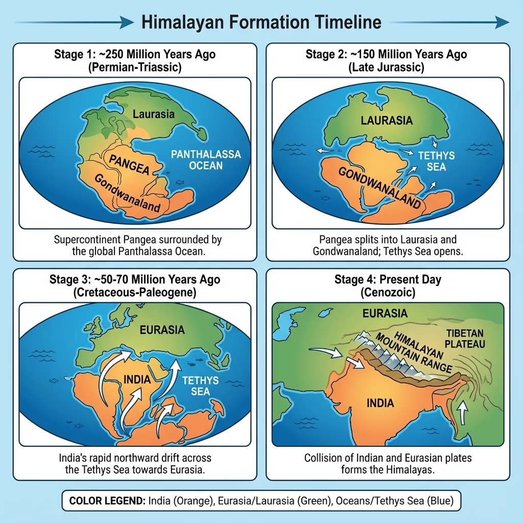
| How did the Himalayas form? Name the major mountain passes. | Tectonic Genesis: Formed due to the continent-continent collision of the Indo-Australian plate and the Eurasian plate, which buckled the sediment of the intervening Tethys Sea into young fold mountains.
|
Plains, Plateaus, Coasts & Islands
Great Northern Plains Stratigraphy
Great Northern Plains Stratigraphy
| Cue Words | Notes |
|---|---|
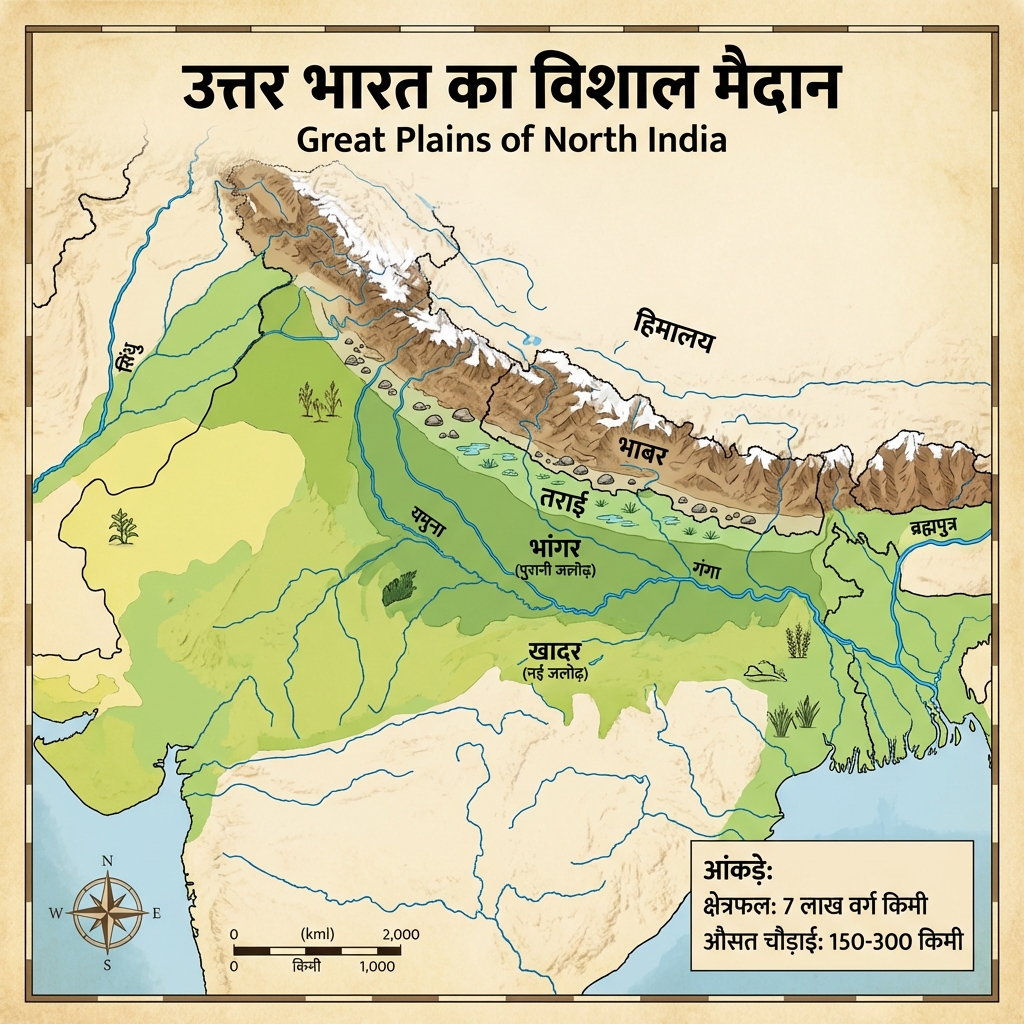
| Compare the geological profiles of Bhabar, Tarai, Bhangar, and Khadar. | Morphological Belts of the Plains:
|
Peninsular Plateau & Volcanic Deccan Trap
Peninsular Plateau & Volcanic Deccan Trap
| Cue Words | Notes |
|---|---|
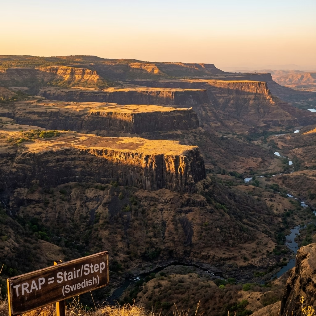
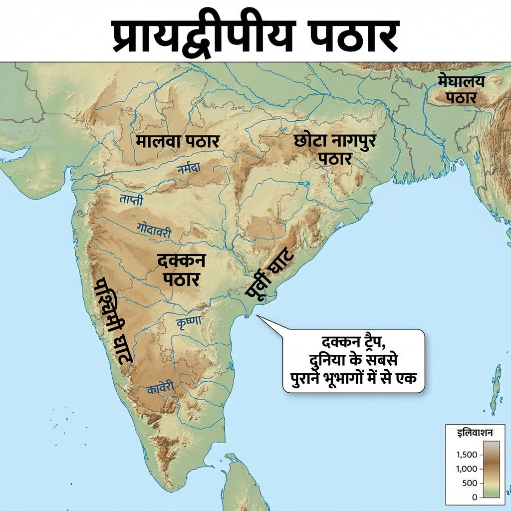
| Describe the tectonic origin of the Peninsular Plateau and the Deccan Trap. | Plateau System:
|
Coastal Plains & Asymmetrical Coastlines
Coastal Plains & Asymmetrical Coastlines
| Cue Words | Notes |
|---|---|
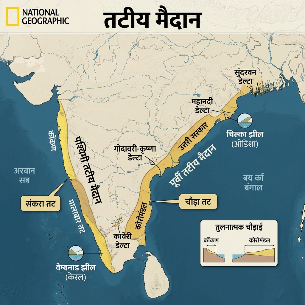
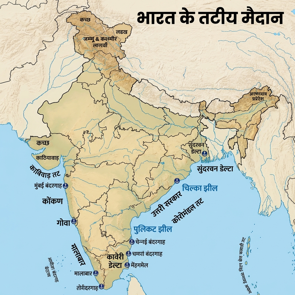
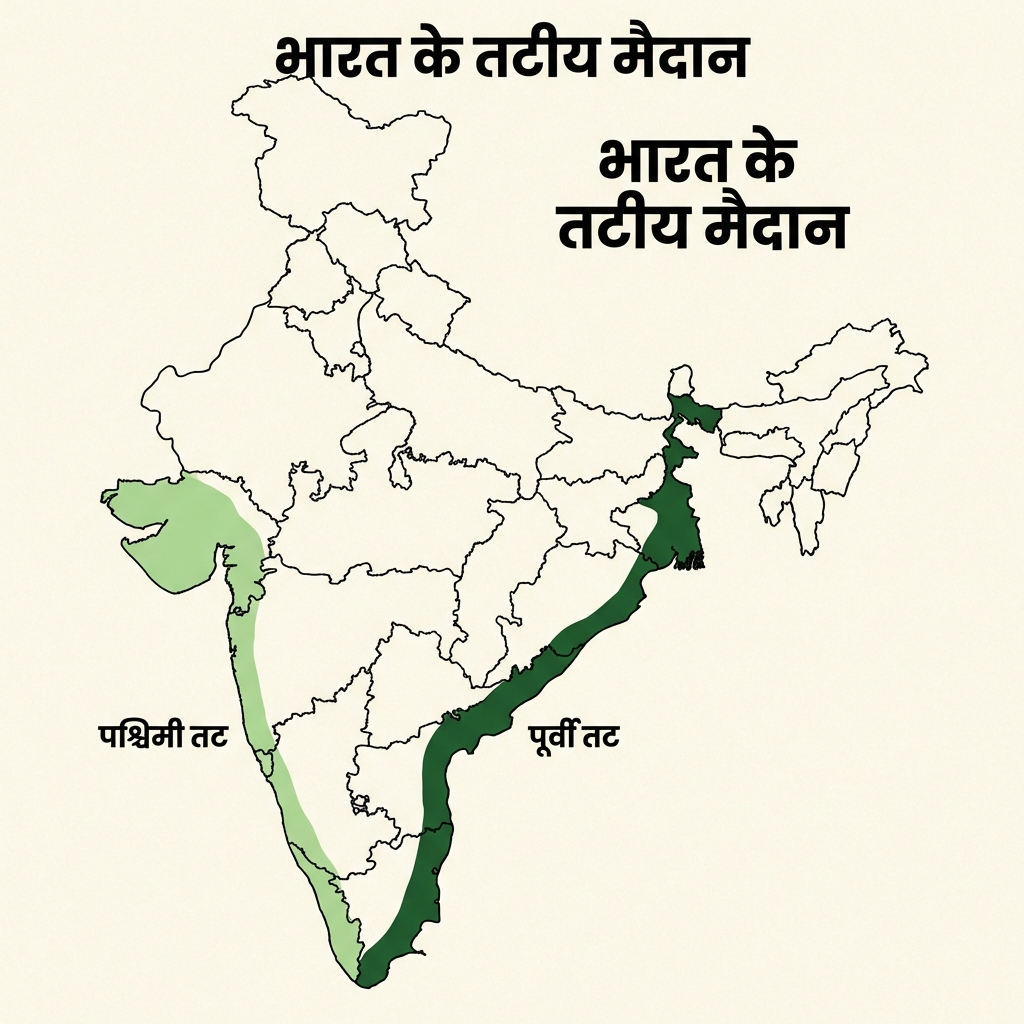
| Contrast the Western and Eastern Coastal Plains of India. | Coastal Asymmetry:
|
Island Archipelagos & Desert Systems
Island Archipelagos & Desert Systems
| Cue Words | Notes |
|---|---|
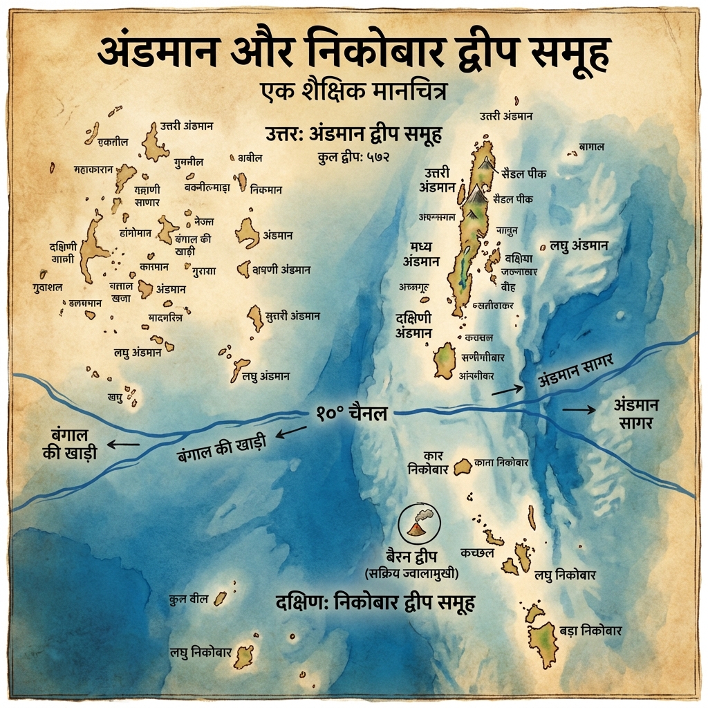
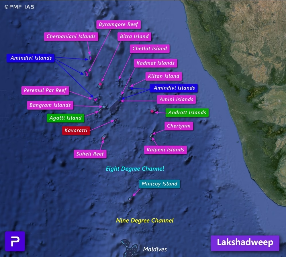
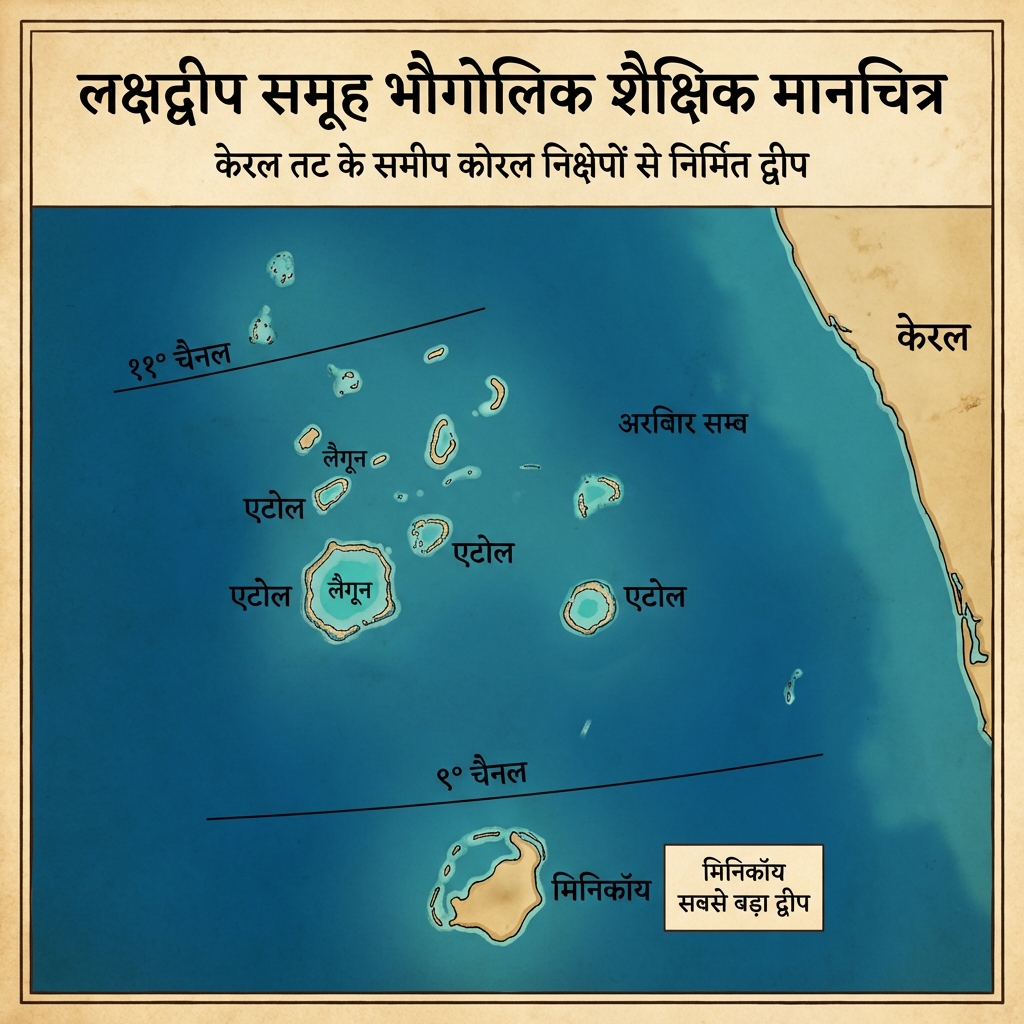
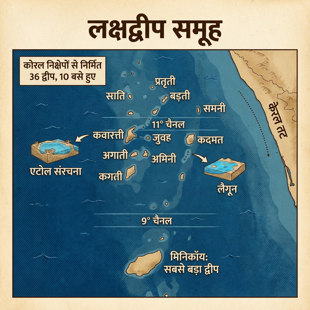
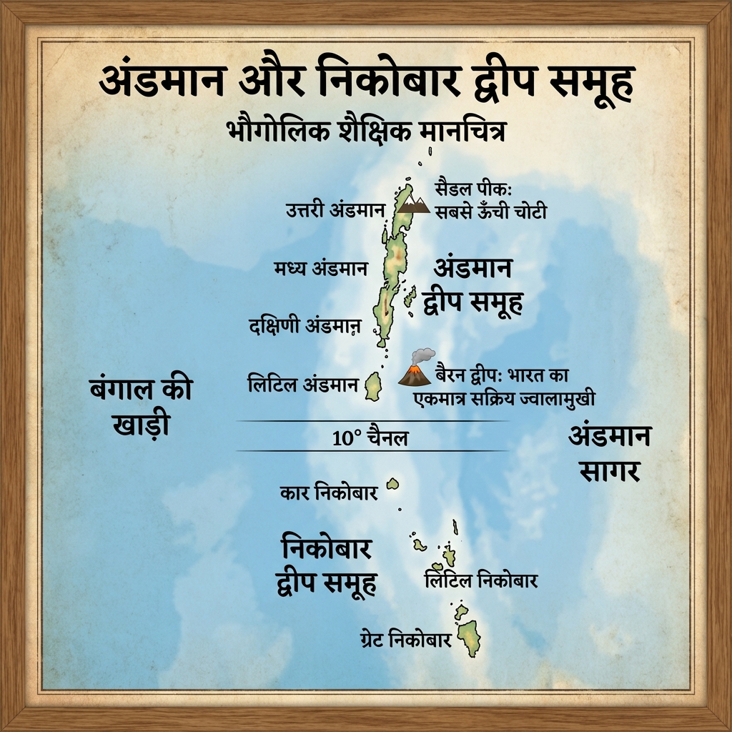
| Contrast the geomorphic origins of the Andaman & Nicobar and Lakshadweep islands. | Indian Islands:
|
| Explain the geographic constraints of the Thar Desert. | The Thar Desert (Great Indian Desert): Located west of the Aravalli Range. It remains arid and dry because:
|
High-Yield UPSC Revision Pointers
- Ten Degree Channel: The oceanic channel separating the Andaman group (Little Andaman) from the Nicobar group (Car Nicobar) at latitude.
- Tropic and Meridian Intersection: The Tropic of Cancer and Standard Meridian intersect at Koriya district in the state of Chhattisgarh.
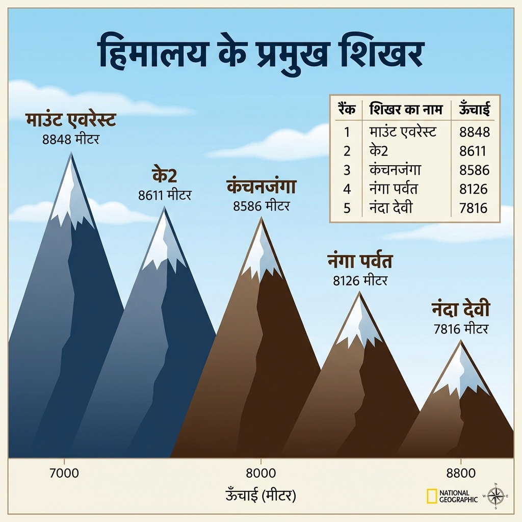
- Kanchenjunga: Standing at 8,586 meters on the Sikkim-Nepal border, it is the highest mountain peak in India's sovereign territory.
- Bhabar Stream Disappearance: The highly porous pebble beds of Bhabar cause streams to sink and disappear, only to emerge downstream in the marshy Tarai belt.
⛰️ Purvanchal Hills (Eastern Extension of the Himalayas)
- Purvanchal: The collective name for the hill ranges in India's North-East where the Himalayas take a sharp southward bend after the Namcha Barwa syntaxis, forming a north-south trending chain distinct from the east-west Himalayan arc.
- Constituent Ranges (north to south): Patkai Bum, Naga Hills, Manipur Hills (around Loktak Lake), Mizo Hills (Lushai Hills), and the Tripura Hills — generally lower and structurally softer (sedimentary) than the main Himalayas.
- Significance: Acts as a natural boundary with Myanmar and forms the watershed between the Brahmaputra and the Irrawaddy (Myanmar) drainage systems.
Visual & Illustrative Assets
🖼️ Supplemental Asset Directory
- India as a Geographical Unit:
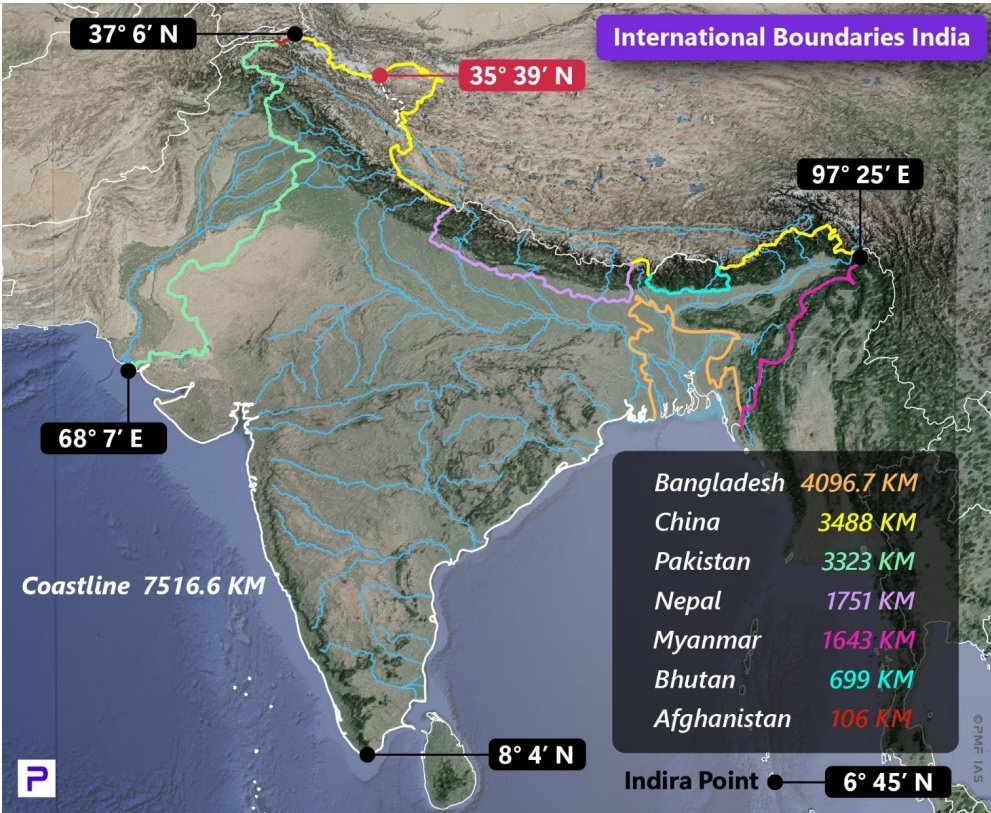
- India's Frontiers and Boundary Lines:
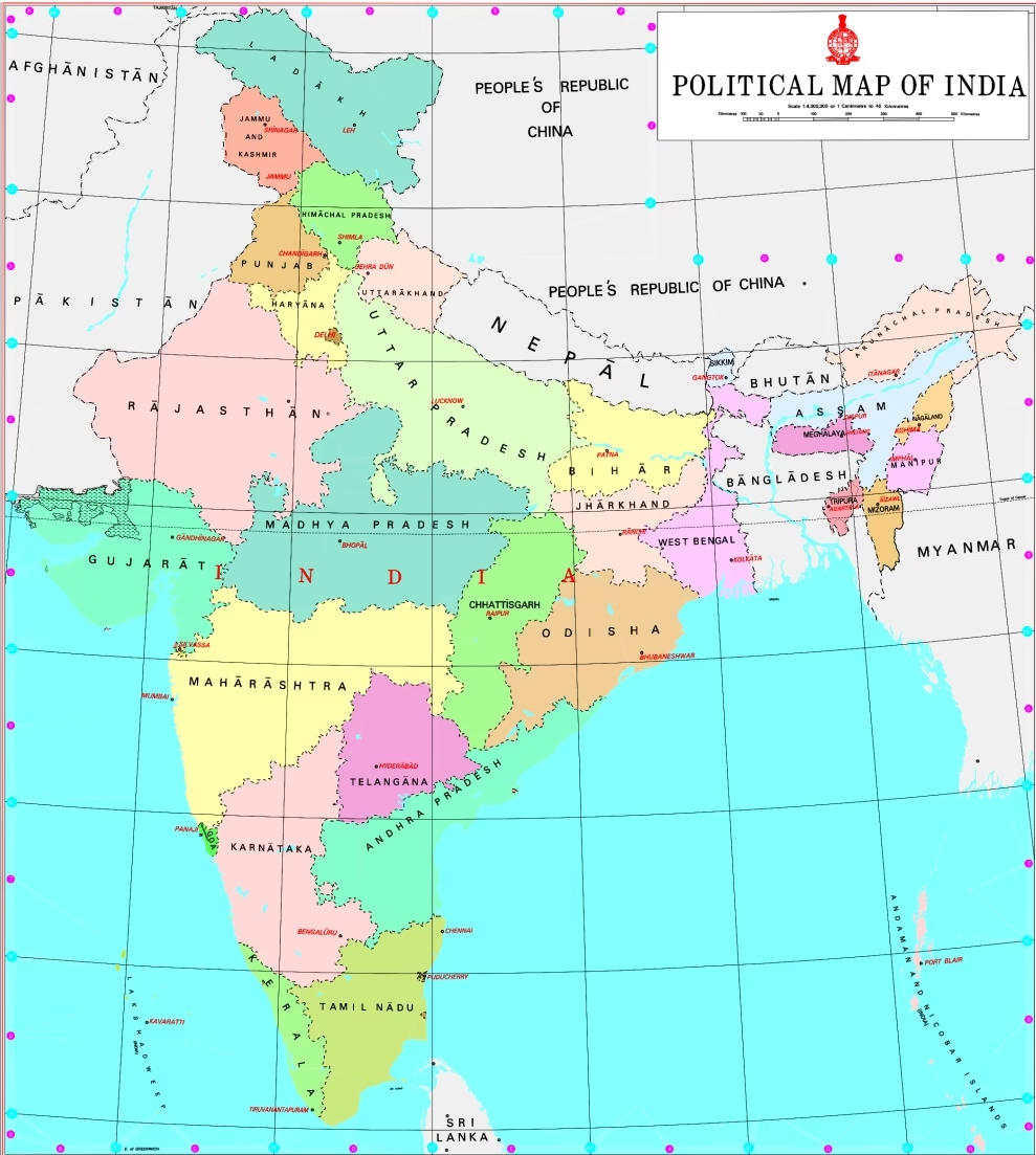
- India: Geographical Extent (Bhaugolik Vistar):
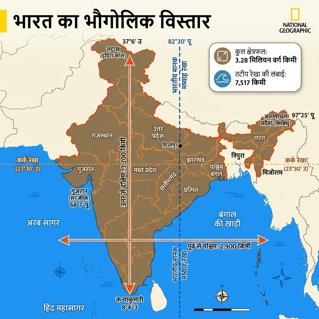
- India: Physiographic Divisions (Bhu-akriti):
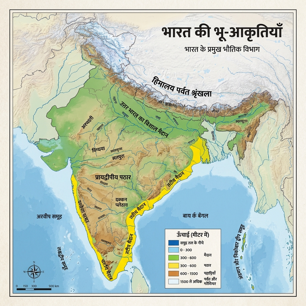
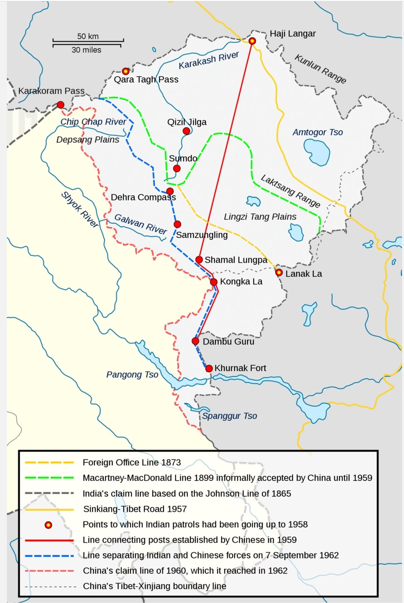
- Historical Boundary Lines and Frontier Regions:
- Physical Map of India (Major Divisions):
- Physiographic Divisions of the Himalayas:
- Himalayan Formation (Tectonic Collision):
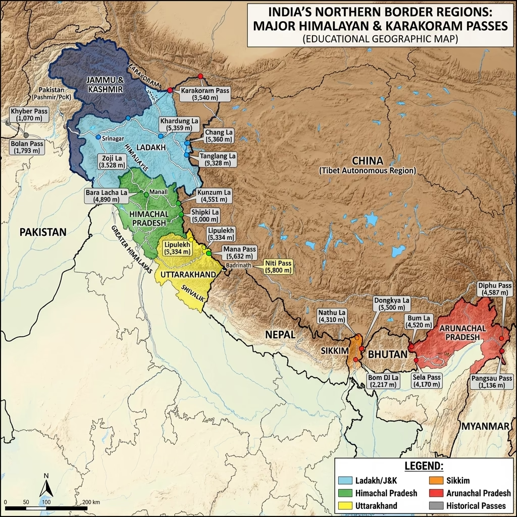
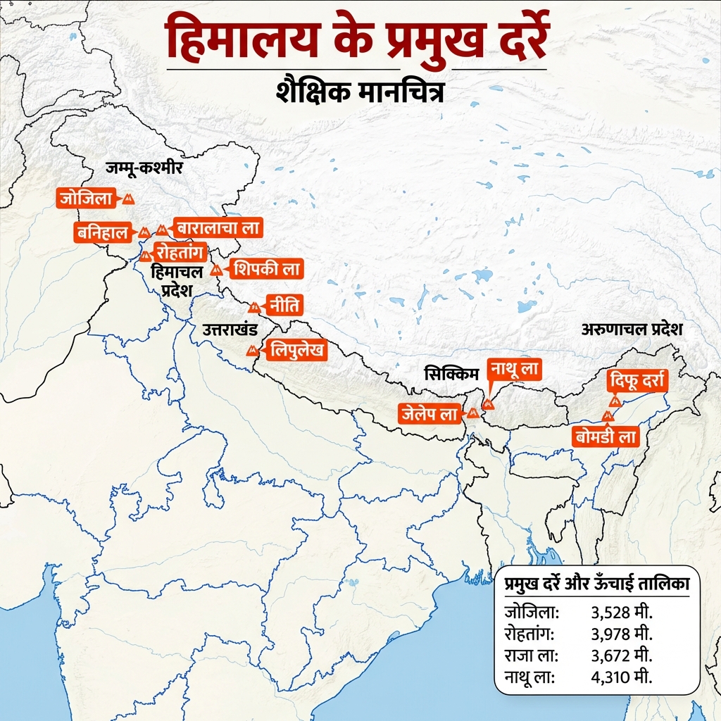
- Major Mountain Passes of India:
- Cross-section of Northern Plains:
- Great Northern Plains Overview:
- The Deccan Trap (Step-like Volcanic Formations):
- Western vs Eastern Ghats:

- Andaman and Nicobar Islands Overview:
- Andaman and Nicobar (Detailed Archipelago Map):
- India: Coastal Plains (Tatiya Maidan) Overview:
- Lakshadweep Islands Map:
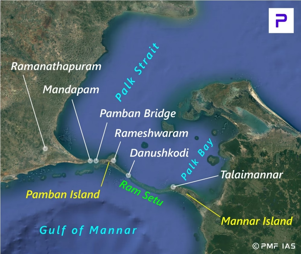
- India: Straits and Strategic Channels:
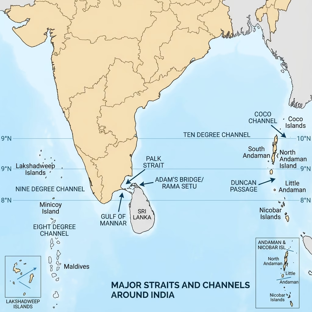
- India: Geographical Extent v2:

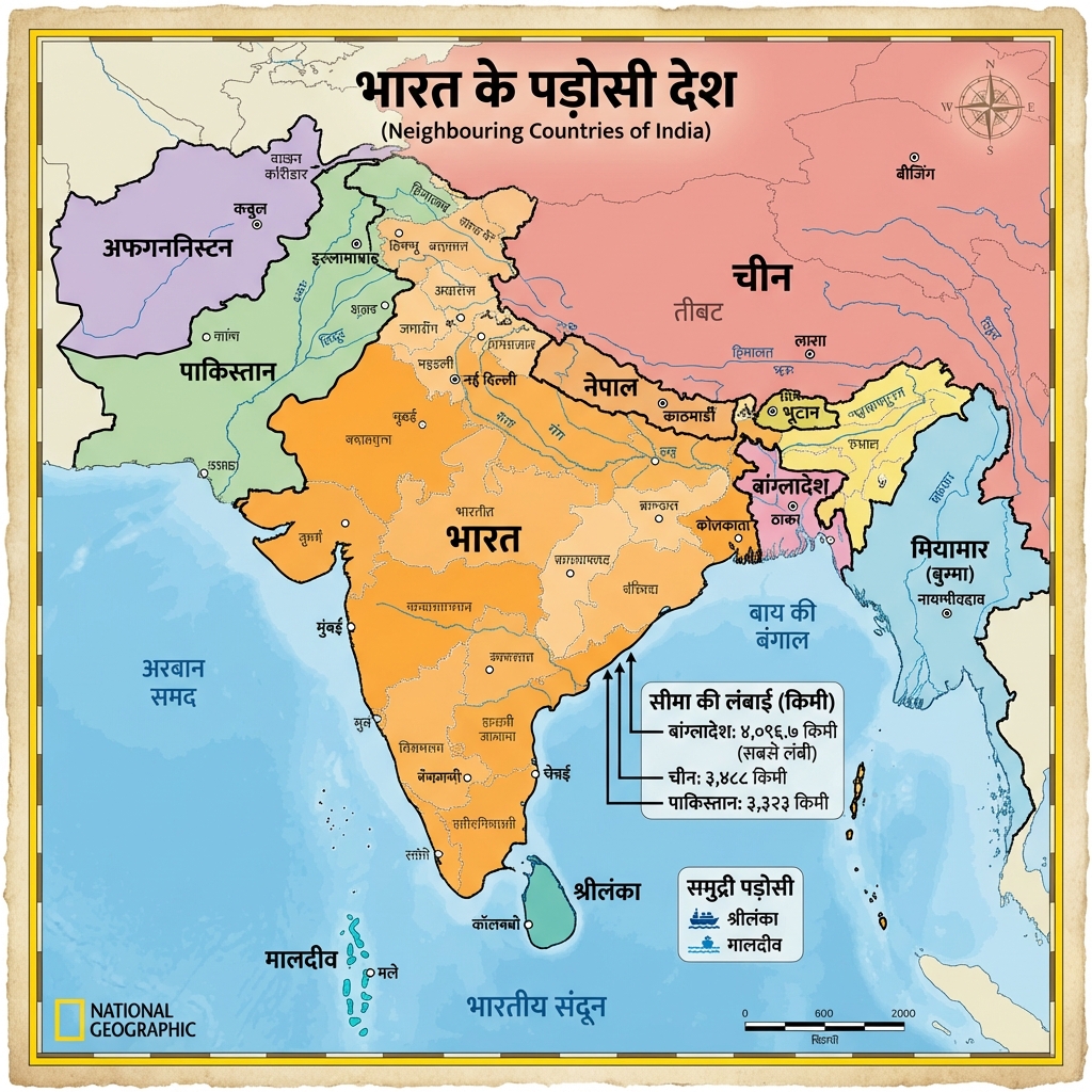
- India: Neighbors (Padosi Desh) Map:
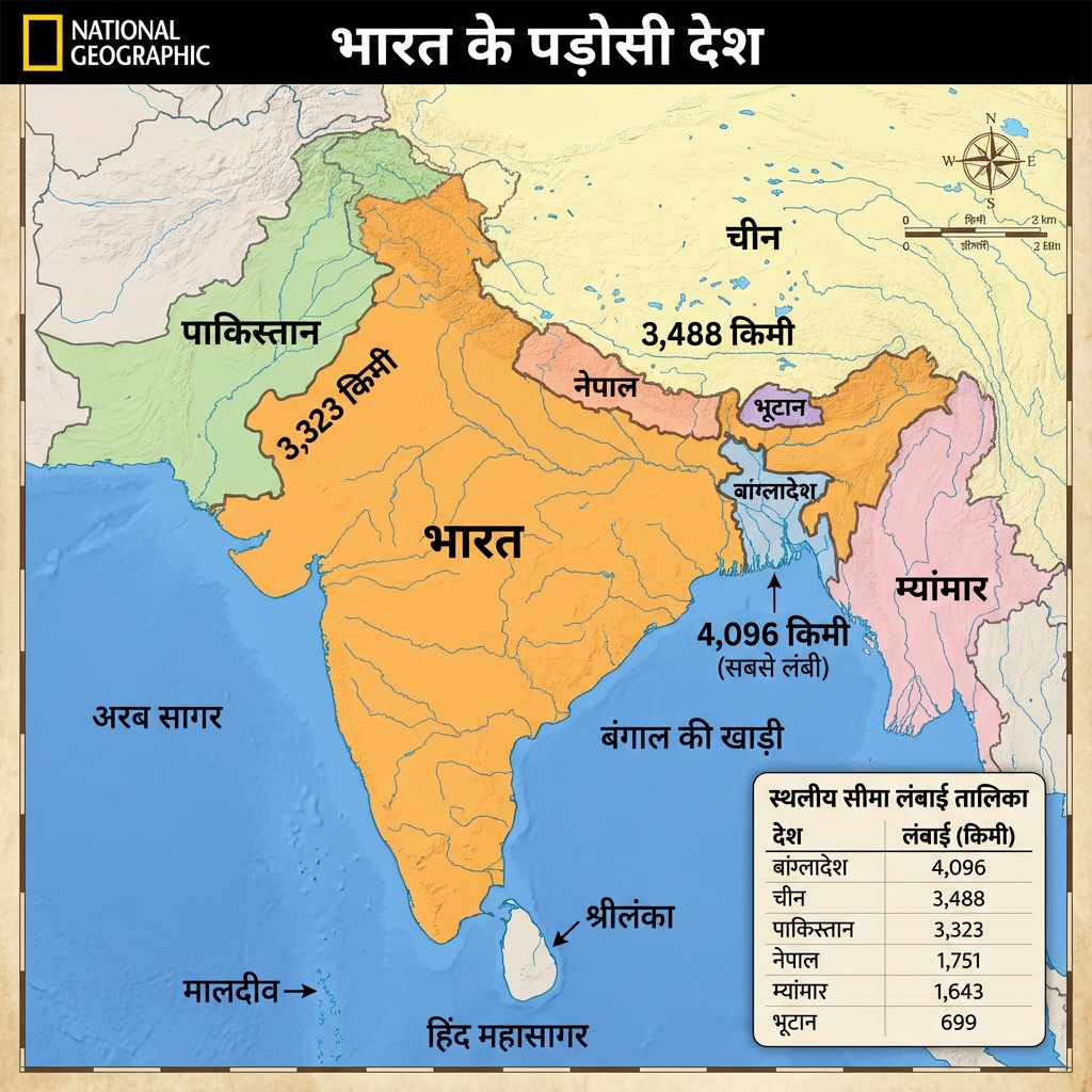
- India: Neighbors v2 Detailed Map:
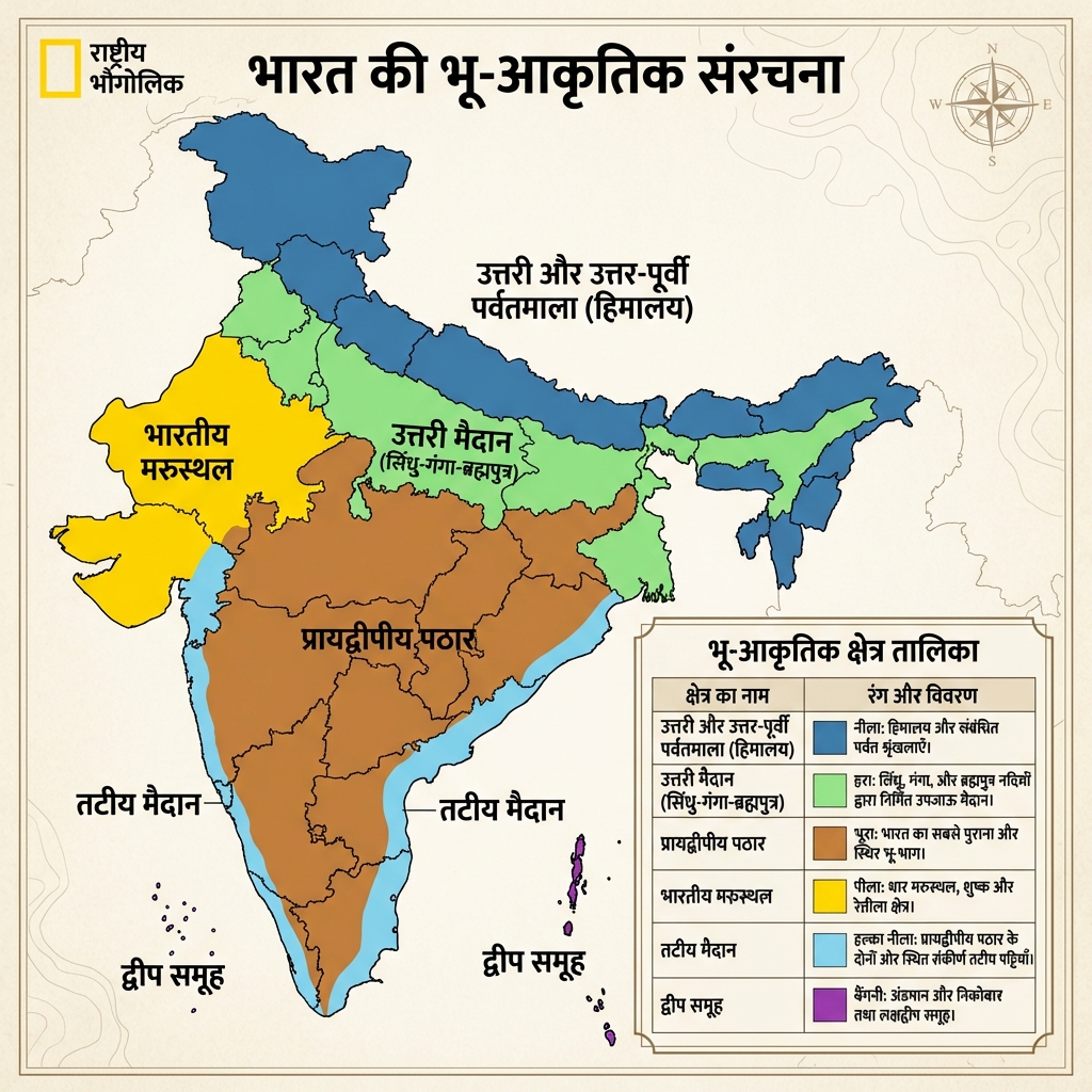
- India: Physiographic Divisions v2:
- Himalayan Ranges (Parvat Shreniya) Detailed:
- Himalayan Peaks (Pramukh Shikhar) Map:
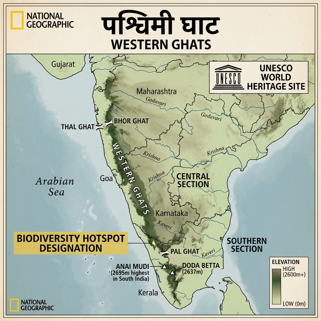
- Western Ghats (Pashchimi Ghat) Detailed:
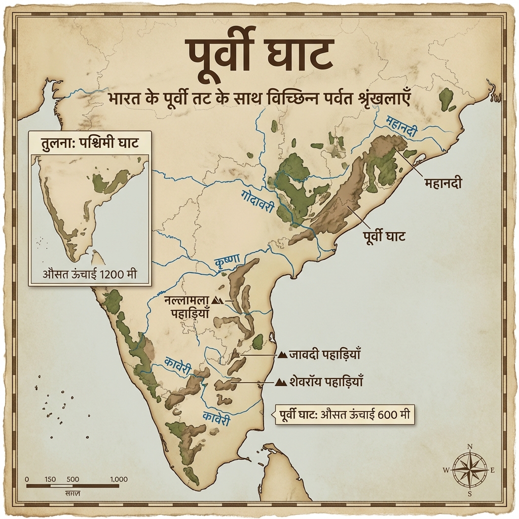
- Eastern Ghats (Poorvi Ghat) Detailed:
- Indian Islands (Dweep Samuh) Overview:
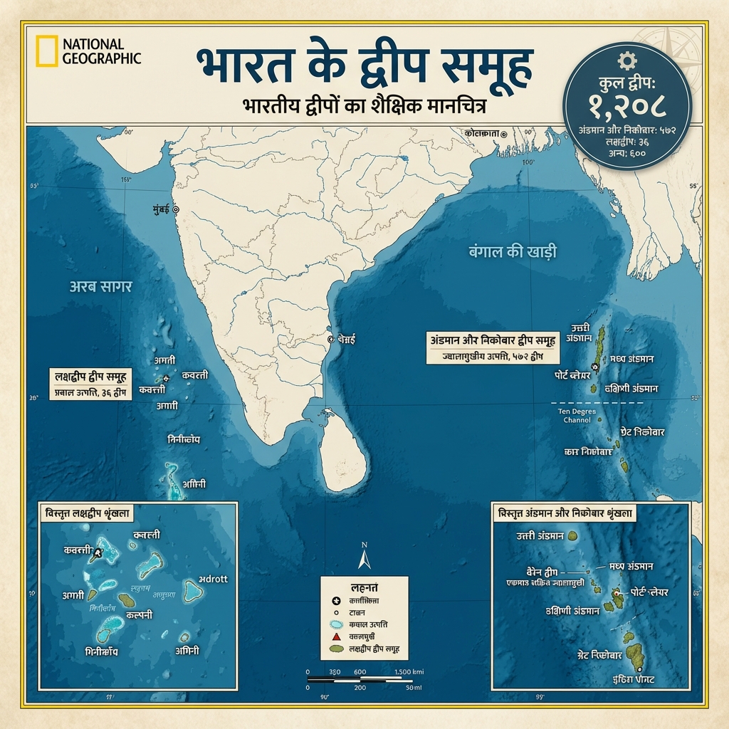
- Andaman & Nicobar v2:
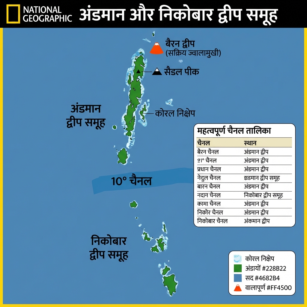
- Andaman v3 Detailed:
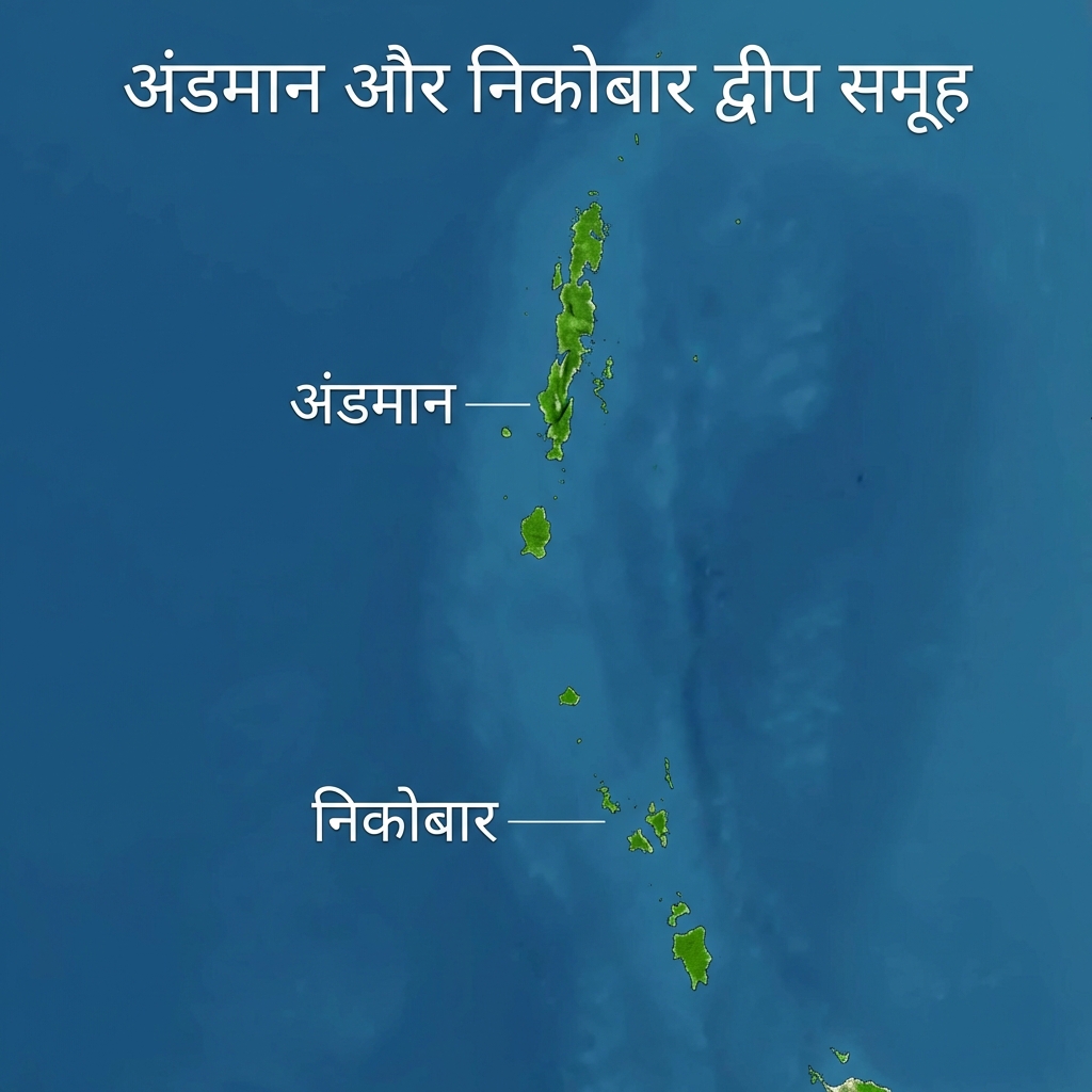
- Lakshadweep v2:
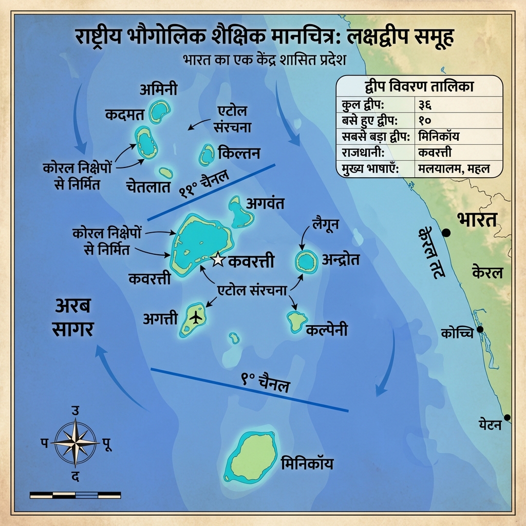
- Lakshadweep v3:
- Himalaya Cross-Section v2 (Alt):
- Himalayan Ranges v3:
- Himalayan Ranges v3 (Alt):
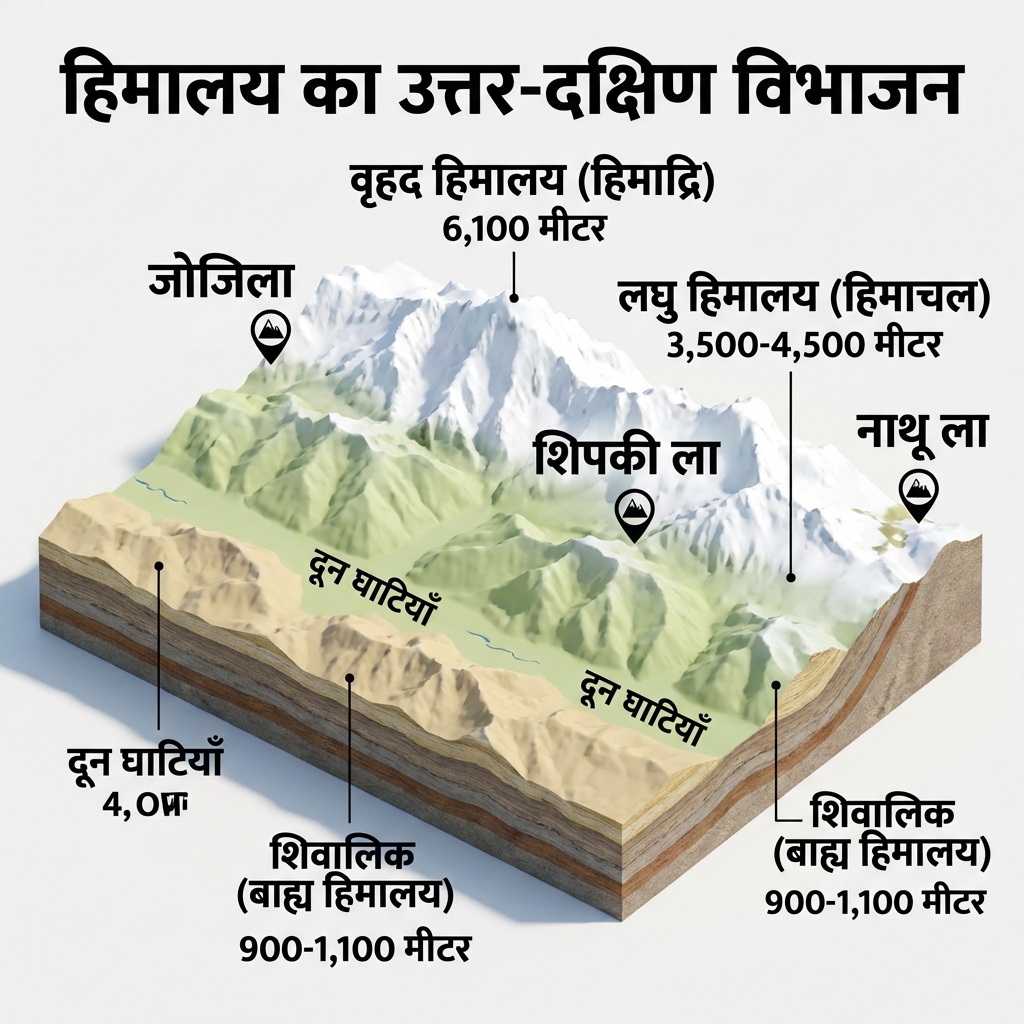
- Himalayan Passes (Himalaya Darre) v2:
- Peninsular Plateau (Prayadweepiya Pathar):
- Lakshadweep Islands: Physical Overview:
- Coastal Plains (Tatiya Maidan) Detailed Map:
- Coastal Plains (Tatiya Maidan) v2 Alt:
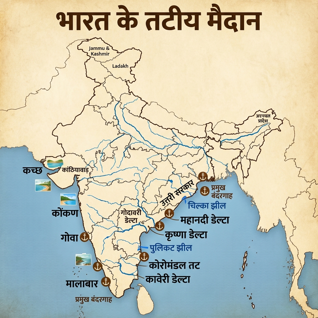
- Coastal Plains (Tatiya Maidan) v2 Detailed:
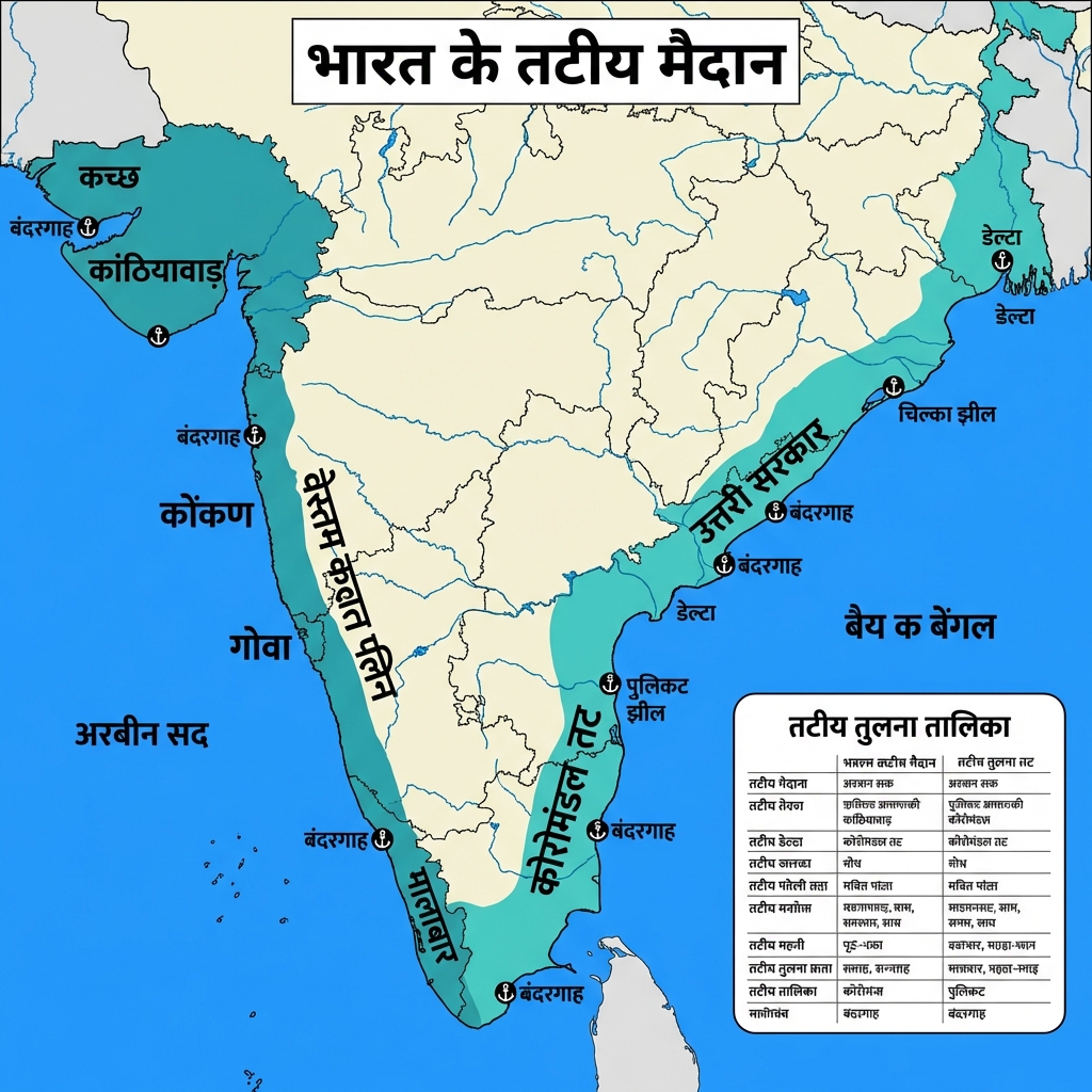
- Himalaya Cross-Section v1:
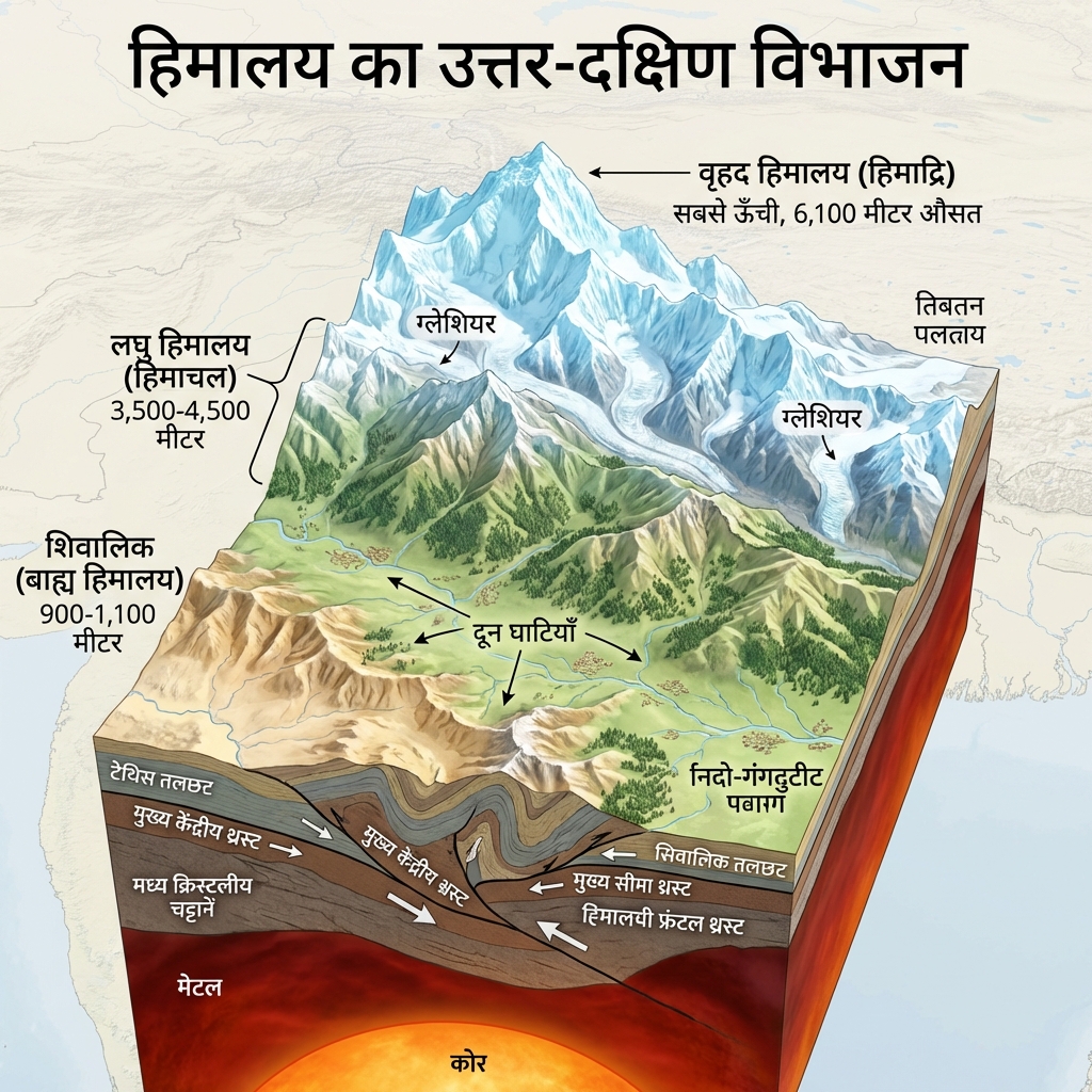
- Coastal Plains (Tatiya Maidan) v3:
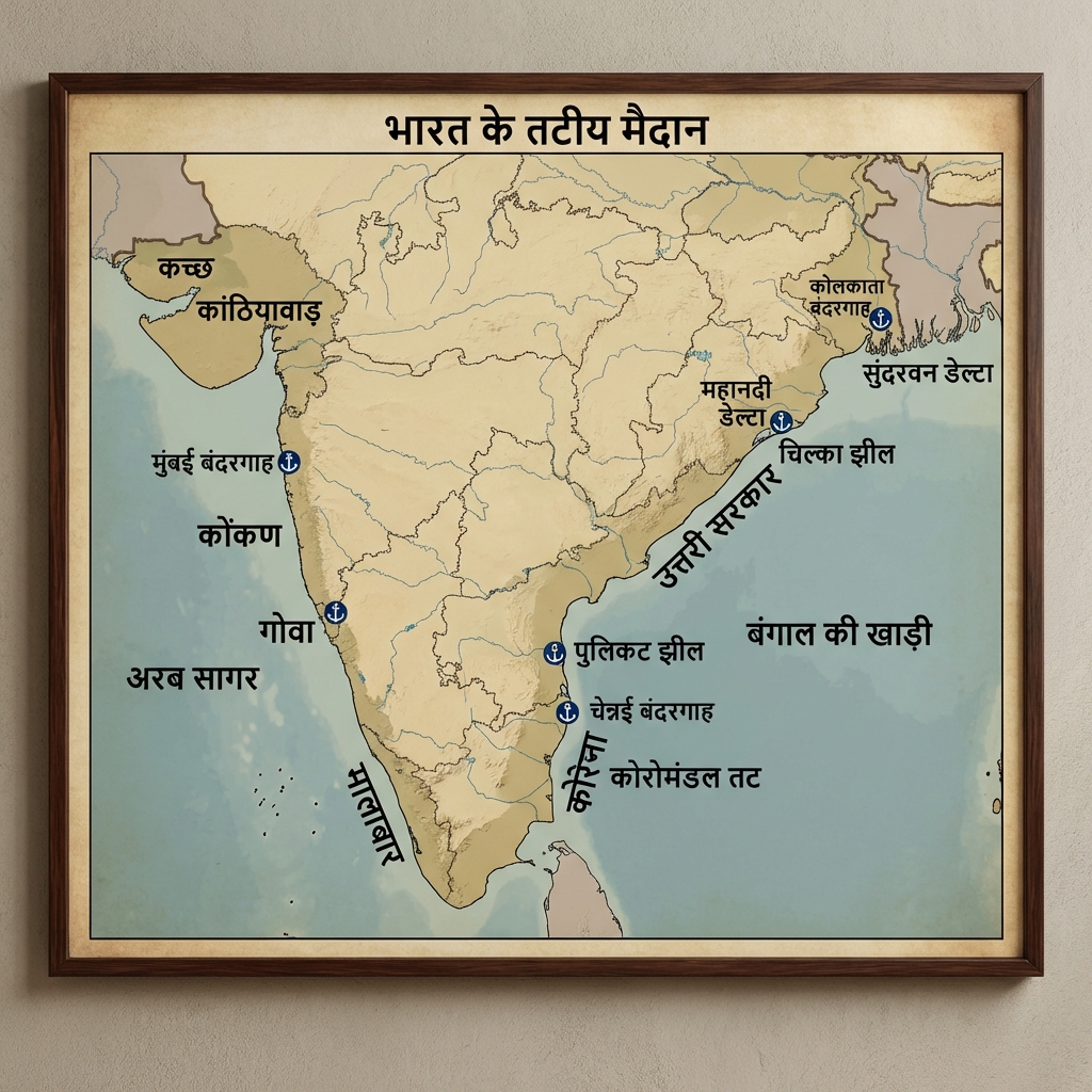
- Andaman v3 v2 Detailed:
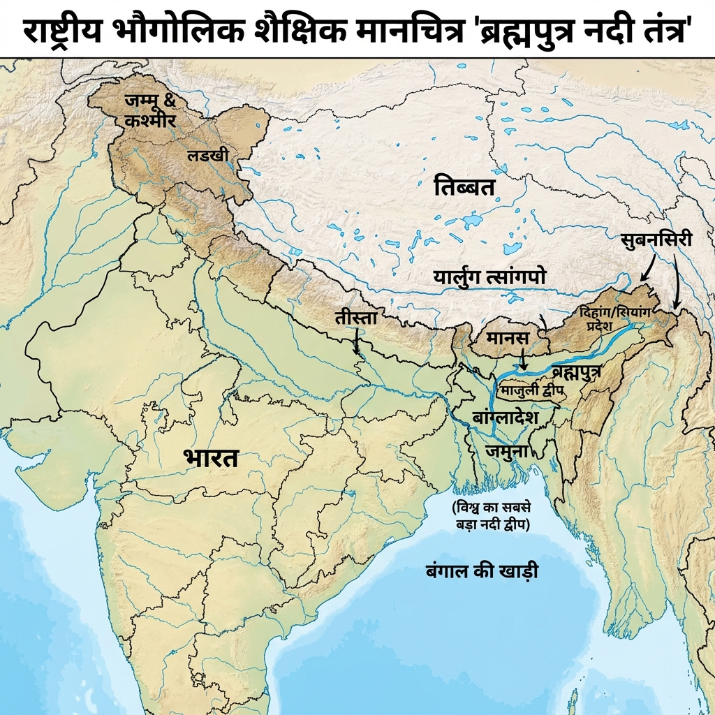
- Brahmaputra v4:
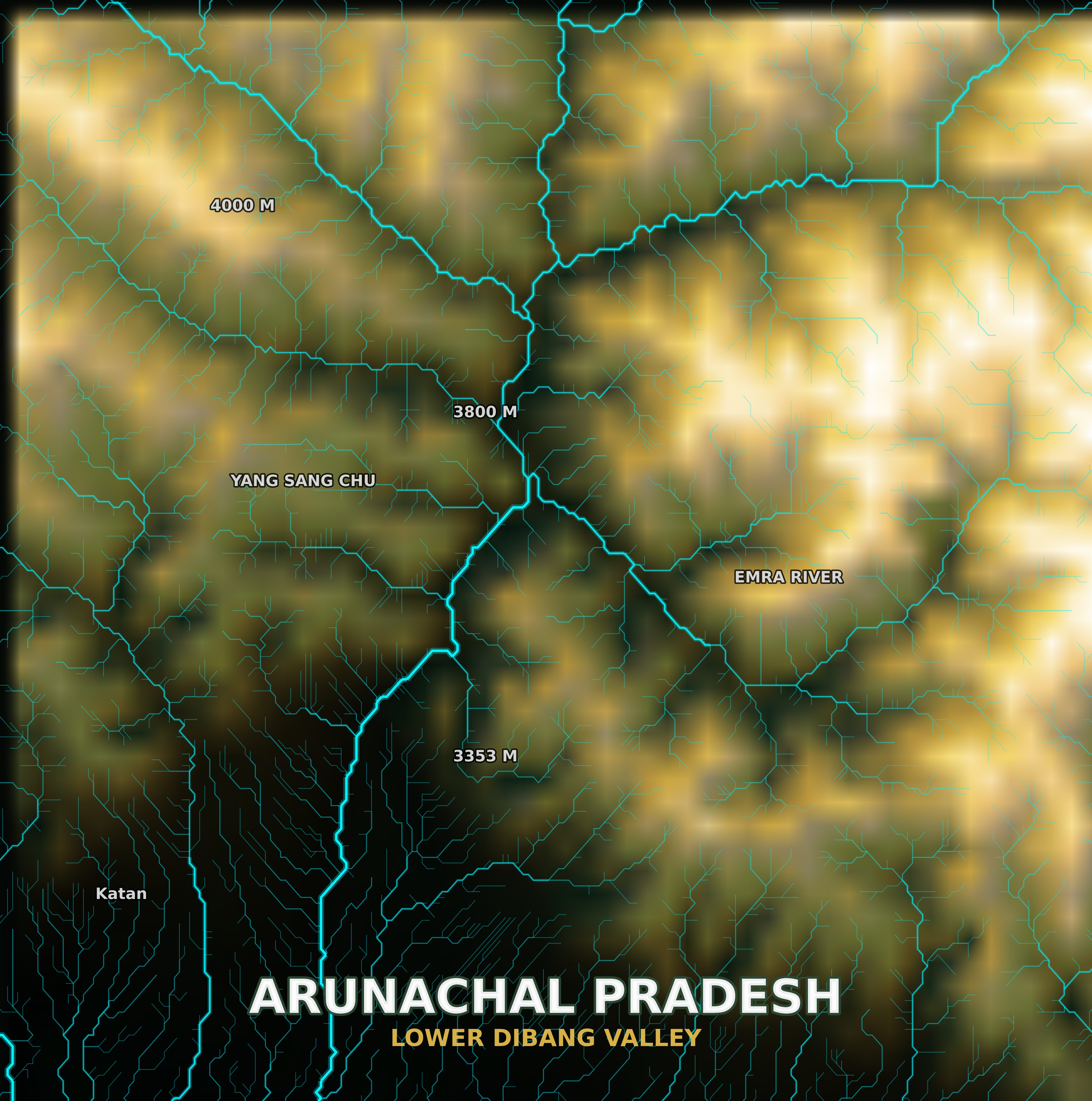
- Arunachal Pradesh: Landscape Replica/Model:
- Coastal Plains (Tatiya Maidan) Minimal:
Mains Practice Questions
- "Describe the Physiographic Divisions of India and their role in the country's economic development."
- "Explain the structural differences between the Himalayan Mountains and the Peninsular Plateau."
- "Analyze the factors responsible for the asymmetry between the Eastern and Western Coastal Plains of India."