Indian Resources, Agriculture & Industries
Forestry, Agriculture & Mineral Resources
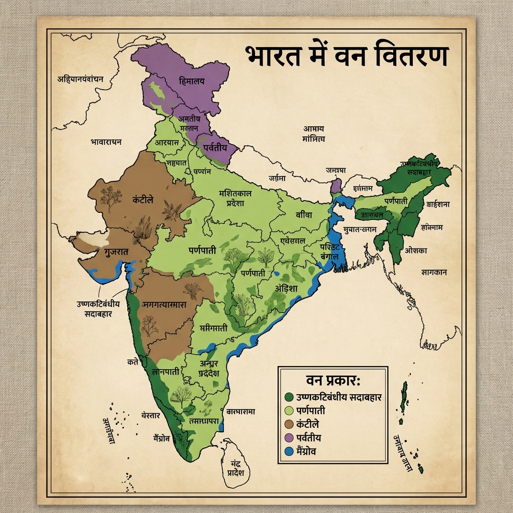
Forest Cover & Vegetation Statistics
Forest Cover & Vegetation Statistics
| Cue Words | Notes |
|---|---|
| State the key forest cover statistics from the India State of Forest Report (ISFR) 2021. | ISFR 2021 Key Findings:
|
Agriculture Systems & Irrigation Profiles
Agriculture Systems & Irrigation Profiles
| Cue Words | Notes |
|---|---|
| Compare the three main crop seasons in India and specify their planting periods. | Cropping Seasons:
|
| Analyze the major irrigation sources in India. | Irrigation Profile:
|
Mineral Distribution & Critical Mineral Mission
Mineral Distribution & Critical Mineral Mission
| Cue Words | Notes |
|---|---|
| Map the spatial distribution of major metallic, non-metallic, and strategic minerals in India. | Mineral Database:
|
| Outline the objective of the National Critical Minerals Mission (2025). | Critical Minerals Mission: A strategic initiative to identify, secure, and process 30 critical minerals (including Lithium, Cobalt, Nickel, and Rare Earth Elements) to reduce import dependency and secure high-tech supply chains for electric vehicles and clean energy. Notable lithium discoveries include Reasi (J&K) and Chhattisgarh. |
Industrial Geography & Infrastructure
Manufacturing Industries & Industrial Clusters
Manufacturing Industries & Industrial Clusters
| Cue Words | Notes |
|---|---|
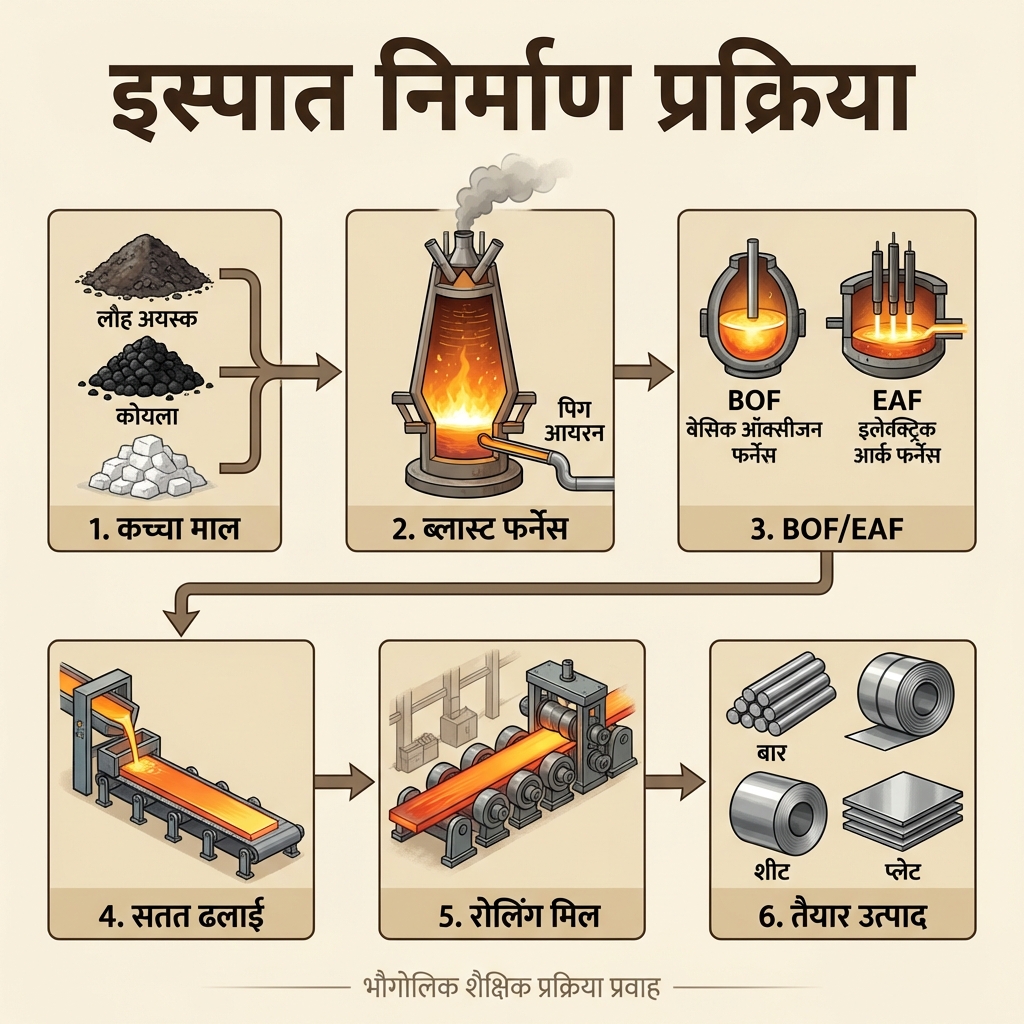
| Outline the location factors for Iron & Steel and Textile industries in India. | Core Manufacturing Industries:
|
| Detail India's high-tech clusters and trade corridors. | Industrial Hubs & Infrastructure:
|
High-Yield UPSC Revision Pointers
- Muga Silk: A rare, natural golden-yellow silk produced exclusively in the Brahmaputra valley of Assam. It has received a Geographical Indication (GI) tag.
- Kandla SEZ: Established in 1965 in Gujarat, it is India's and Asia's first Export Processing Zone (EPZ), later converted into a Special Economic Zone (SEZ).
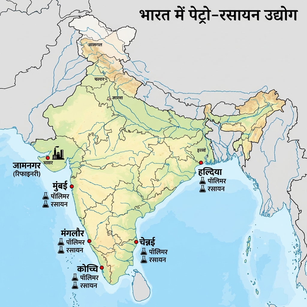
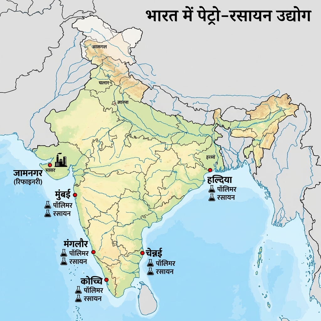
- Jamnagar Refinery: Operated by Reliance Industries in Gujarat, it is the world's largest grass-roots petroleum refining hub.
- Bamboo Classification: In 2017, the Indian Forest Act was amended to reclassify bamboo grown in non-forest areas as "grass" to permit its felling, transport, and economic use.
Visual & Illustrative Assets
🖼️ Supplemental Asset Directory
- Forest Types of India Map:
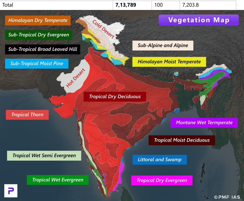
- India's Natural Vegetation (Key Species):

- Indian Crop Seasons (Fasal Rituyen):
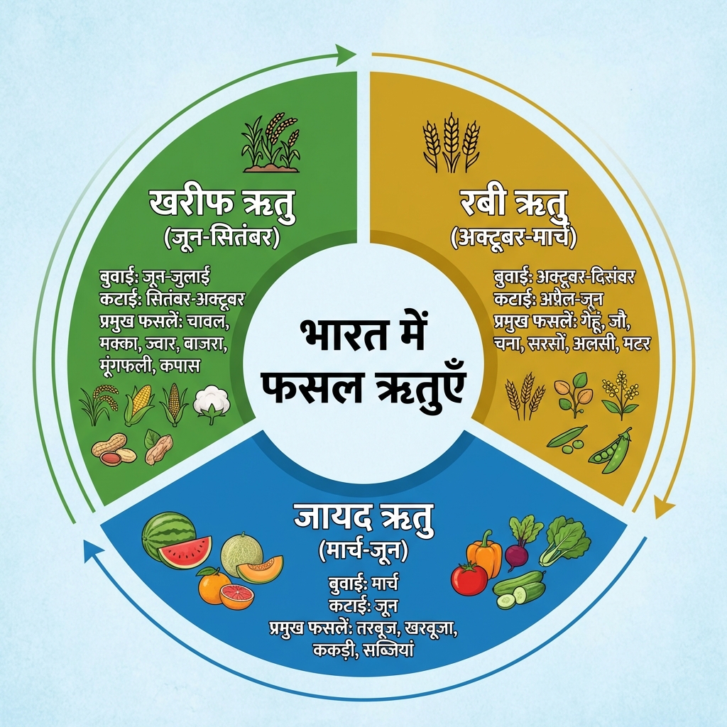
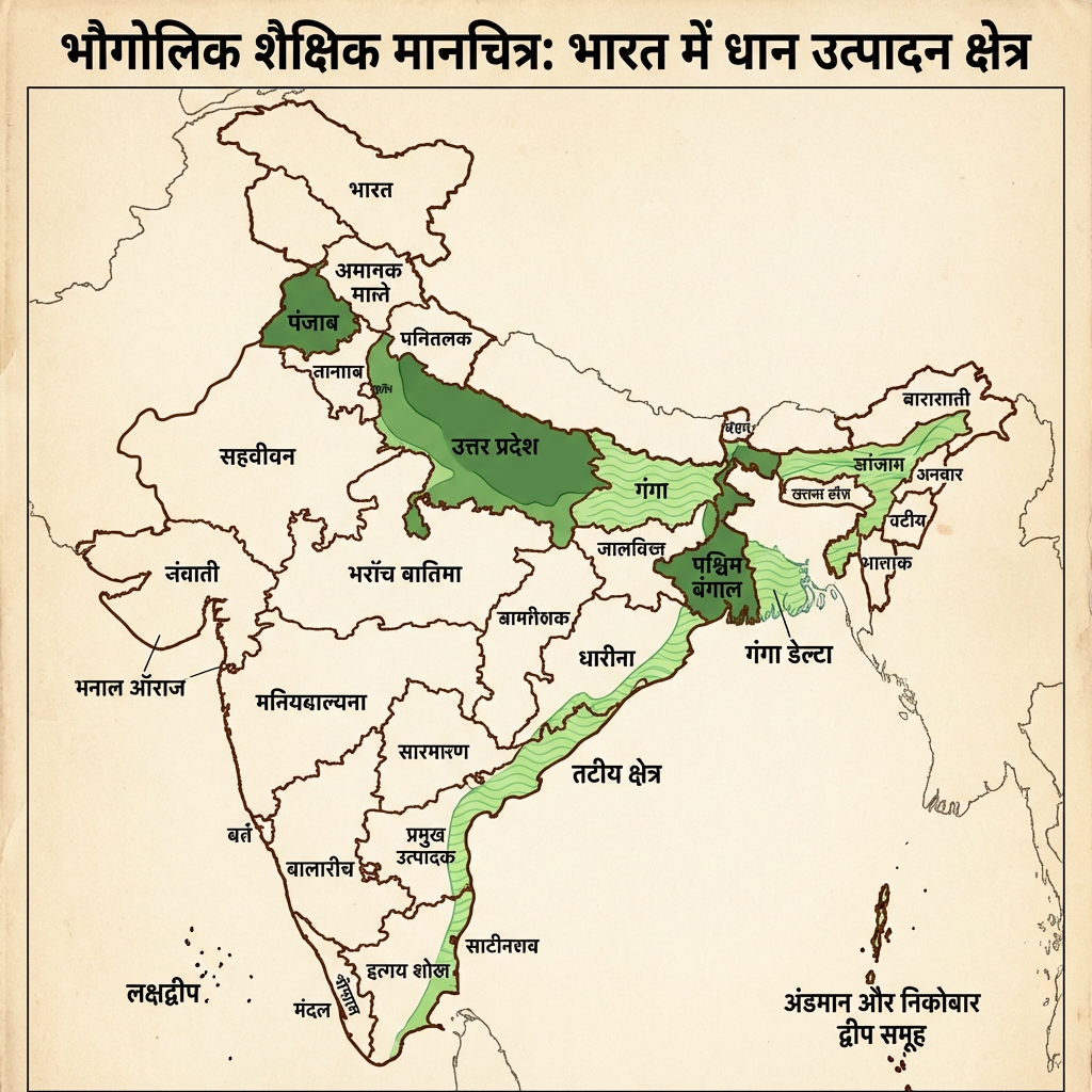
- Rice Production (Dhan Utpadan) Map:
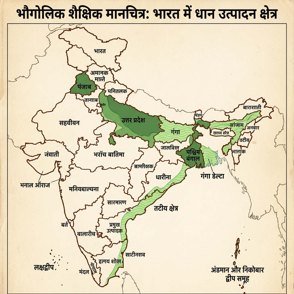
- Wheat Production (Gehun Utpadan) Map:
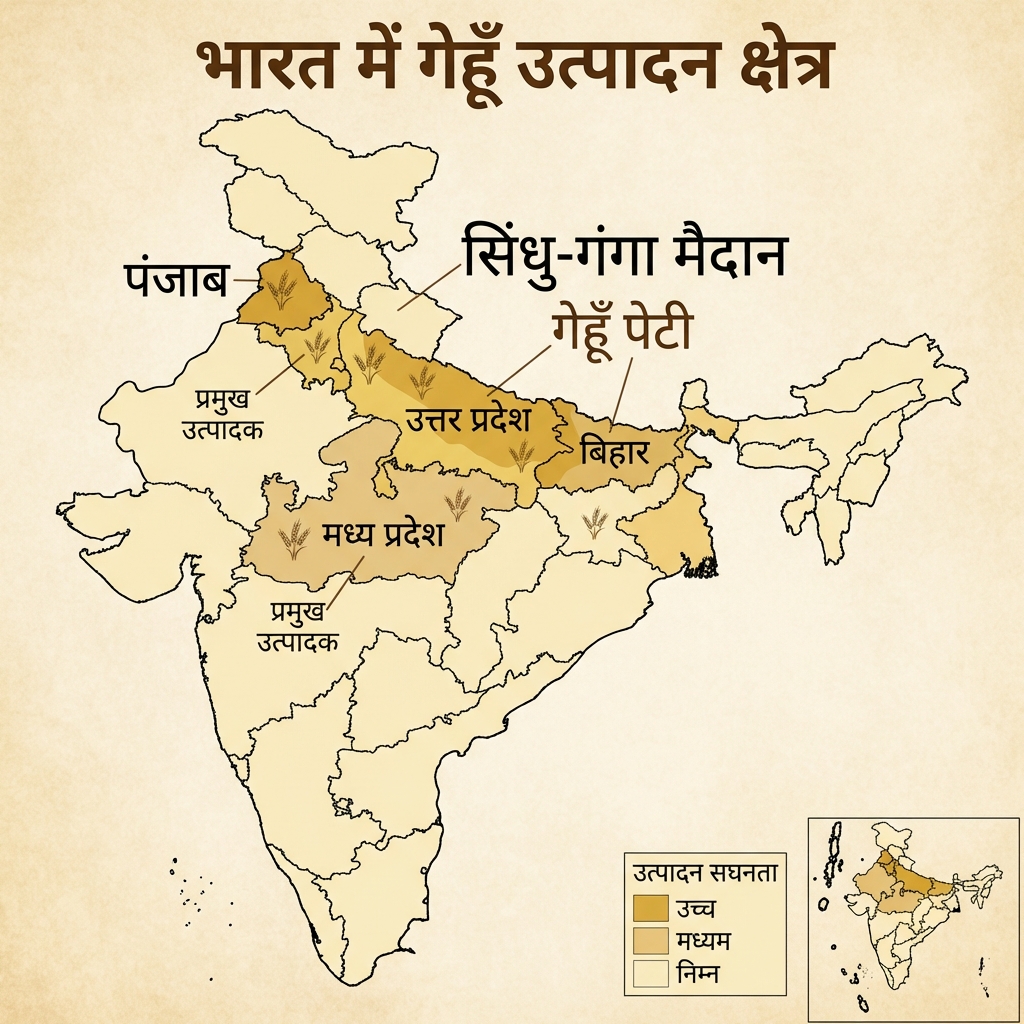
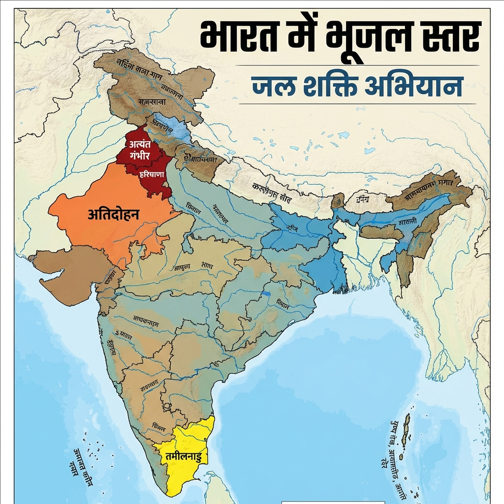
- Groundwater Distribution (Bhu-jal Vitaran):
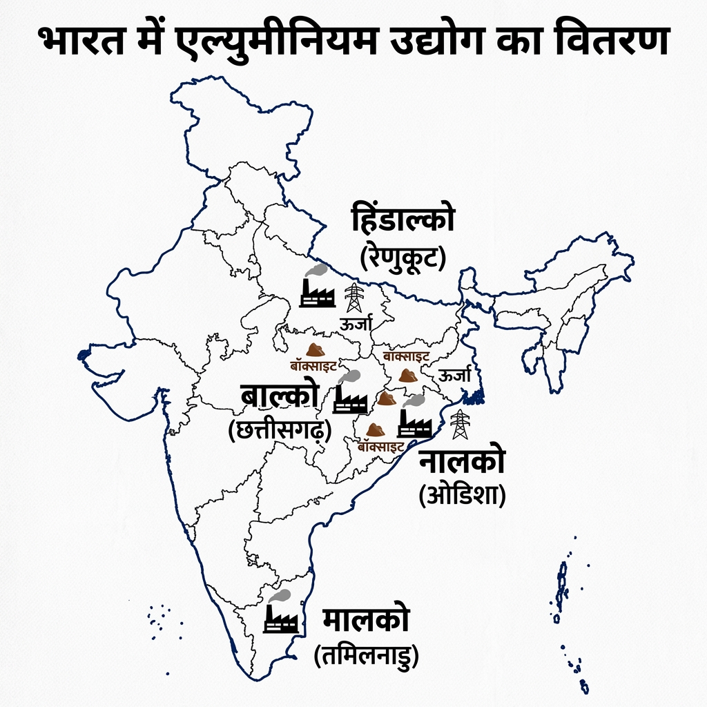
- Mineral Resources of India:
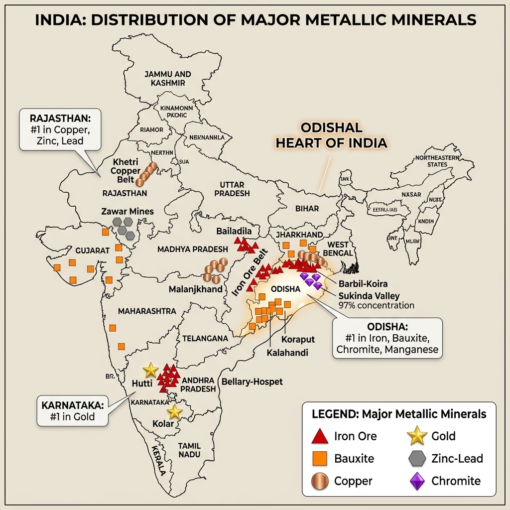
- Coal Distribution (Coal Vitaran) Map:
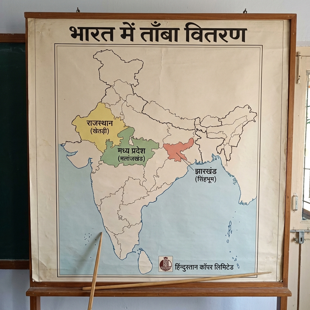
- Bauxite Distribution (Bauxite Vitaran) Map:
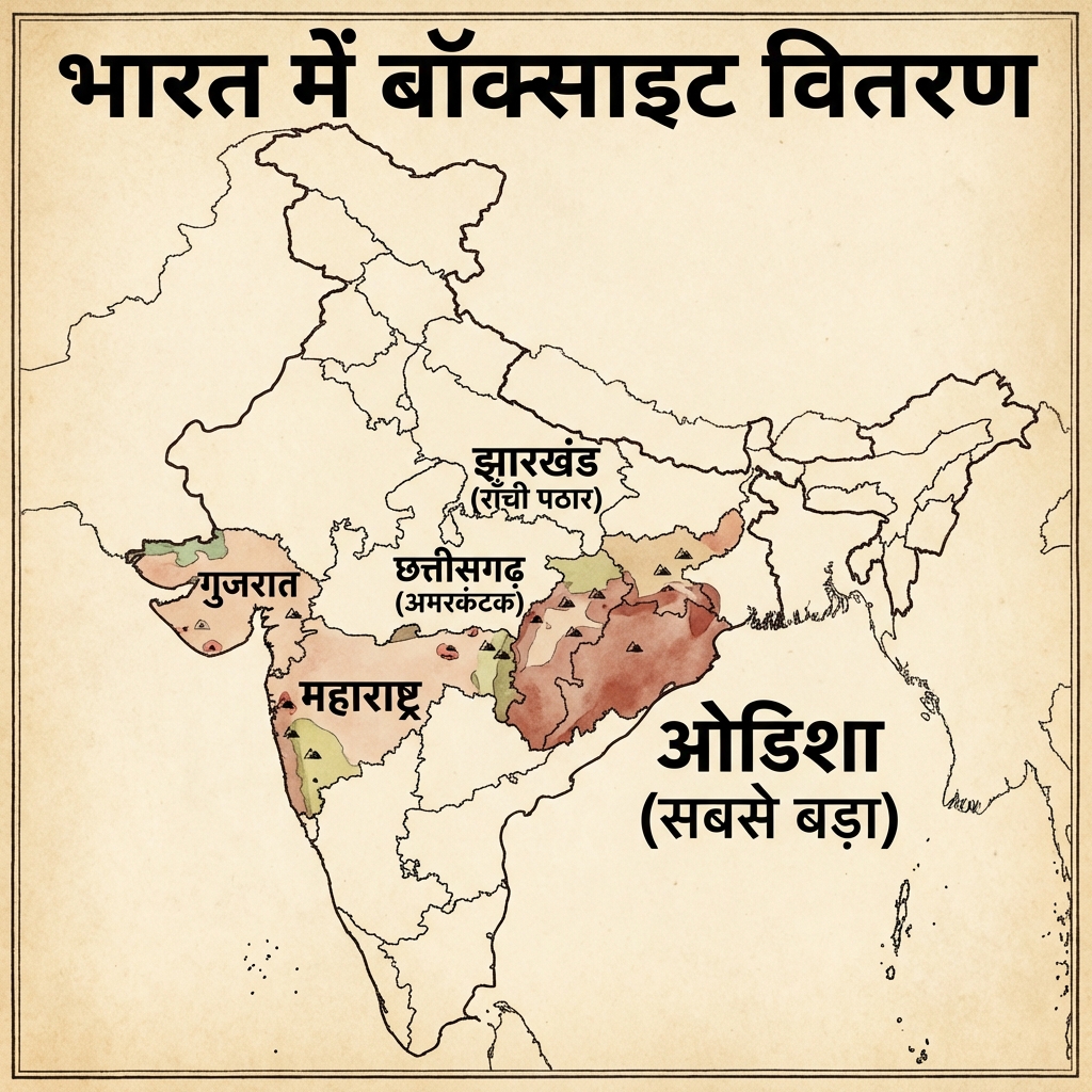
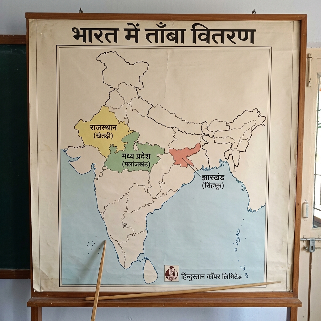
- Copper Distribution (Tamba Vitaran) Map:
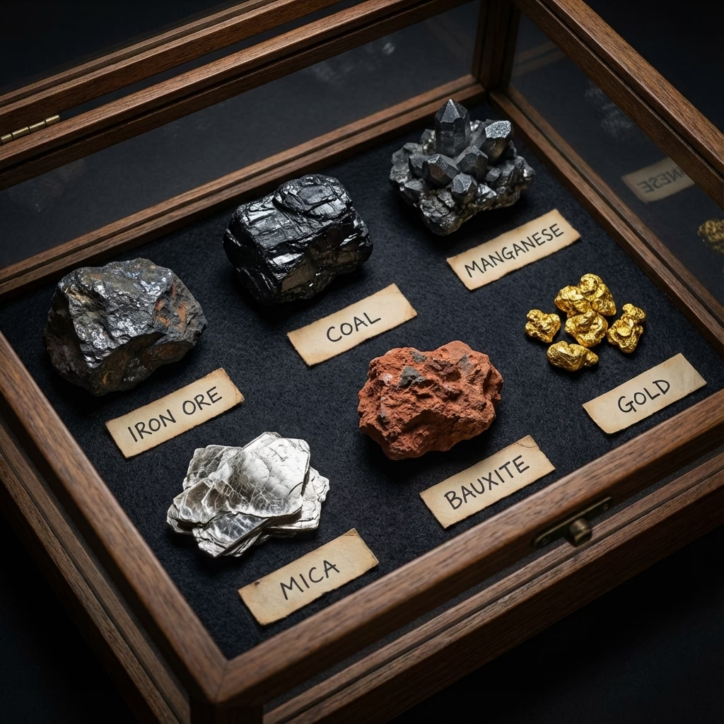
- Critical and Strategic Minerals of India:
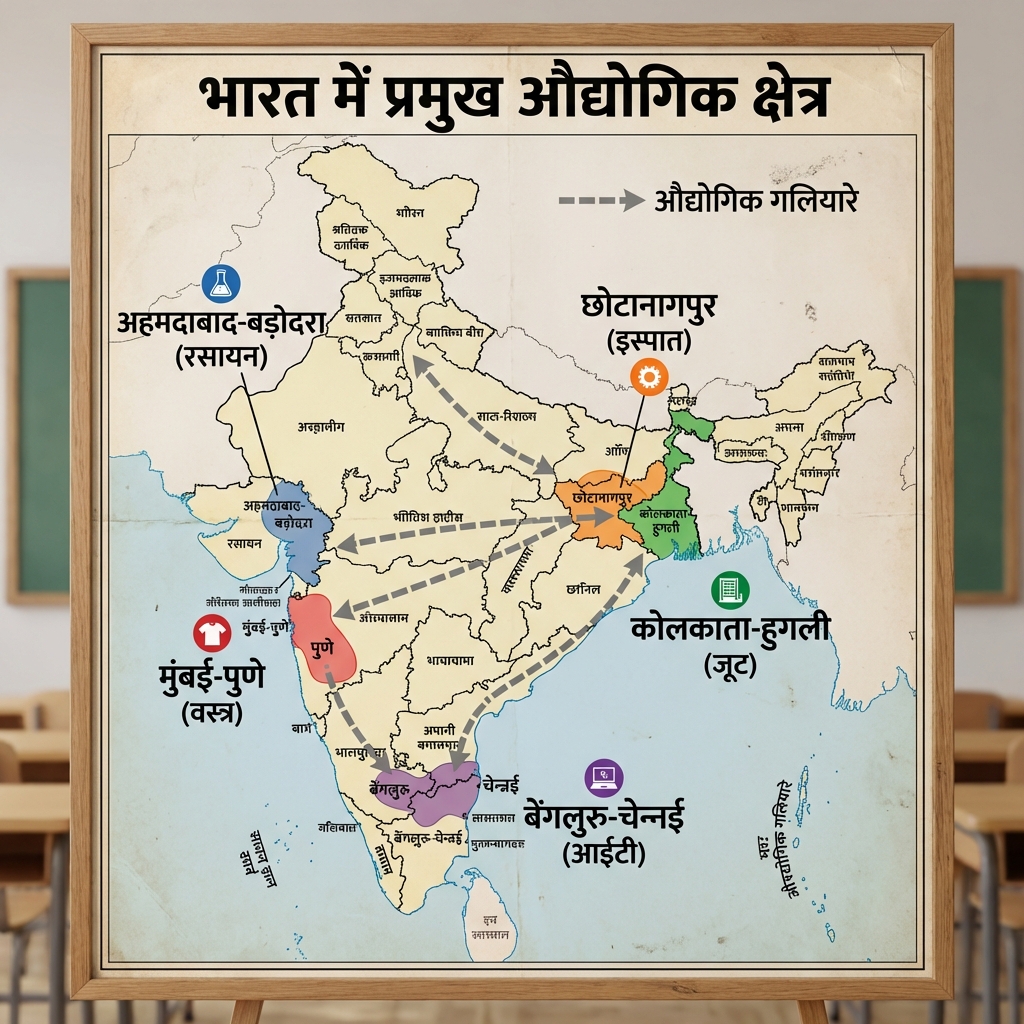
- India's Industrial Regions:
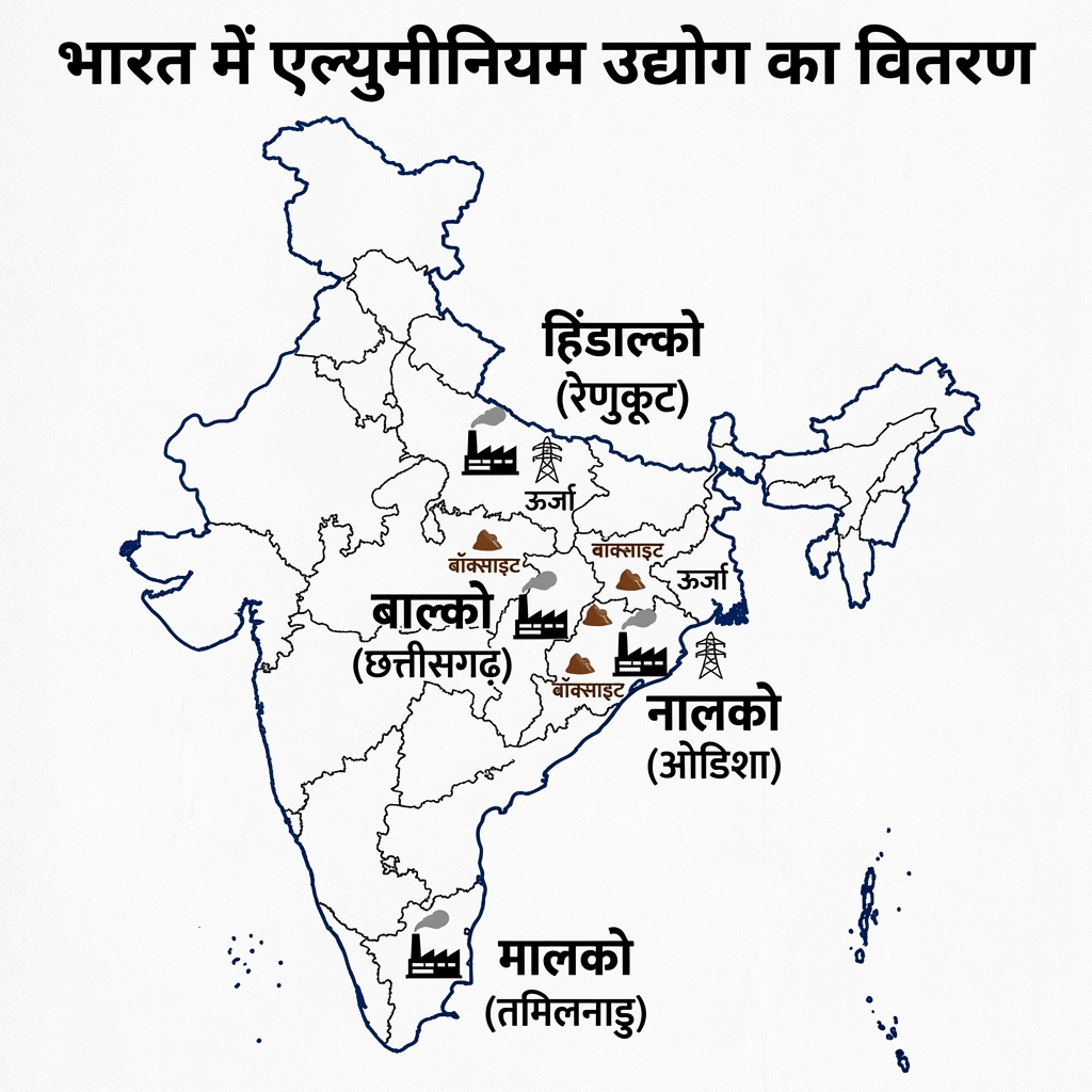
- Aluminium Industry (Aluminium Udyog) Distribution:
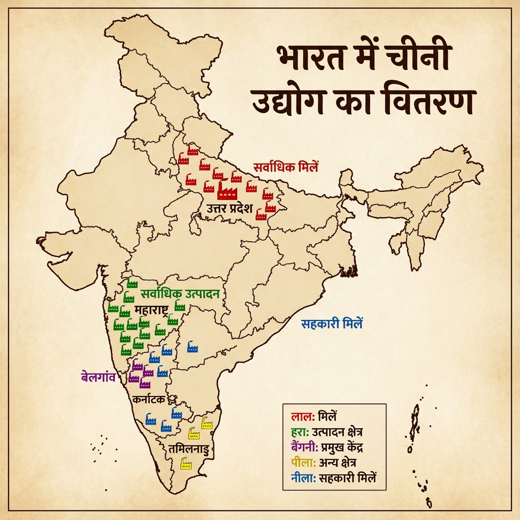
- Sugar Industry (Chini Udyog) Distribution:
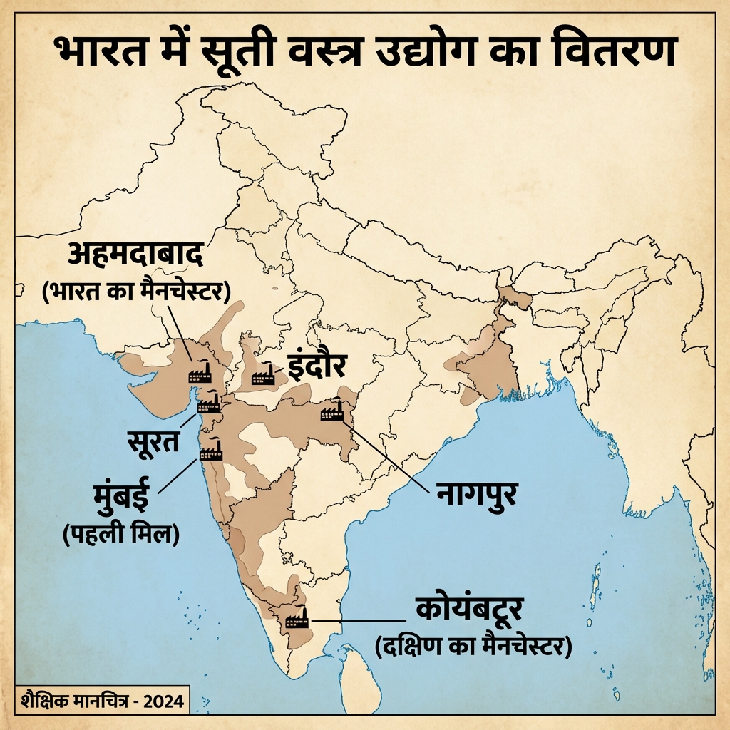
- Cotton Textile Industry (Suti Vastra) Distribution:
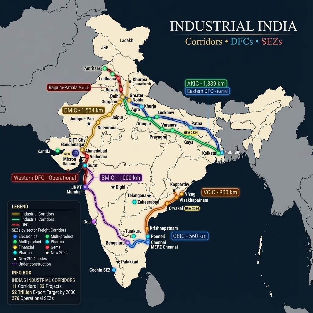
- India's Industrial Corridors and SEZs:
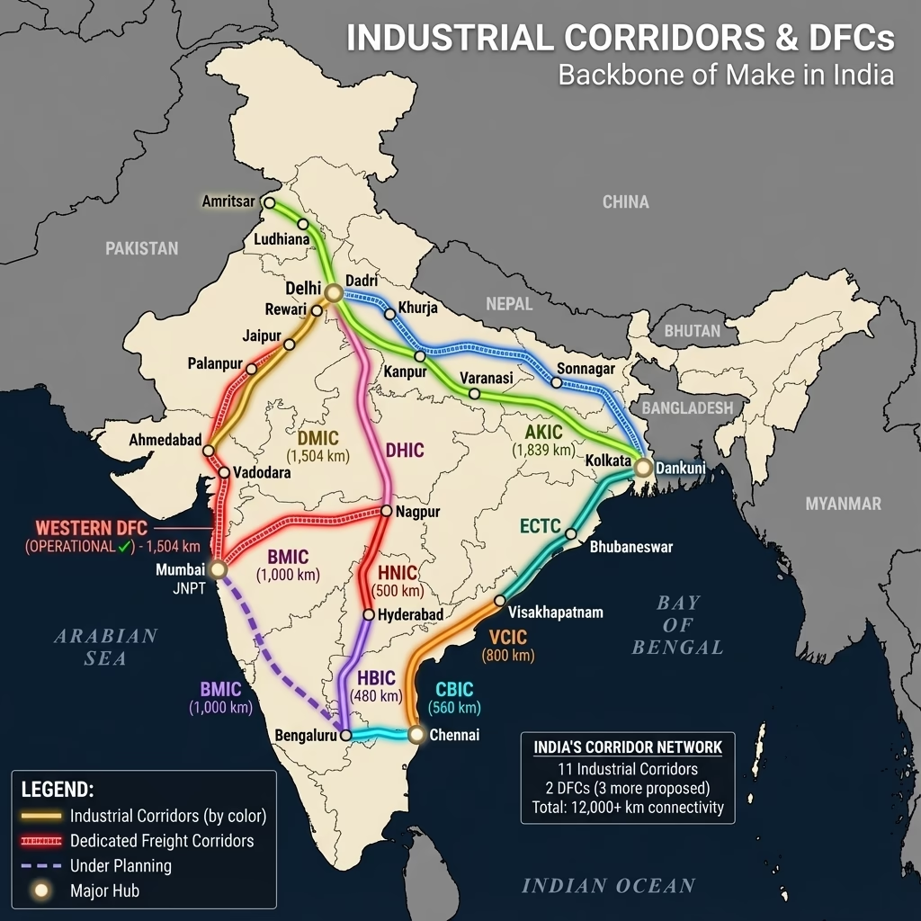
- Dedicated Freight Corridors (DFC) Network:
- Indian Forests (Van Vitaran) Map:
- Groundwater Levels (Bhujal Star) Distribution:
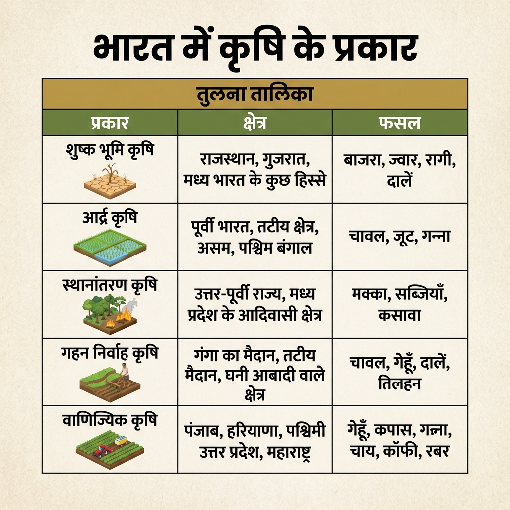
- Agriculture Types (Krishi Prakar) Overview:
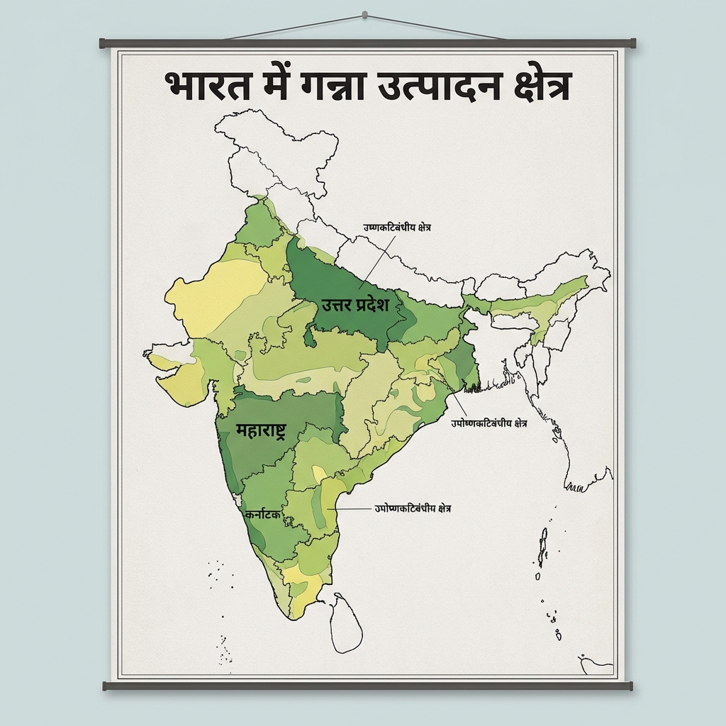
- Sugarcane Production (Ganna Utpadan) Map:
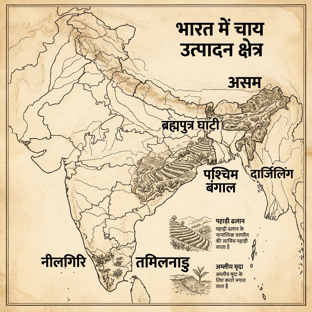
- Tea Production (Chai Utpadan) Map:
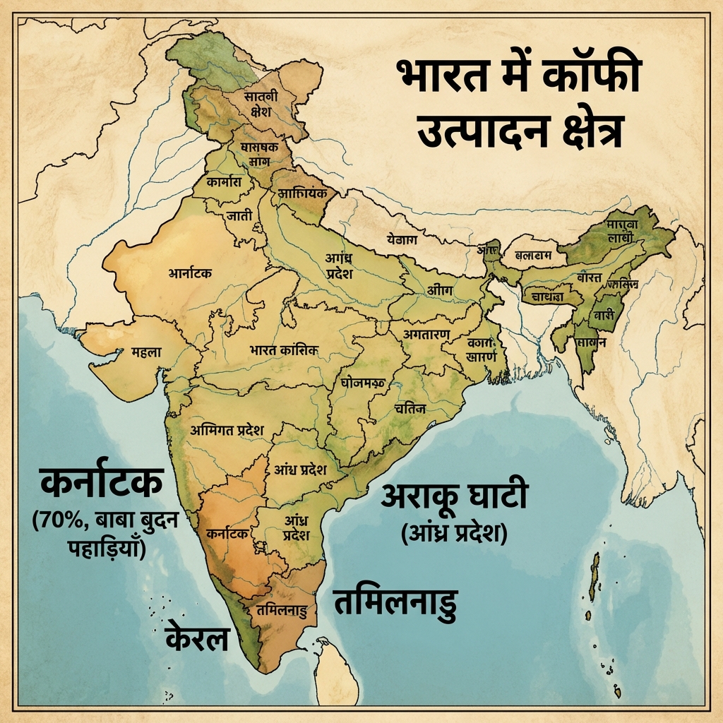
- Coffee Production (Coffee Utpadan) Map:
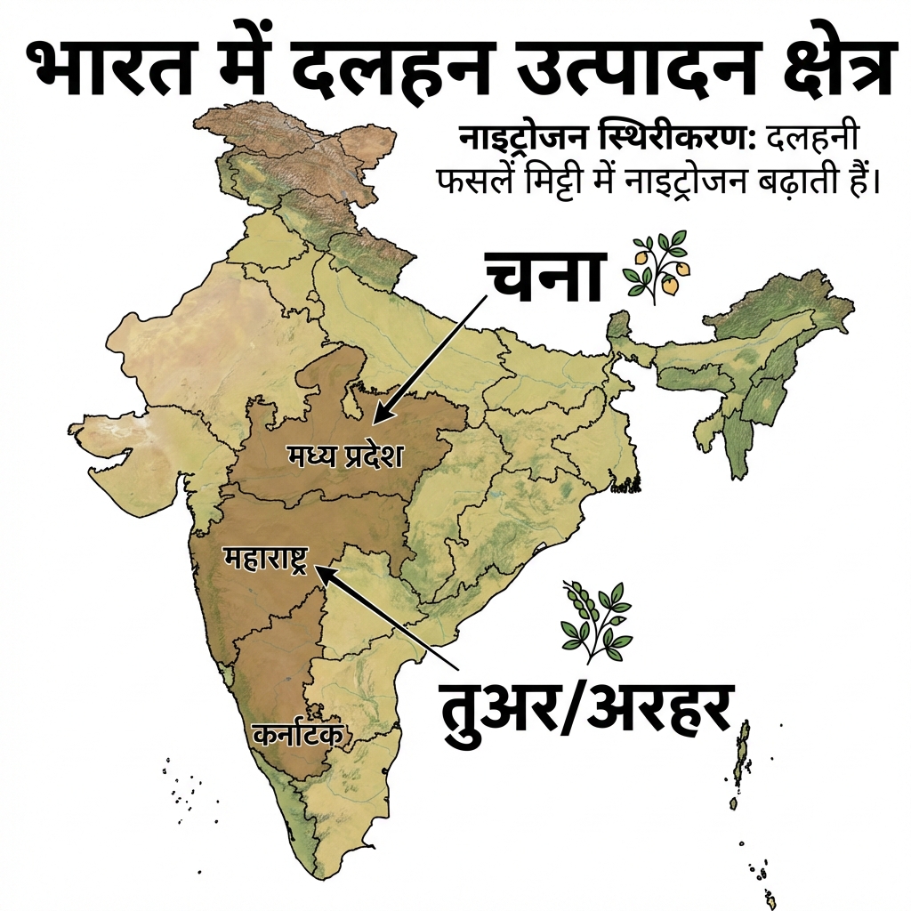
- Pulses Production (Dalhan Utpadan) Map:
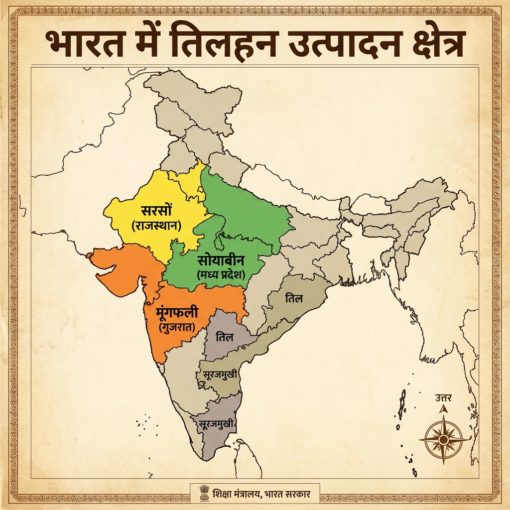
- Oilseeds Production (Tilhan Utpadan) Map:
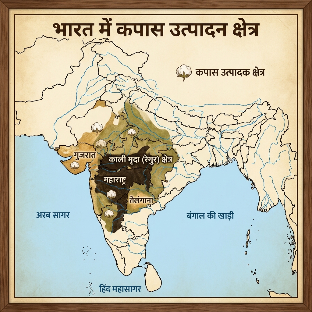
- Cotton Production (Kapas Utpadan) Map:
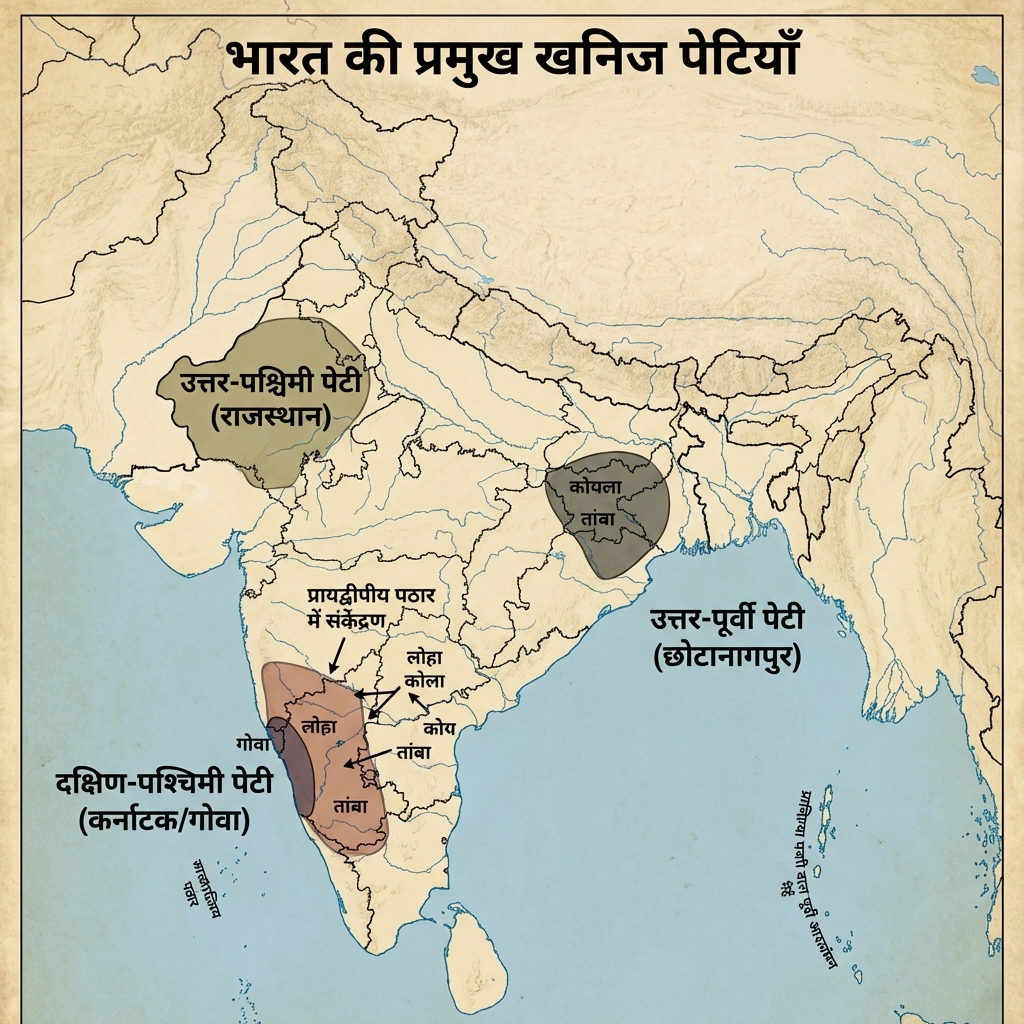
- Mineral Belts (Khanij Petiyan) Map:
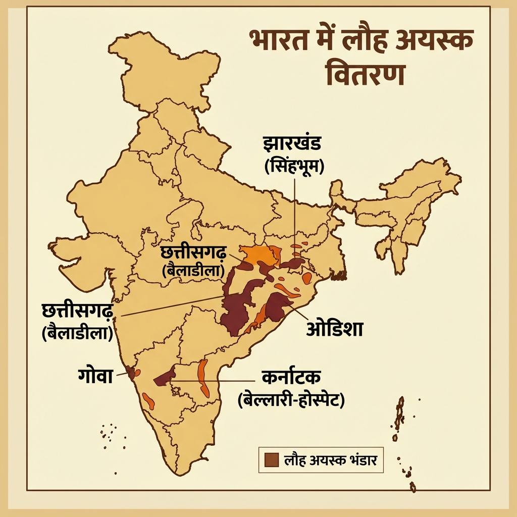
- Iron Ore (Lauha Ayask) Distribution Map:
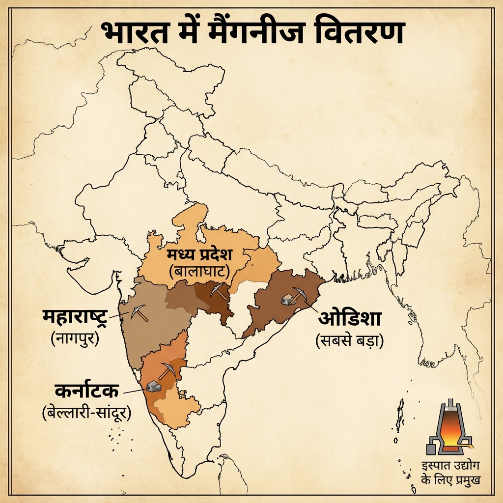
- Manganese Distribution Map:
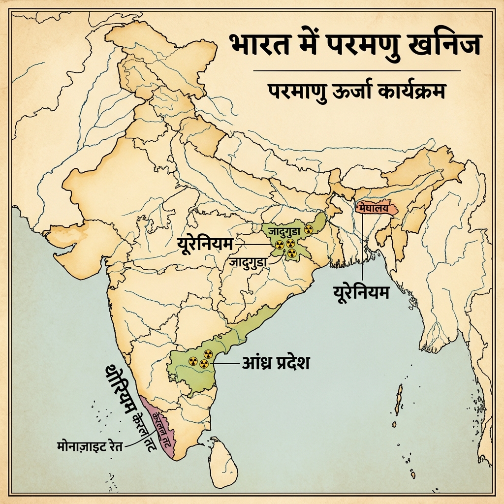
- Nuclear Minerals (Parmanu Khanij) Map:
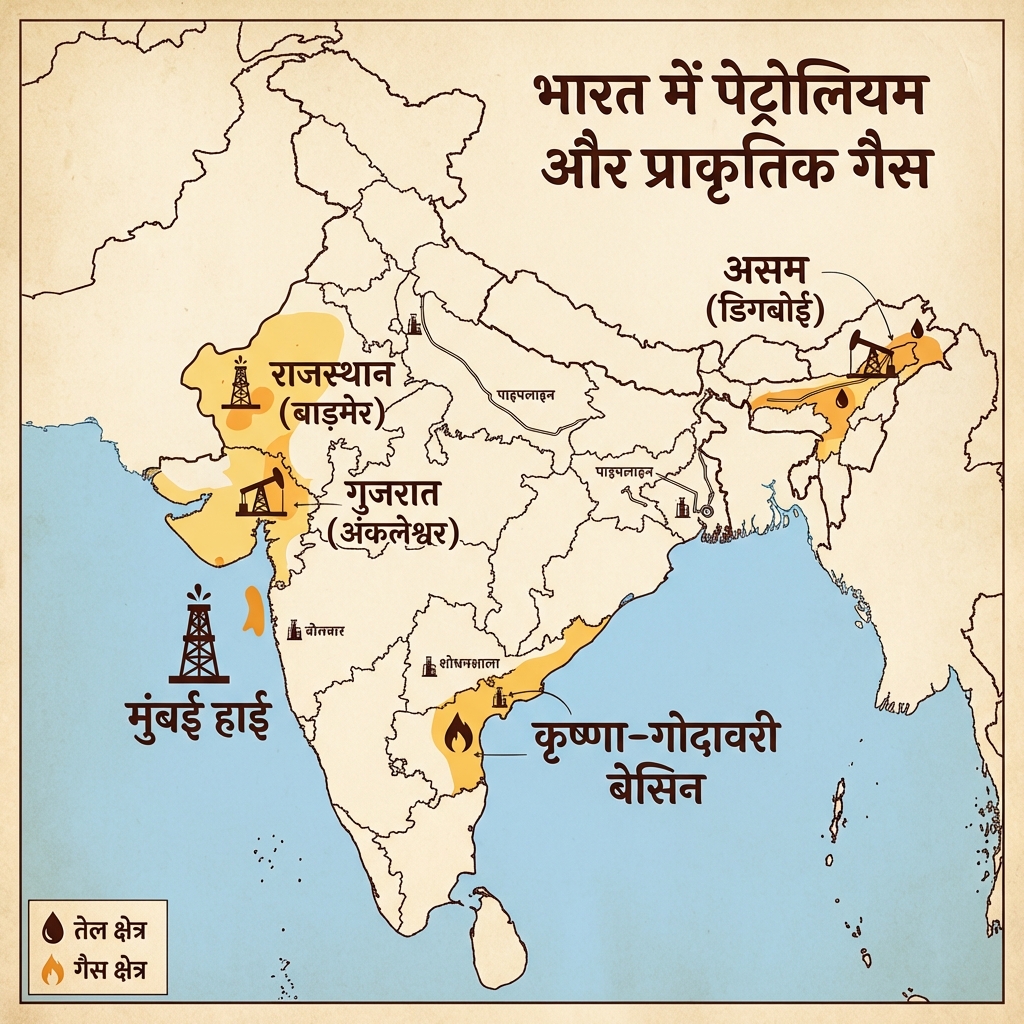
- Petroleum & Gas Map:
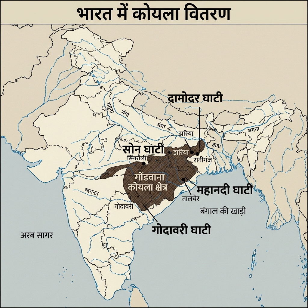
- Coal Distribution (Koyla Vitaran) v2:
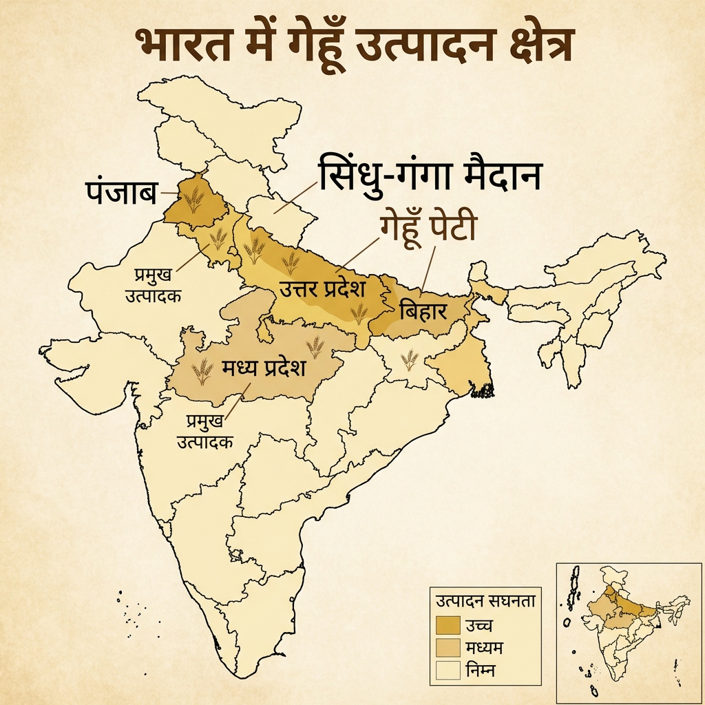
- Wheat Production (Gehun Utpadan) v2:
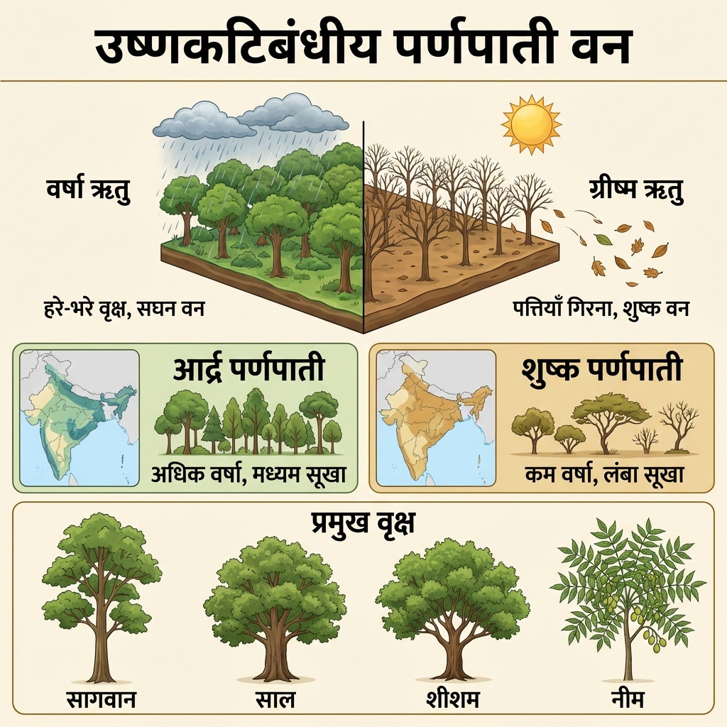
- Deciduous Forest (Parnapati Van) Distribution:
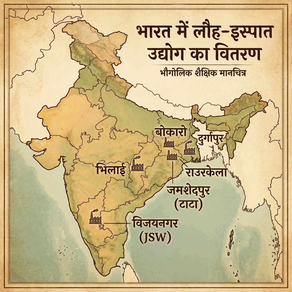
- Iron & Steel Industry (Loha Ispat) Map:
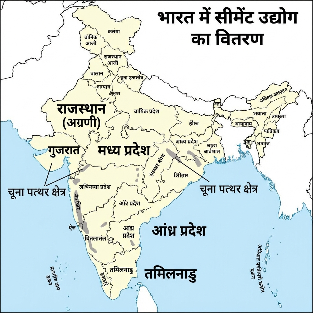
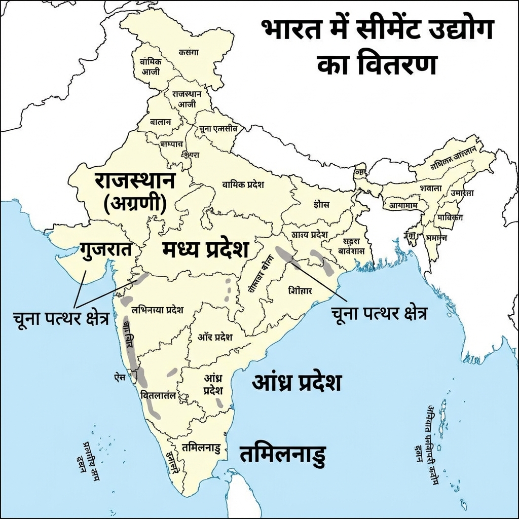
- Cement Industry (Cement Udyog) Map:
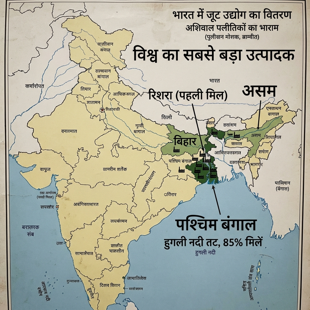
- Jute Industry (Joot Udyog) Map:
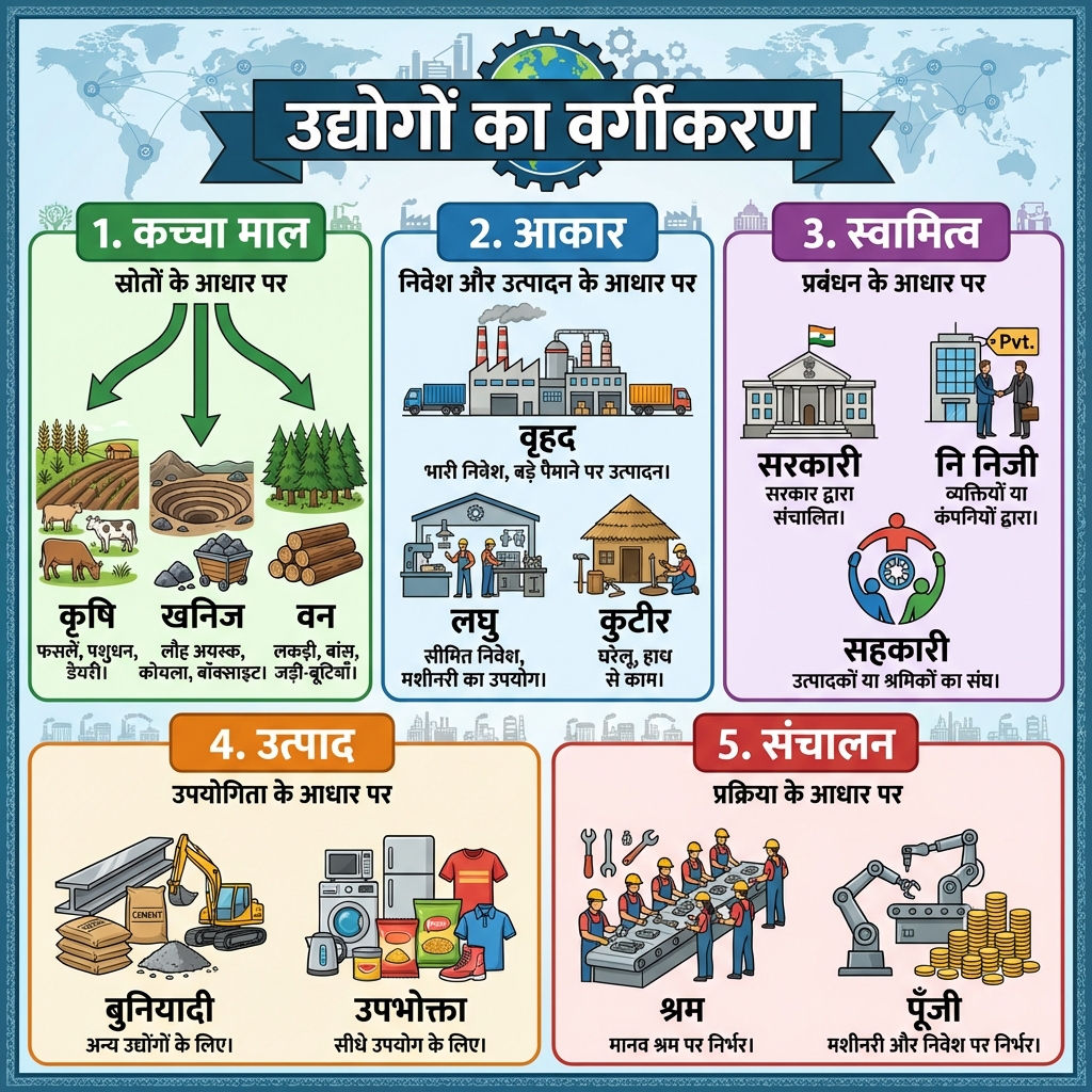
- Industry Classification (Udyog Vargikaran):
- Petrochemical Industry Map:
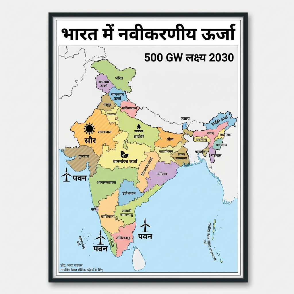
- Renewable Energy Overview:
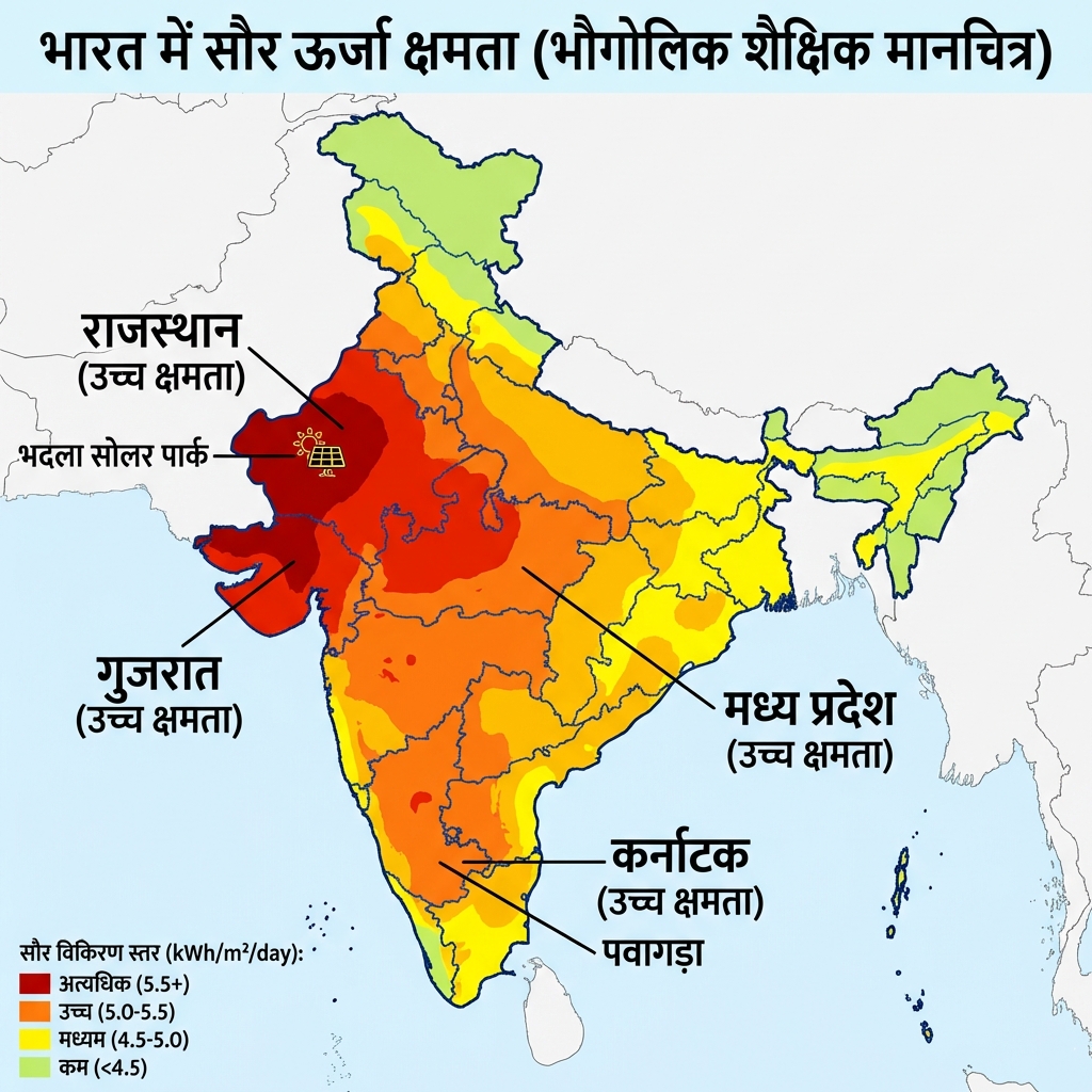
- Solar Energy (Saur Urja) Map:
- Wind Energy (Pawan Urja) Map:
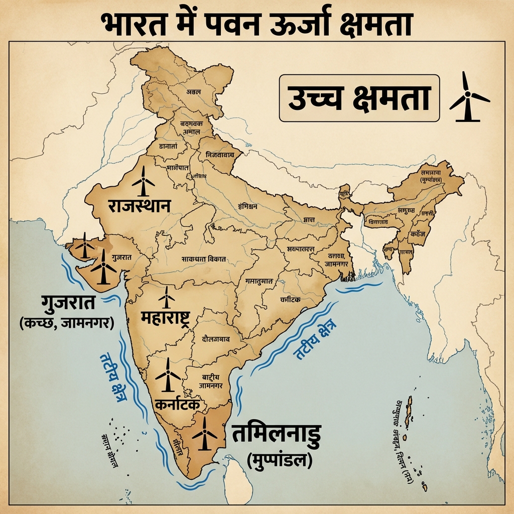
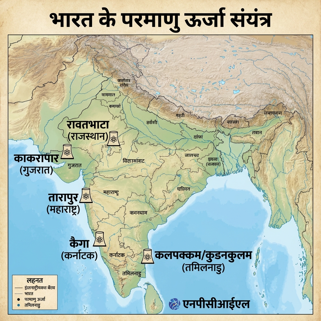
- Nuclear Power Plants (Parmanu Sanyantra) Map:
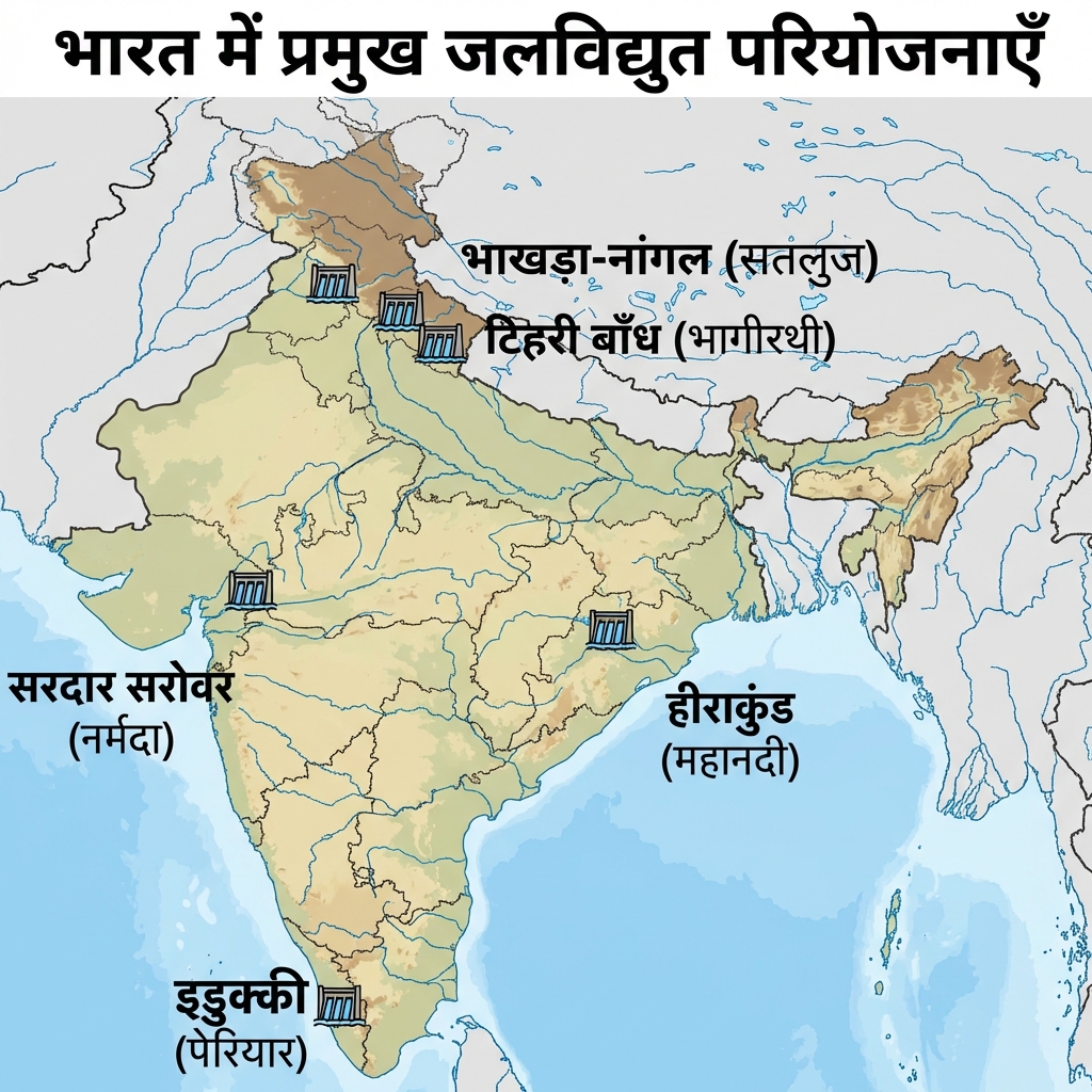
- Hydroelectric Projects Map:
- Iron & Steel Production Process:
- Sugar Industry (Chini Udyog) v2:
- Rice Production (Dhan Utpadan) v2:
- Petrochemical Industry v2:
Mains Practice Questions
- "Analyze the spatial distribution of Iron and Steel Industry in India with reference to Weber's Least Cost Theory."
- "Discuss the significance of ISFR 2021 findings for India's climate commitments."
- "Examine the challenges and prospects of the National Critical Mineral Mission."
🌾 Green Revolution & White Revolution
- Green Revolution (from 1966-67): A package technology of high-yielding variety (HYV) seeds, chemical fertilizers, irrigation, and pesticides that dramatically raised foodgrain yields, led on the research side by Norman Borlaug (wheat, globally) and M.S. Swaminathan (adaptation for India, "father of India's Green Revolution").
- Regional Concentration: Benefits were concentrated mainly in Punjab, Haryana, and western Uttar Pradesh, primarily boosting wheat yields; rice gains came somewhat later and more unevenly.
- White Revolution (Operation Flood): Launched in 1970 under the National Dairy Development Board led by Verghese Kurien ("Father of the White Revolution" / "Milkman of India"), making India the world's largest milk producer via the Anand (Amul) cooperative model.
High-Yield Rapid Revision Additions
| Cue Words | Notes |
|---|---|
| What is the plant diversity profile of India? Identify its phytogeographic zones and botanical anomalies. | Plant Diversity & Biomes:
|
| Detail India's water availability metrics (surface vs groundwater). | Water Statistics:
|
| Identify the nodal water management institutions and recent schemes. | Water Administration & Schemes:
|