World Regional Geography: Continental Profiles
Continental Systems & Extremes
Continental Profiles & Extremes
Continental Profiles & Extremes
| Cue Words | Notes |
|---|---|
| Summarize Asia's physical extremes and key features. | Asia (Continent of Contrast):
|
| Summarize Africa's physical extremes and key features. | Africa (Plateau Continent):
|
| Summarize North and South America's physical extremes. | The Americas:
|
| Summarize Europe, Australia, and Antarctica's physical profiles. | Europe, Australia, & Antarctica:
|
Mountain Systems, Plateaus & Deserts
Mountain Systems, Plateaus & Deserts
| Cue Words | Notes |
|---|---|
| Name the major mountain systems and plateaus across continents. | Mountains & Uplands:
|
| Classify major hot and cold deserts of the world. | Desert Systems:
|
Global Hydrography & Straits
Global Hydrography & Straits
| Cue Words | Notes |
|---|---|
| Identify the world's most significant lakes and their unique records. | Significant Lakes:
|
| Explain the strategic importance of key global straits. | Strategic Straits:
|
High-Yield UPSC Revision Pointers
- Horn of Africa: Formed by Somalia, Ethiopia, Eritrea, and Djibouti (SEED).
- Scandinavia: Norway, Sweden, Denmark (geographically); including Finland and Iceland culturally/politically.
- Balkans: Geopolitical region in Southeast Europe including Greece, Bulgaria, Romania, Serbia, and others.
- Great Rift Valley: Structural geological trench stretching from Lebanon to Mozambique (~6,000 km).
🚢 Strategic Canals & Seven Summits
- Suez Canal: Connects the Mediterranean Sea to the Red Sea (via the Isthmus of Suez, Egypt), avoiding the Cape of Good Hope route around Africa; opened 1869, no locks (sea-level canal).
- Panama Canal: Connects the Atlantic and Pacific Oceans across the Isthmus of Panama; uses a lock system (unlike Suez) to lift ships over the isthmus, opened 1914.
- Seven Summits (highest peak per continent): Everest (Asia), Aconcagua (South America), Denali (North America), Kilimanjaro (Africa), Elbrus (Europe), Vinson Massif (Antarctica), Puncak Jaya or Kosciuszko (Oceania/Australia, disputed definition).
Visual & Illustrative Assets
🖼️ Supplemental Asset Directory
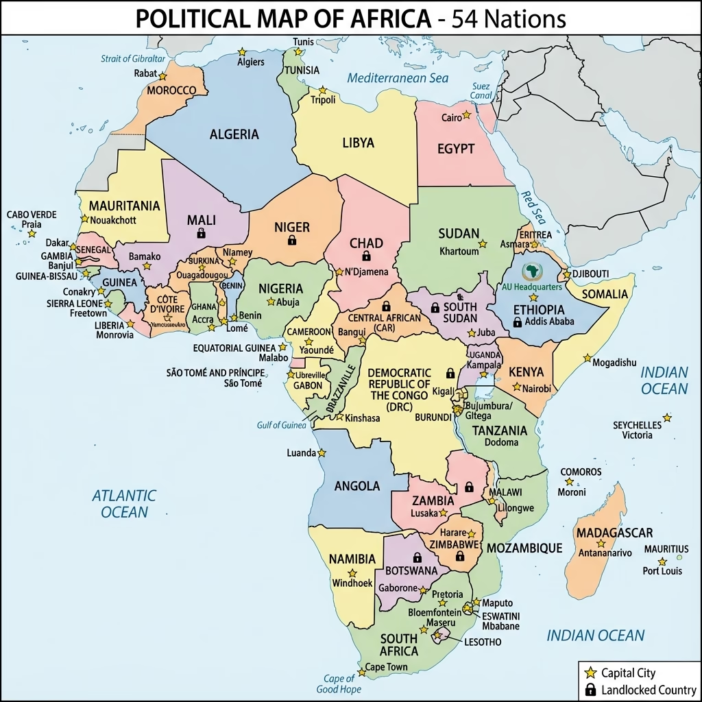
- Africa: Political Map and Regional Organization:
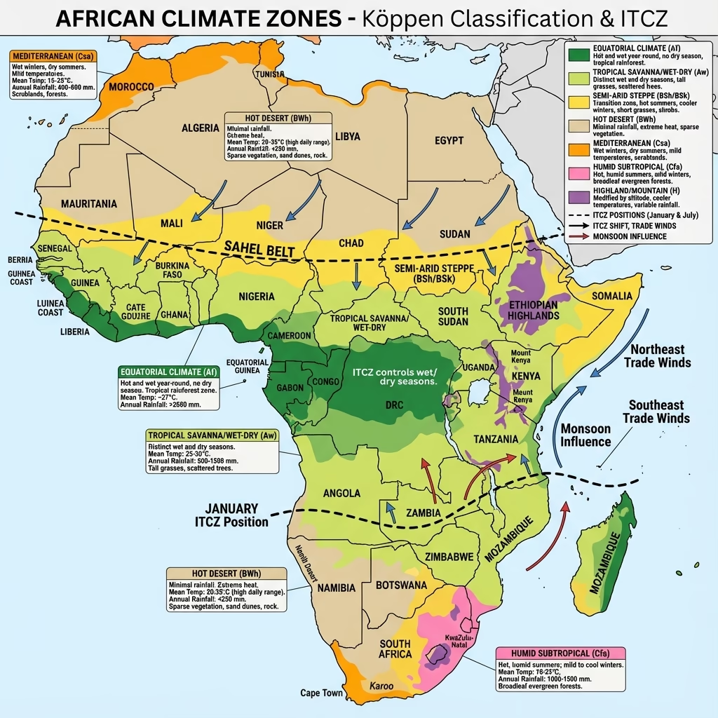
- Africa: Climate and Rainfall Patterns:
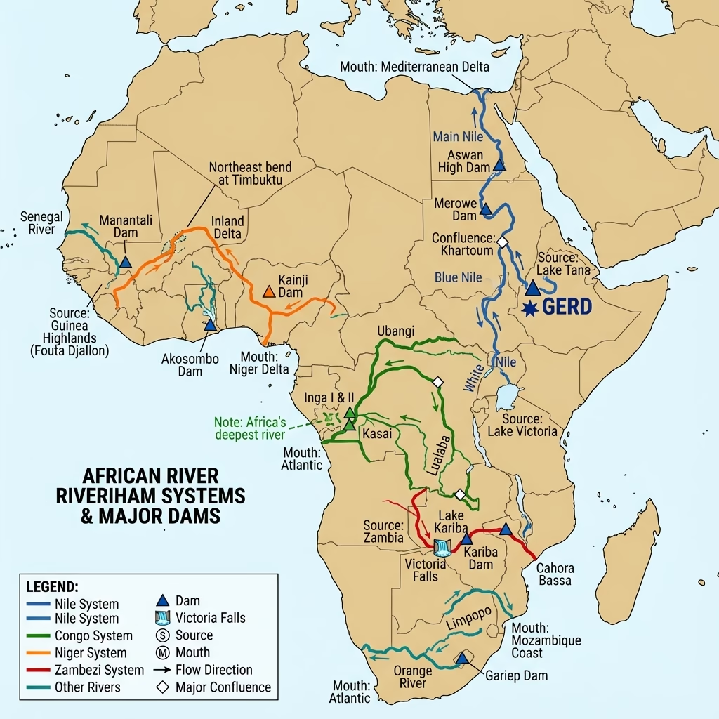
- Africa: Major River Systems and Drainage:
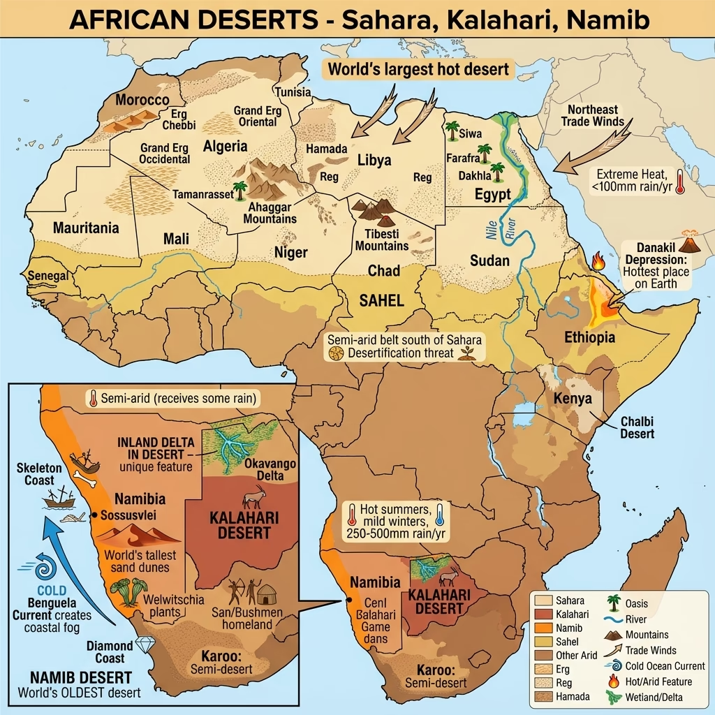
- Africa: Deserts and Arid Regions:
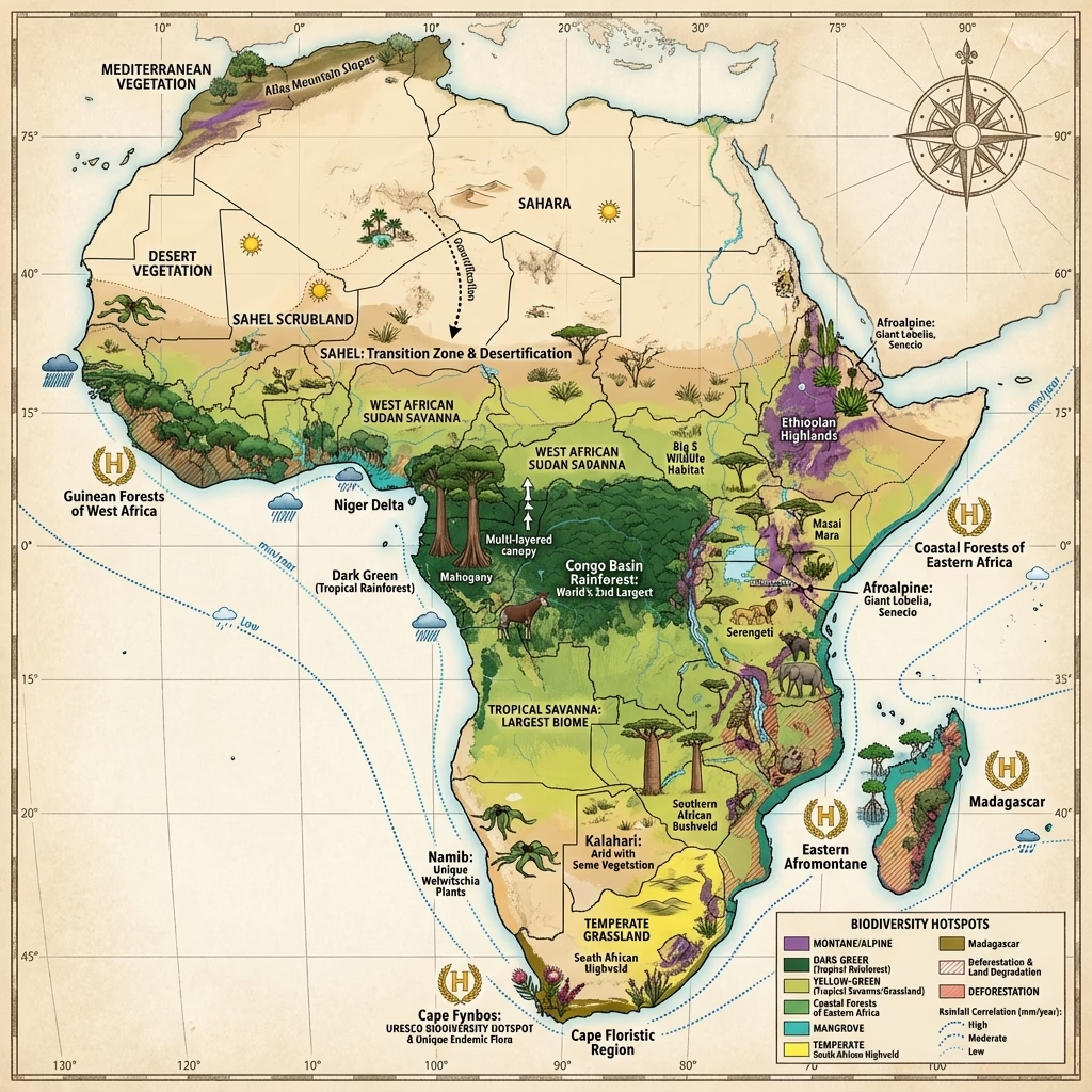
- Africa: Natural Vegetation and Biomes:
Mains Practice Questions
- "Analyze the impact of the Great Rift Valley on the drainage and vegetation patterns of the African continent."
- "Compare the physical characteristics of the Amazon Basin with the Congo Basin."
- "Discuss the strategic and economic importance of major Global Straits in contemporary international trade."