World Mapping, Regions & Landmarks
Asian Extremes & Strategic Hydrology
Asian Physical Superlatives & Neighboring Geography
Asian Physical Superlatives & Neighboring Geography
| Cue Words | Notes |
|---|---|
| List the physical superlatives of the Asian continent. | Asian Physical Superlatives:
|
| Analyze the hydrological and geographic features of Pakistan and Bangladesh. | India's Neighbors:
|
Maritime Chokepoints & Global Economic Hubs
Strategic Straits & Maritime Chokepoints
Strategic Straits & Maritime Chokepoints
| Cue Words | Notes |
|---|---|
| Identify the key global maritime straits and their strategic connections. | Strategic Straits Database:
|
Global Canals & Economic Passages
Global Canals & Economic Passages
| Cue Words | Notes |
|---|---|
| Compare the connectivity and strategic value of the Suez, Panama, and Kiel canals. | Strategic Canals:
|
Economic Hubs, Landmarks & Riverside Cities
Economic Hubs, Landmarks & Riverside Cities
| Cue Words | Notes |
|---|---|
| Identify the industrial specialties of major global cities. | Global Industrial Specializations:
|
| Map major global capitals to their respective rivers and list the Modern Seven Wonders. | Capitals & Wonders:
|
High-Yield UPSC Revision Pointers
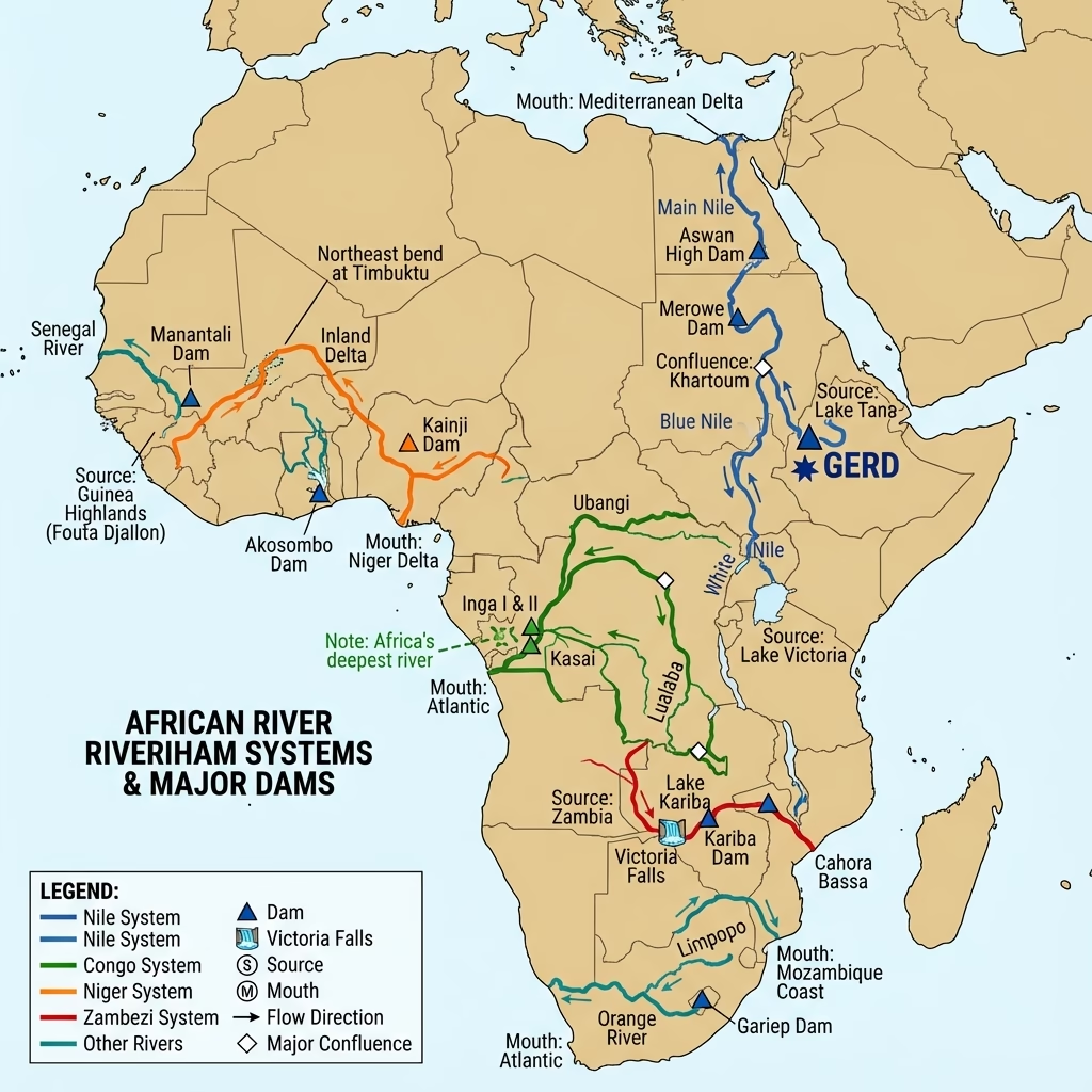
- Blue Nile Source: Originates at Lake Tana in the Ethiopian Highlands. It merges with the White Nile at Khartoum (Sudan) to form the main Nile River.
- Mariana Trench: Bounded by convergent plate subduction in the western Pacific Ocean. The deepest section is the Challenger Deep (~11 km).
- 49th Parallel: The geographical boundary line along the latitude, acting as the international border between the United States and Canada.
- MacMahon Line: The boundary line agreed between Great Britain and Tibet in 1914, representing the effective border between India and China/Tibet in the eastern sector.
🗺️ Map Projections: Mercator vs Conical
- Mercator Projection (Cylindrical): A conformal projection (preserves shape/angles, useful for navigation with straight rhumb lines) that severely distorts area at high latitudes — famously exaggerating the size of Greenland and Antarctica relative to equatorial landmasses.
- Conical Projection: Constructed by projecting the graticule onto a cone tangent to (or intersecting) the globe along one or two standard parallels; best suited for mapping mid-latitude regions with greater east-west than north-south extent (e.g., USA, Russia).
- Homolographic (Equal-Area) Projection: Preserves accurate relative area at the cost of distorting shape — used for thematic world maps (e.g., population or resource distribution) where true area comparison matters more than navigation.
Visual & Illustrative Assets
🖼️ Supplemental Asset Directory
- Caspian Sea and Surrounding Regions:
- Dead Sea (Lowest Point on Earth):
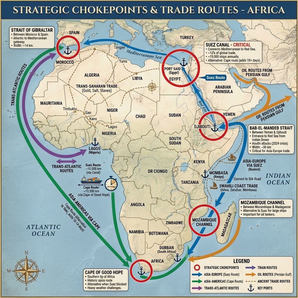
- Global Maritime Chokepoints:
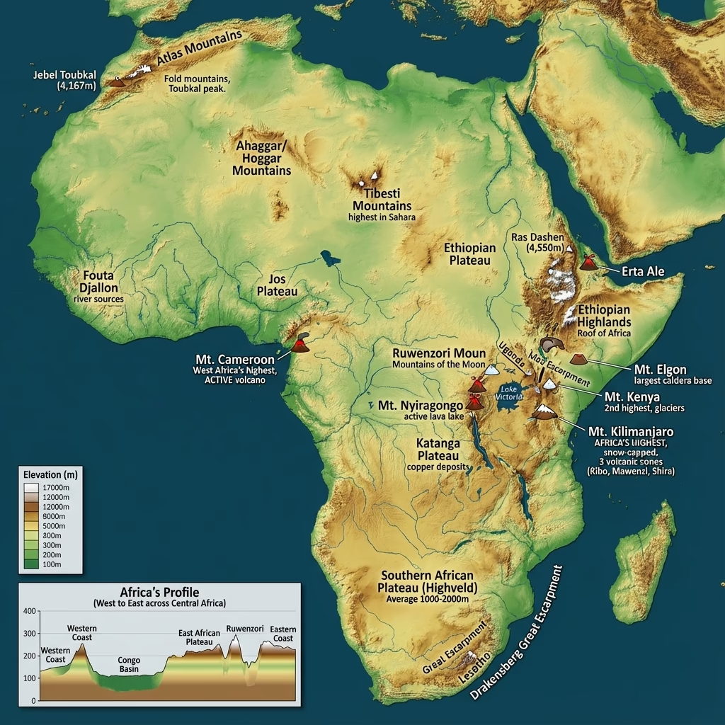
- Africa: Physical Geography:
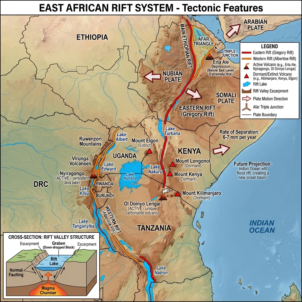
- Africa's Great Lakes and Rift Valley System:
- Major Rivers of Africa:
Mains Practice Questions
- "Evaluate the geopolitical significance of Maritime Chokepoints in the context of global energy security."
- Discuss the impact of China's 'Super Dam' on the Brahmaputra on India's downstream riparian rights.
- "Examine the role of Regional Connectivity (India-ASEAN via Malacca) in India's 'Act East' Policy."