Geomorphology: Interior, Rocks & Endogenic Forces
Earth's Interior & Rock Systems
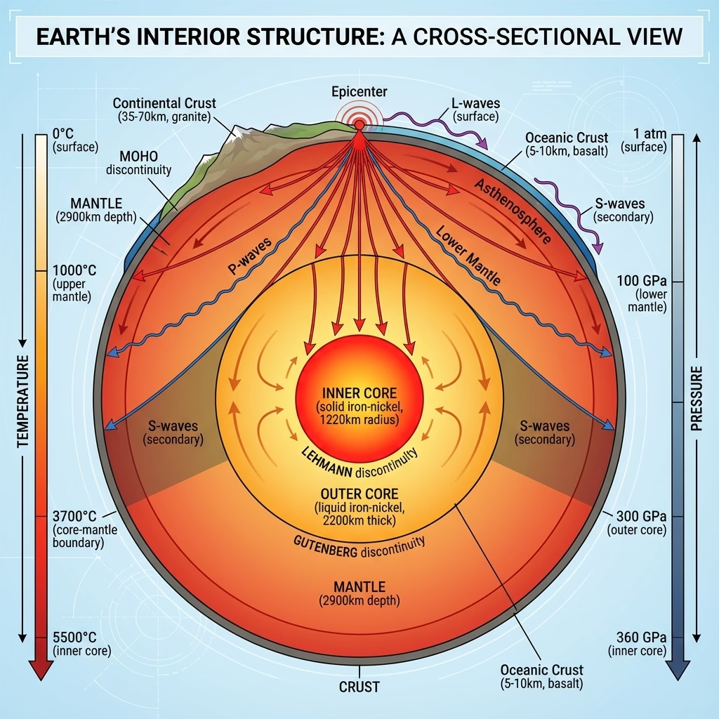
Layers & Seismic Discontinuities
Layers & Seismic Discontinuities
| Cue Words | Notes |
|---|---|
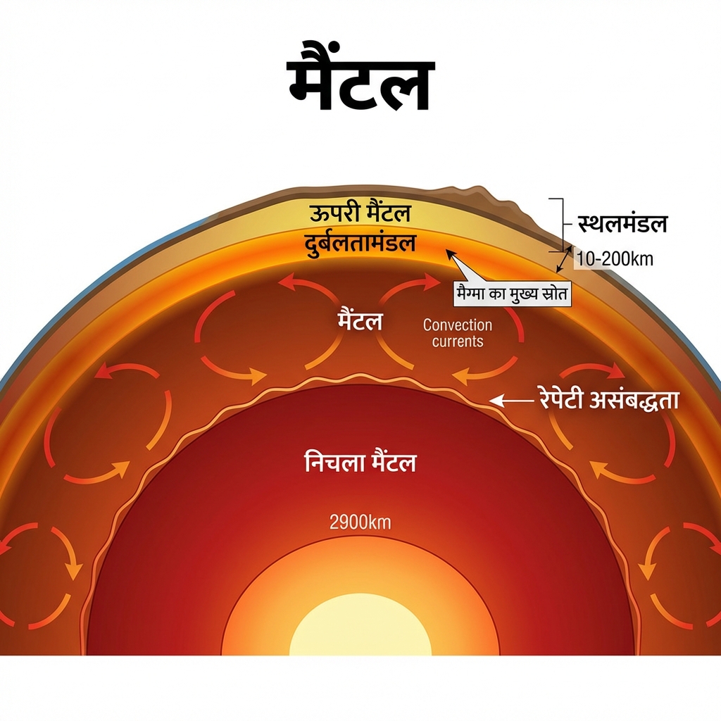
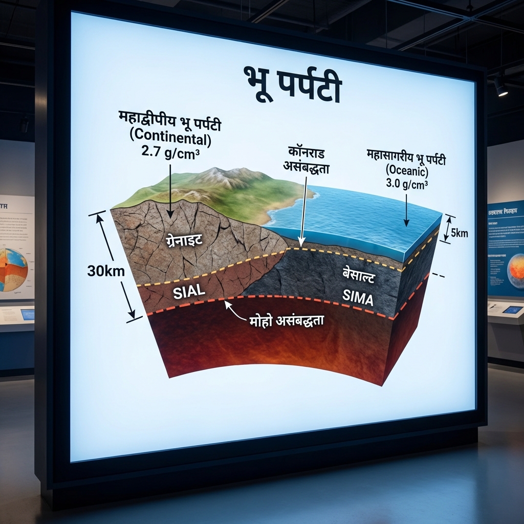
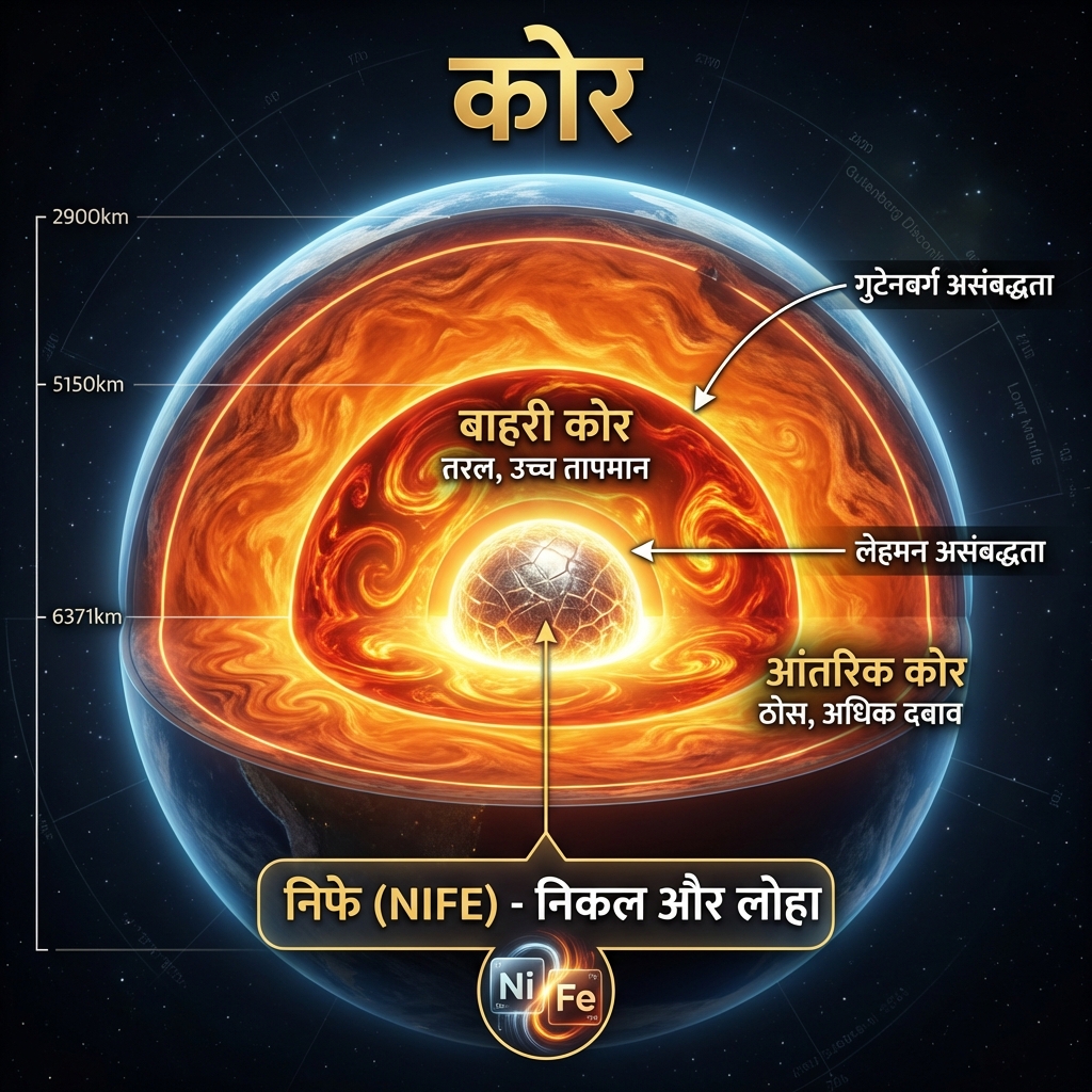
| Detail the composition and key properties of Earth's Crust, Mantle, and Core. | Earth's Layered Structure:
|
| Map the five major seismic discontinuities from the surface to the core. | Seismic Discontinuities:
|
Petrology: Classification & Rock Cycle
Petrology: Classification & Rock Cycle
| Cue Words | Notes |
|---|---|
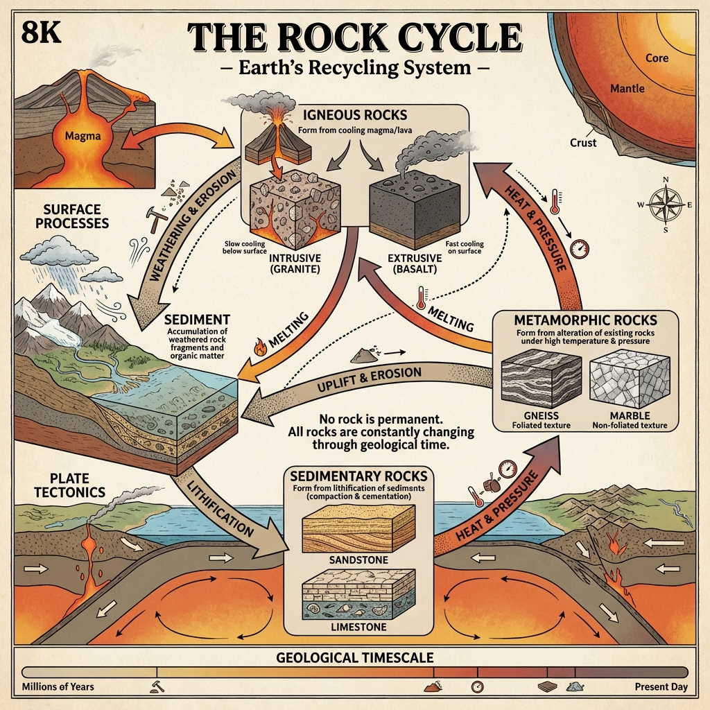
| Explain Igneous Rocks with extrusive and intrusive examples. | Igneous Rocks (Primary):
|
| Explain Sedimentary Rocks and detail their formation process. | Sedimentary Rocks:
|
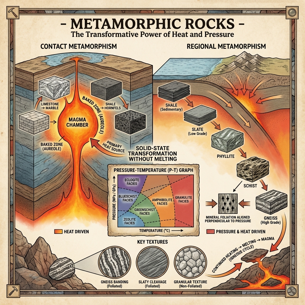
| What is Metamorphic rock? Provide examples of mineral transformations. | Metamorphic Rocks:
|
Tectonic Evolution & Seismic Dynamics
Drift, Spreading & Plate Tectonics
Drift, Spreading & Plate Tectonics
| Cue Words | Notes |
|---|---|
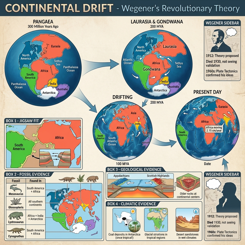
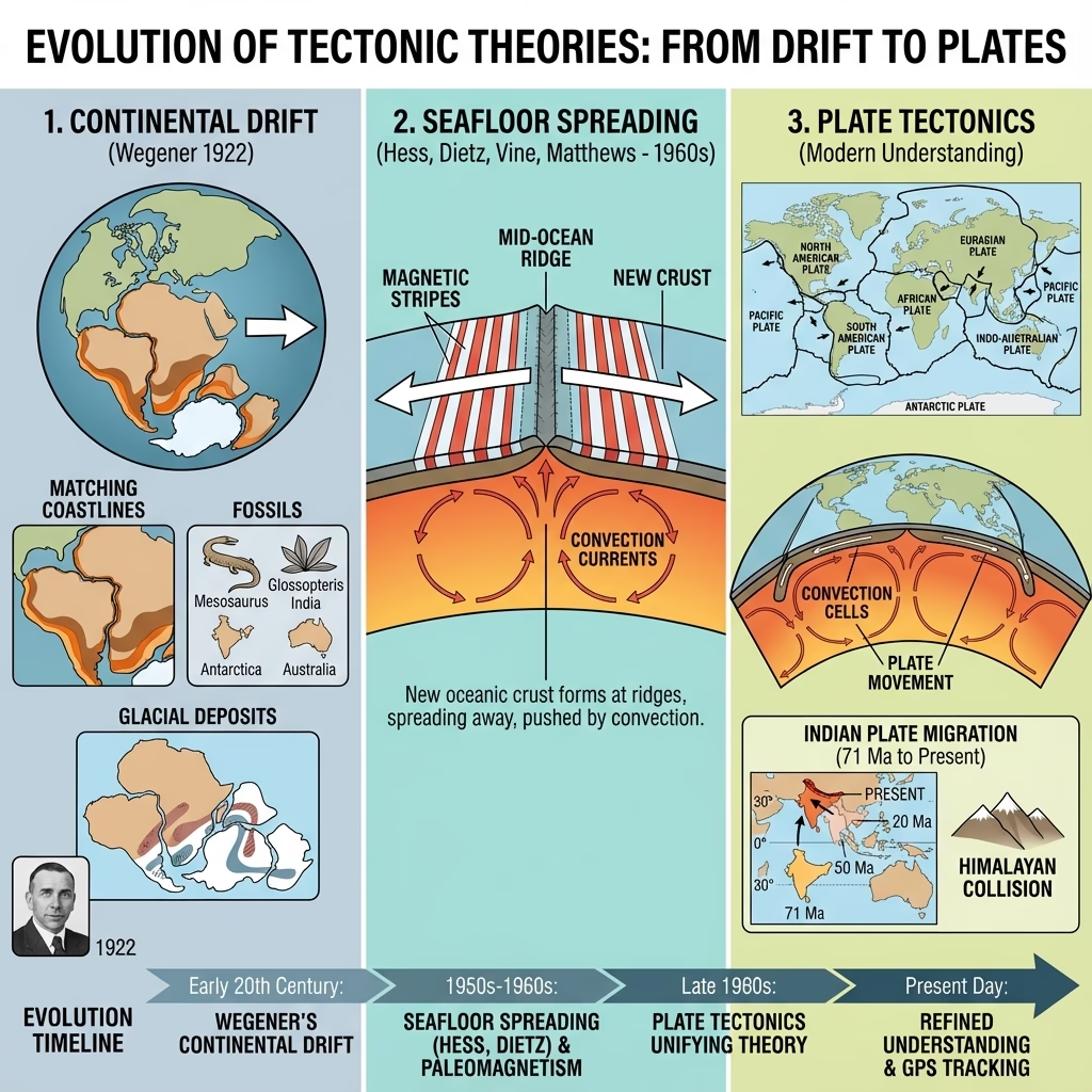
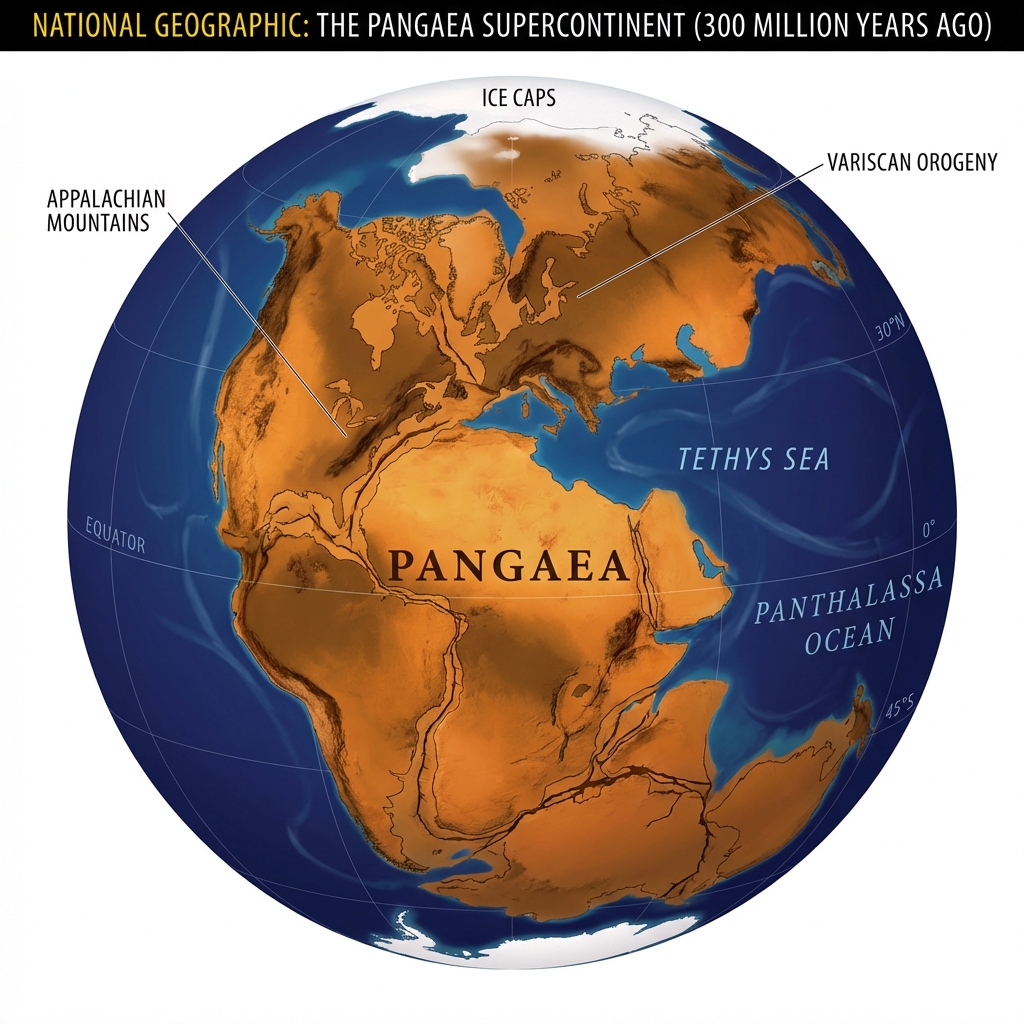
| Explain Wegener's Continental Drift Theory and its primary evidence. | Continental Drift Theory (Alfred Wegener, 1912):
|
| Explain the theory of Seafloor Spreading. | Seafloor Spreading (Harry Hess, 1962): Proposes that magma rises from the mantle at mid-ocean ridges, cooling to form new oceanic crust that spreads laterally, while older crust is pushed away and eventually subducts back into the mantle at deep-sea trenches. |
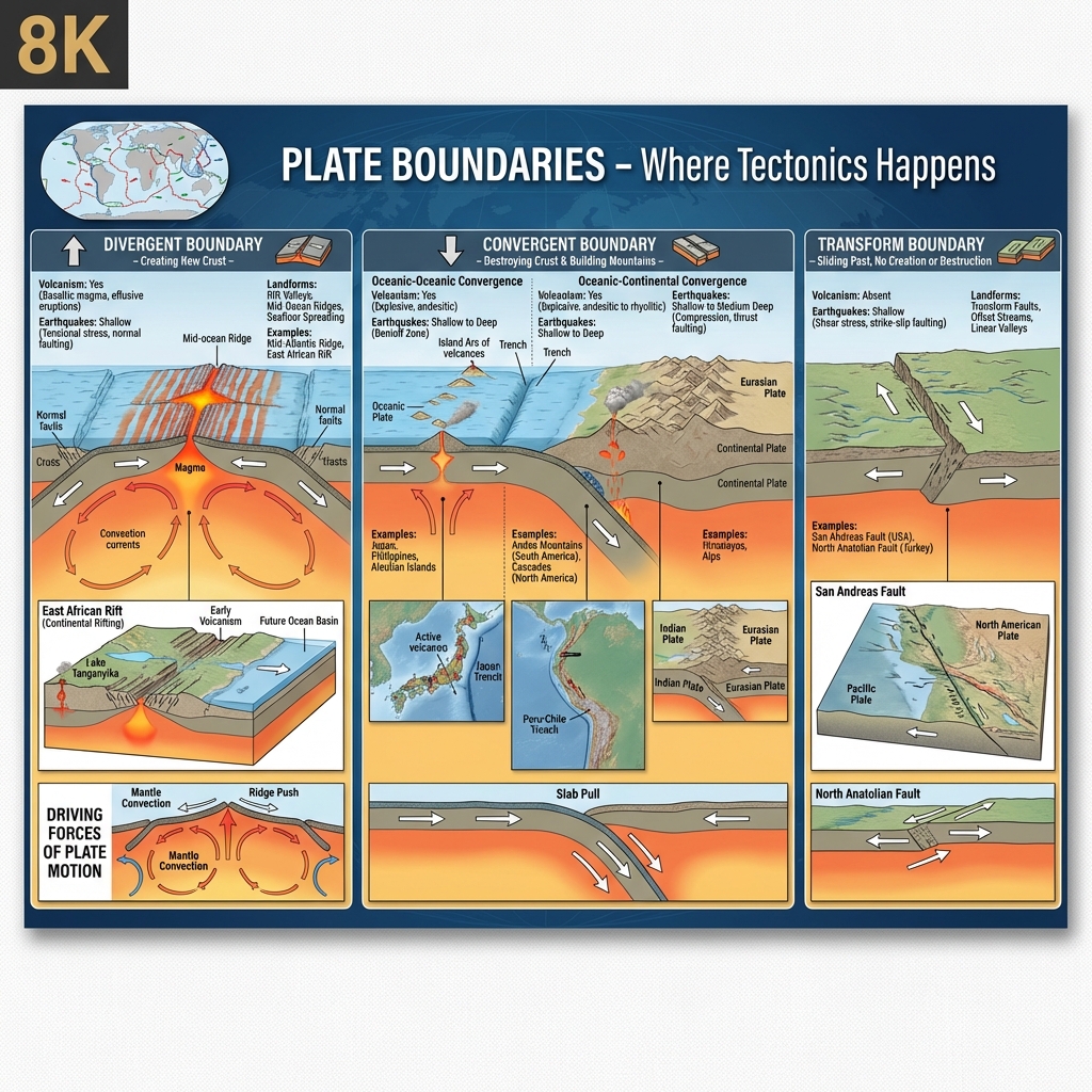
| Detail the three types of plate boundaries defined by Plate Tectonics. | Plate Tectonic Boundaries:
|
Earthquake Physics & Seismic Waves
Earthquake Physics & Seismic Waves
| Cue Words | Notes |
|---|---|
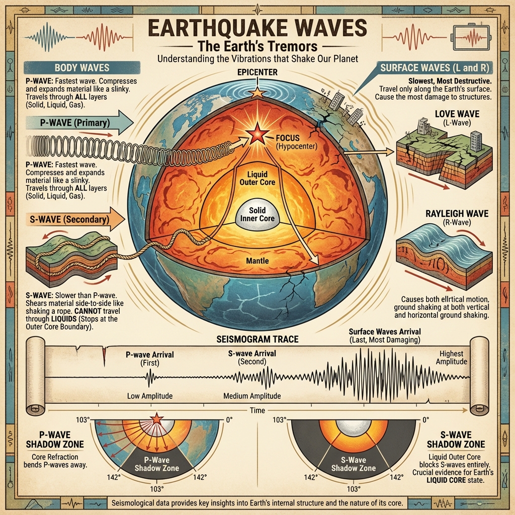
| Compare the properties of Primary (P) and Secondary (S) body waves. | Seismic Body Waves:
|
| What are surface waves and why are they the most destructive? | Surface Waves (L and R Waves): Travel along the Earth's surface. They have lower frequencies and cause the largest ground displacement, making them the most destructive seismic waves. |
| Define P-wave and S-wave shadow zones. | Seismic Shadow Zones:
|
Volcanoes & Magmatic Forms
Volcanoes & Magmatic Forms
| Cue Words | Notes |
|---|---|
| Classify the primary types of volcanoes based on eruption style and structure. | Volcanic Classifications:
|
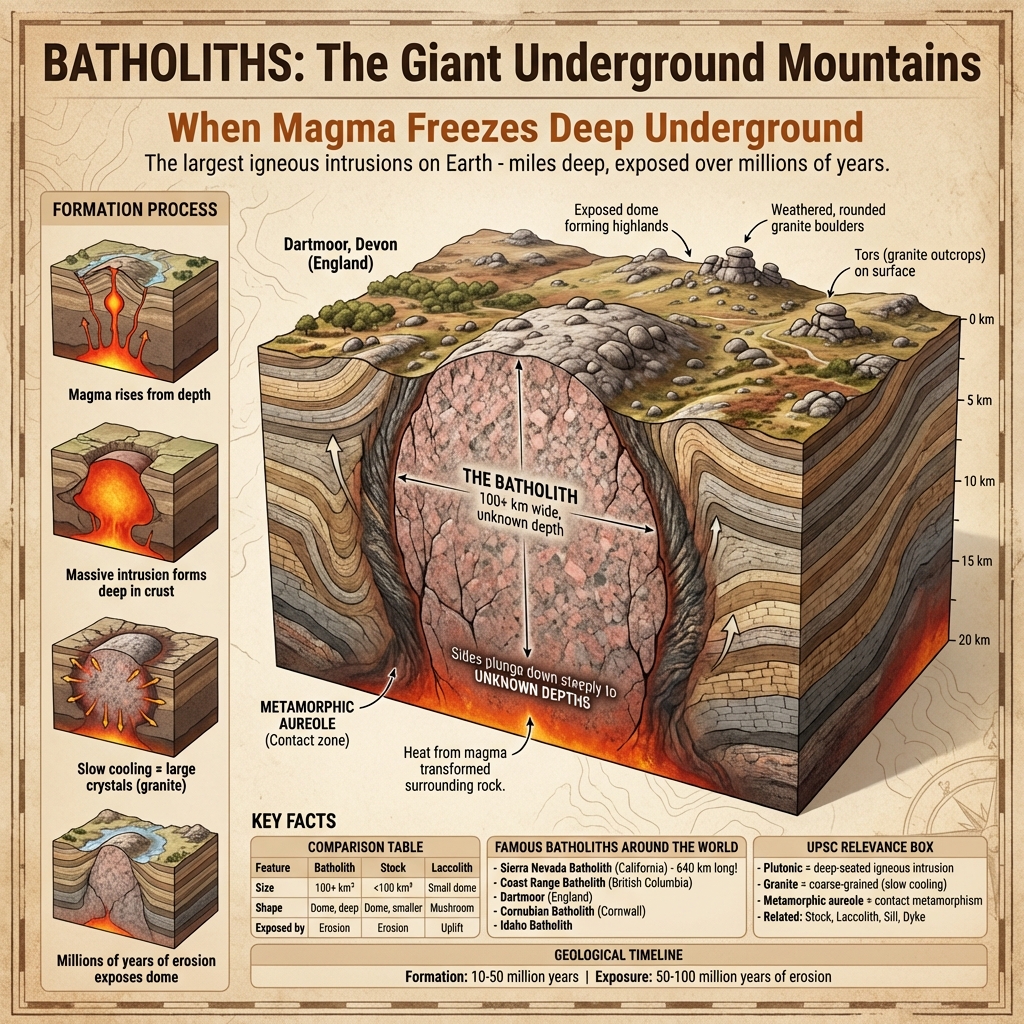
| Explain the intrusive landforms formed by underground cooling of magma: Batholiths, Laccoliths, Sills, and Dykes. | Intrusive Landforms:
|
High-Yield UPSC Revision Pointers
- Pacific Ring of Fire: A horseshoe-shaped zone of subduction and convergence zones hosting 75% of world's active volcanoes and 90% of global earthquakes.
- Mantle Plumes & Hotspots: Volcanic features fed by anomalies in the deep mantle (e.g., Hawaii, Reunion Island).
- Regur (Black Cotton) Soil: Fertile clayey soil formed by the weathering of basaltic rocks in the Deccan plateau.
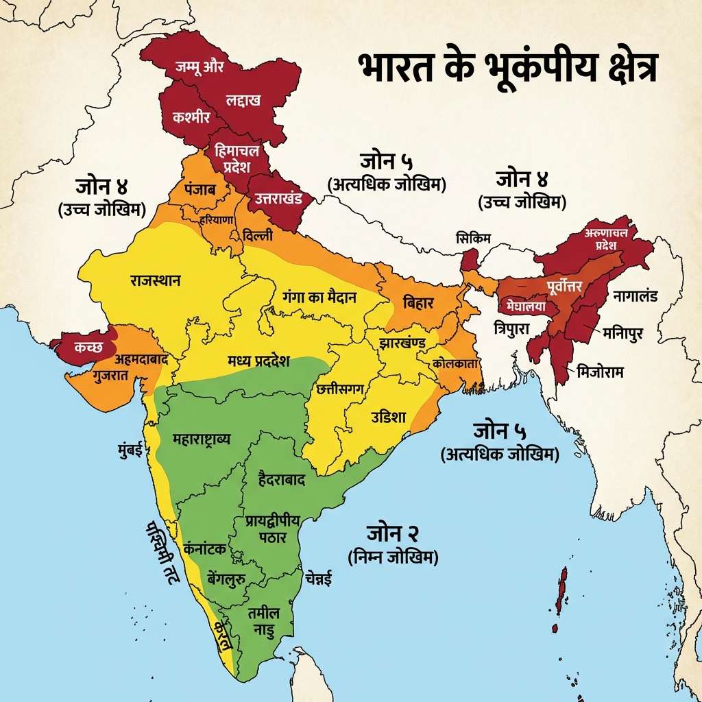
- IS 1893:2025 Earthquake Zoning: India is divided into 4 seismic zones (II, III, IV, V). The Himalayan belt and parts of NE represent Zone V (Very High Damage Risk).
🌋 Barren Island & India's Rock System Chronology
- Barren Island (Andaman & Nicobar): The only confirmed active volcano in South Asia, located in the Andaman Sea; it last erupted in 2022 and sits on the boundary of the Indian and Burma microplates.
- Indian Geological Rock Systems (oldest to youngest, broadly): Archean/Dharwar System (oldest crystalline rocks, gold/iron ore bearing) → Cuddapah System (sedimentary, thick unfossiliferous strata) → Vindhyan System (sedimentary, source of building sandstone, diamond-bearing in parts) → Gondwana System (fluvial, coal-bearing, contains Glossopteris fossils) → Tertiary System (Himalayan orogeny, petroleum-bearing in places).
- Gondwana Coal vs Tertiary Coal: Over 98% of India's coal reserves are of Gondwana age (Damodar, Mahanadi, Godavari valleys); Tertiary coal deposits are smaller and found in Assam, Meghalaya, and Nagaland (lignite/sub-bituminous).
Visual & Illustrative Assets
🖼️ Supplemental Asset Directory
- Earth Interior Structure:
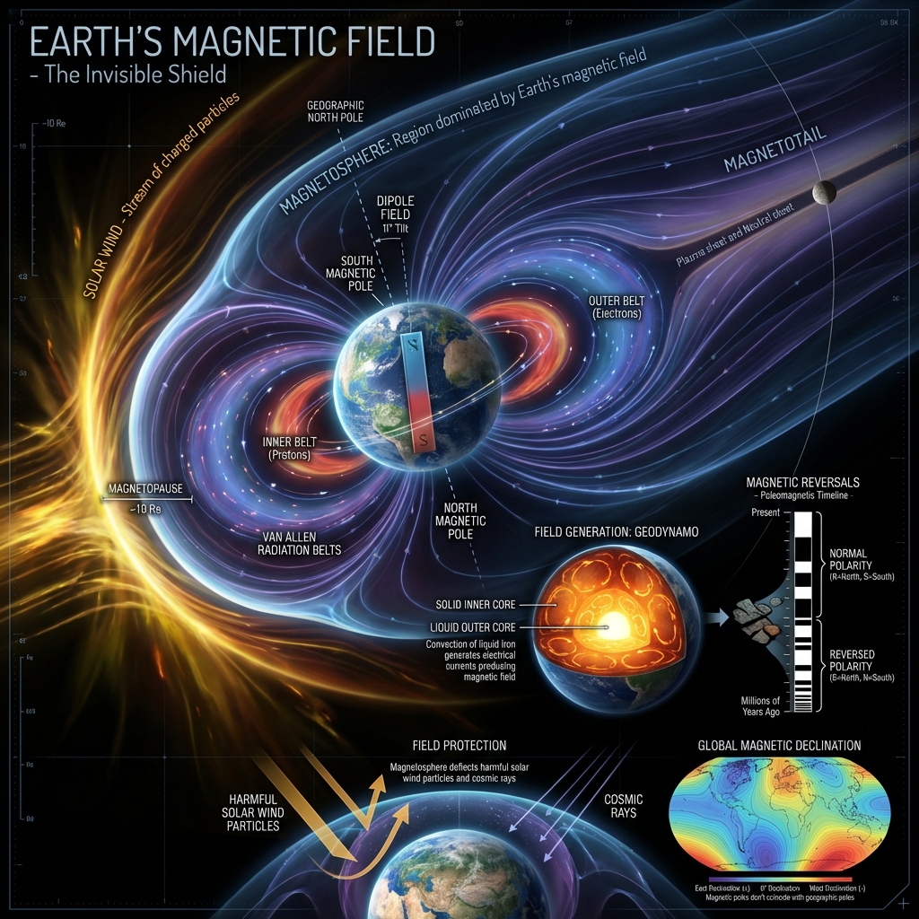
- Geomagnetic Field Dynamo:
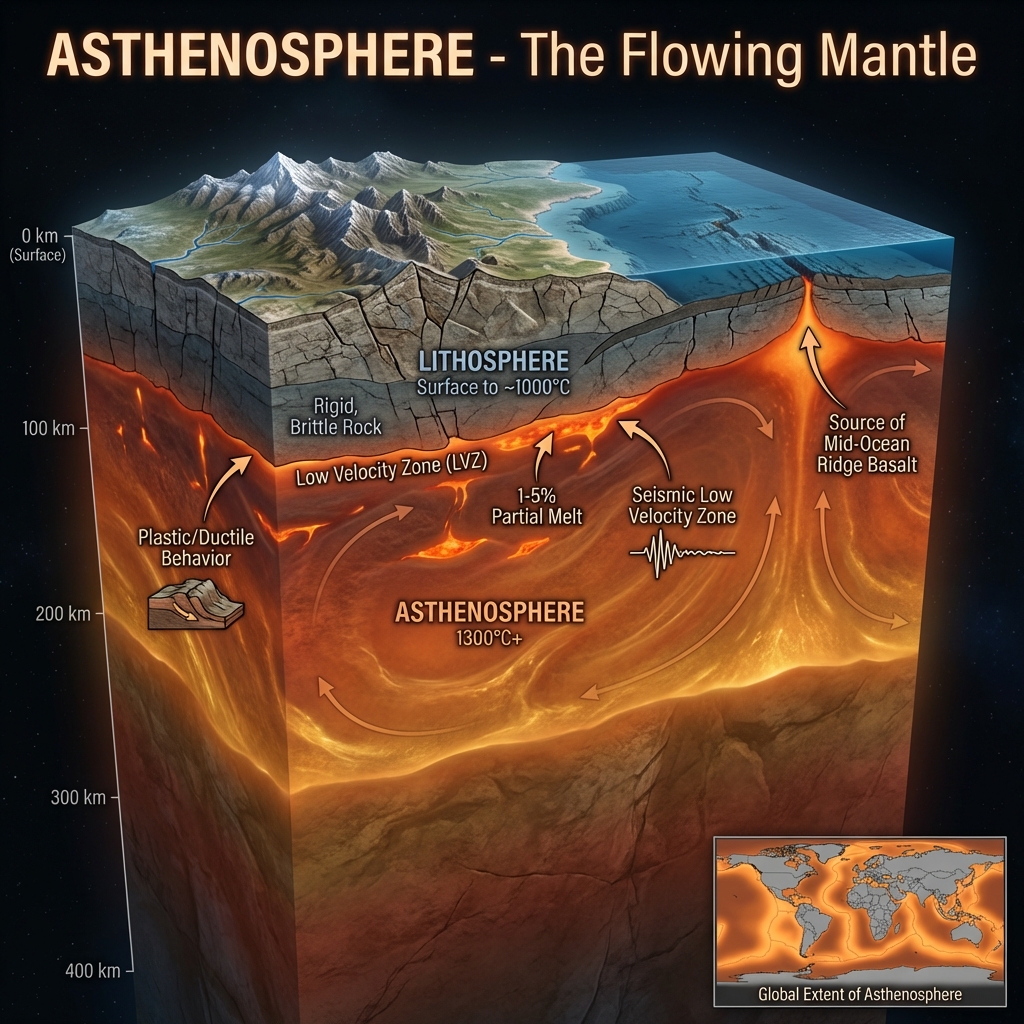
- Asthenosphere Boundary:
- Lithosphere Rheology:
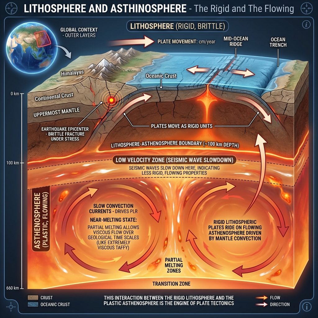
- Mantle Convection:
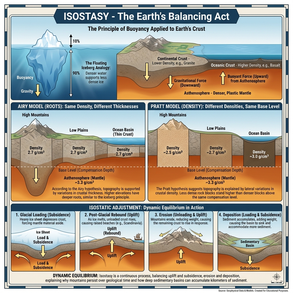
- Crustal Balance (Isostasy):
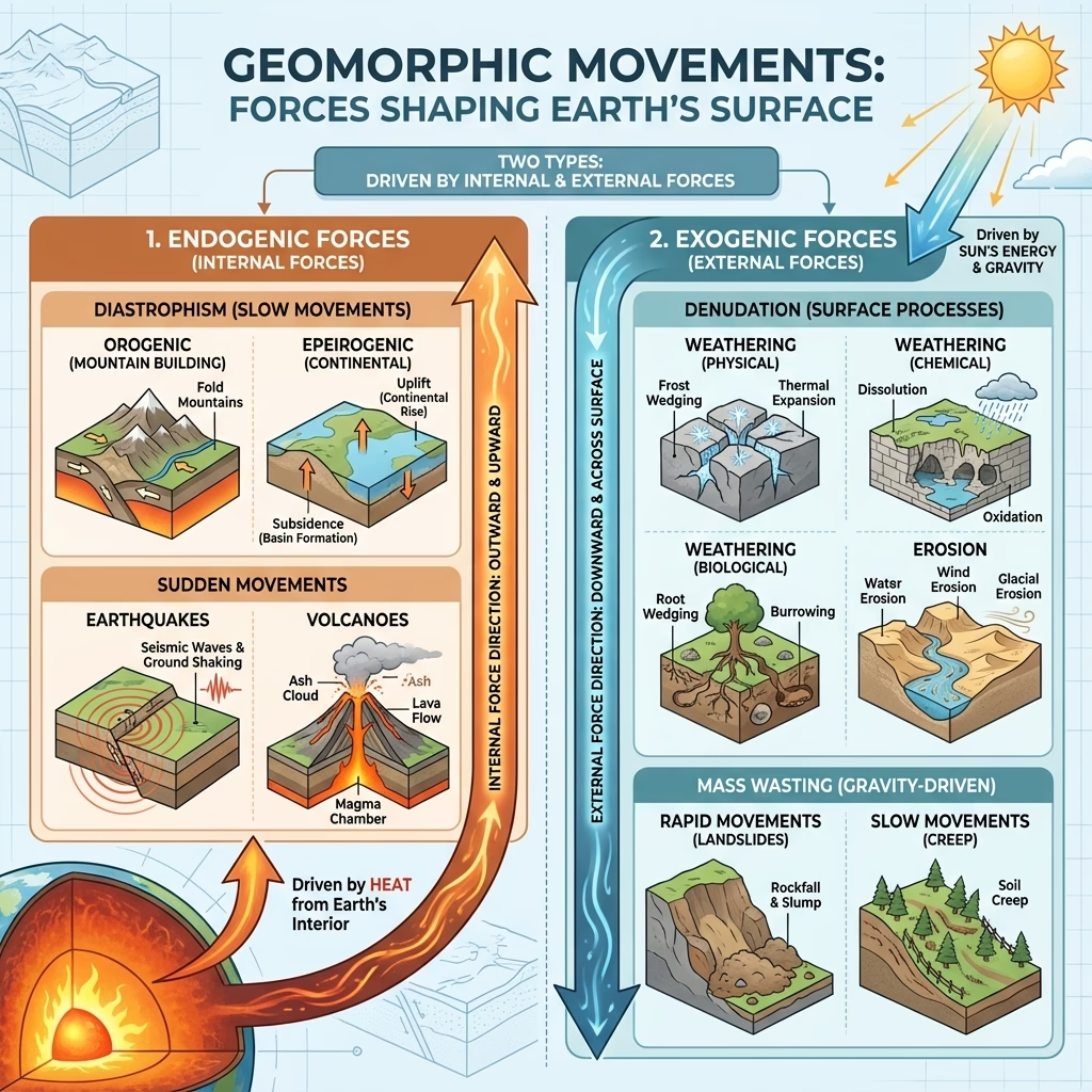
- Geomorphic Movements Diagram:
- Rock Cycle Process:
- Metamorphic Rock Formation:
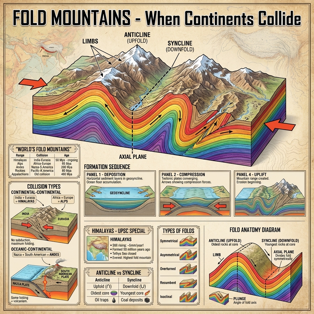
- Orogeny & Fold Mountains:
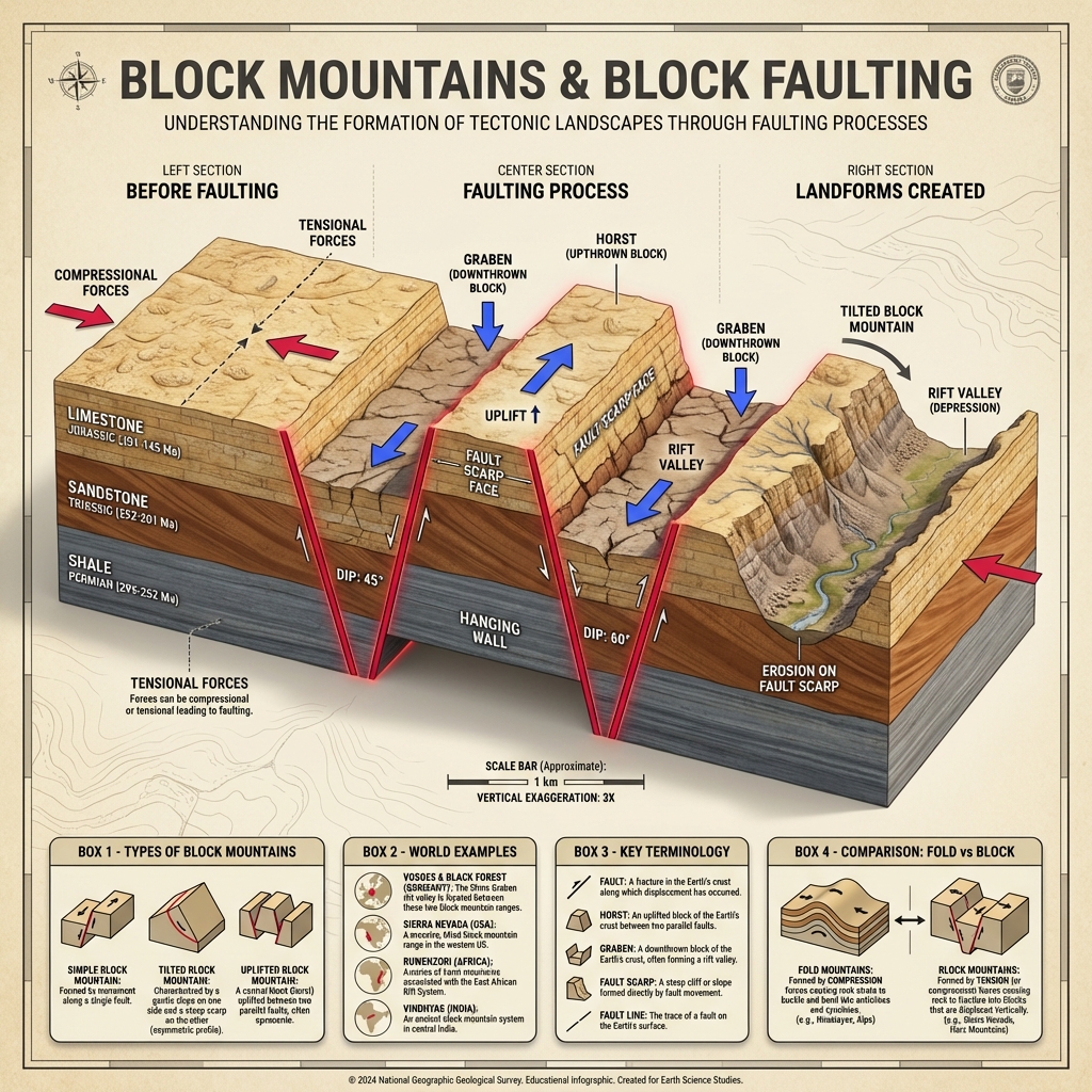
- Horst and Graben Faulting:
- Continental Drift Wegener:
- Seafloor Spreading Dynamics:
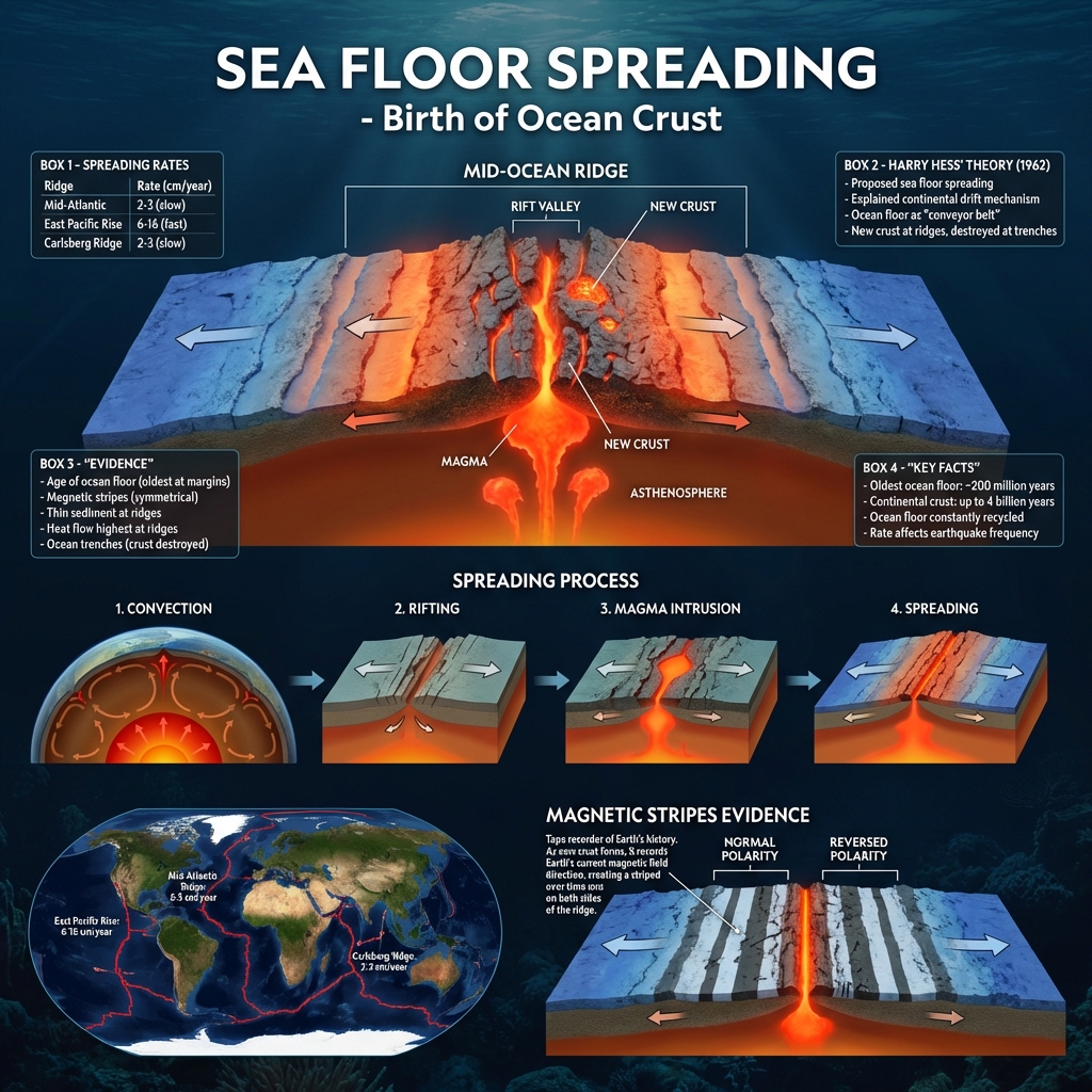
- Plate Tectonics Plates:
- Pangaea Supercontinent Map:
- Plate Boundary Interactions:
- Earthquake Shadow Zones:
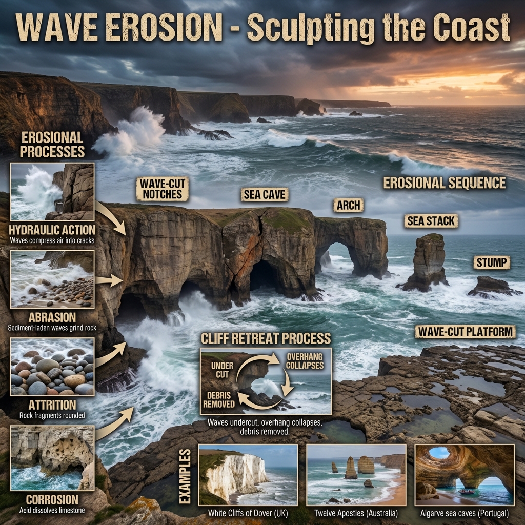
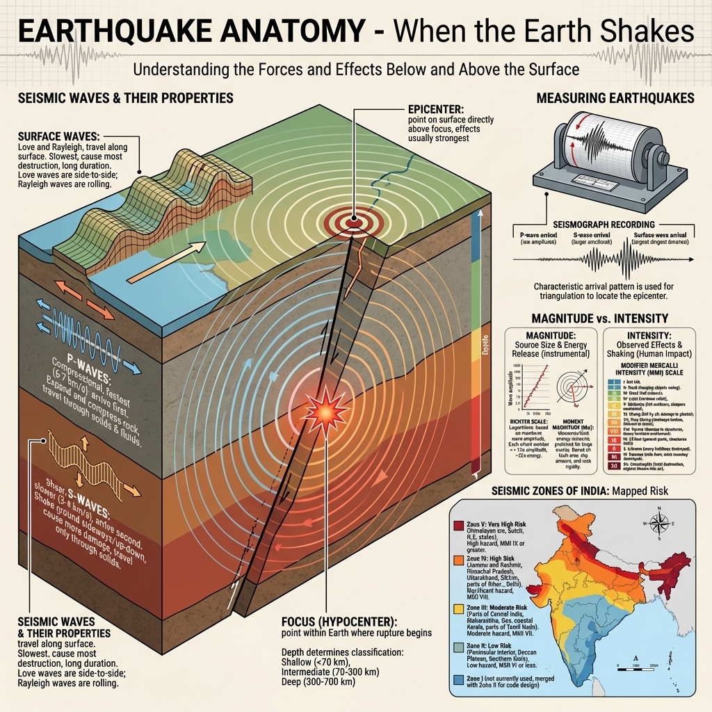
- Earthquake Anatomy:
- Seismic Wave Propagation:
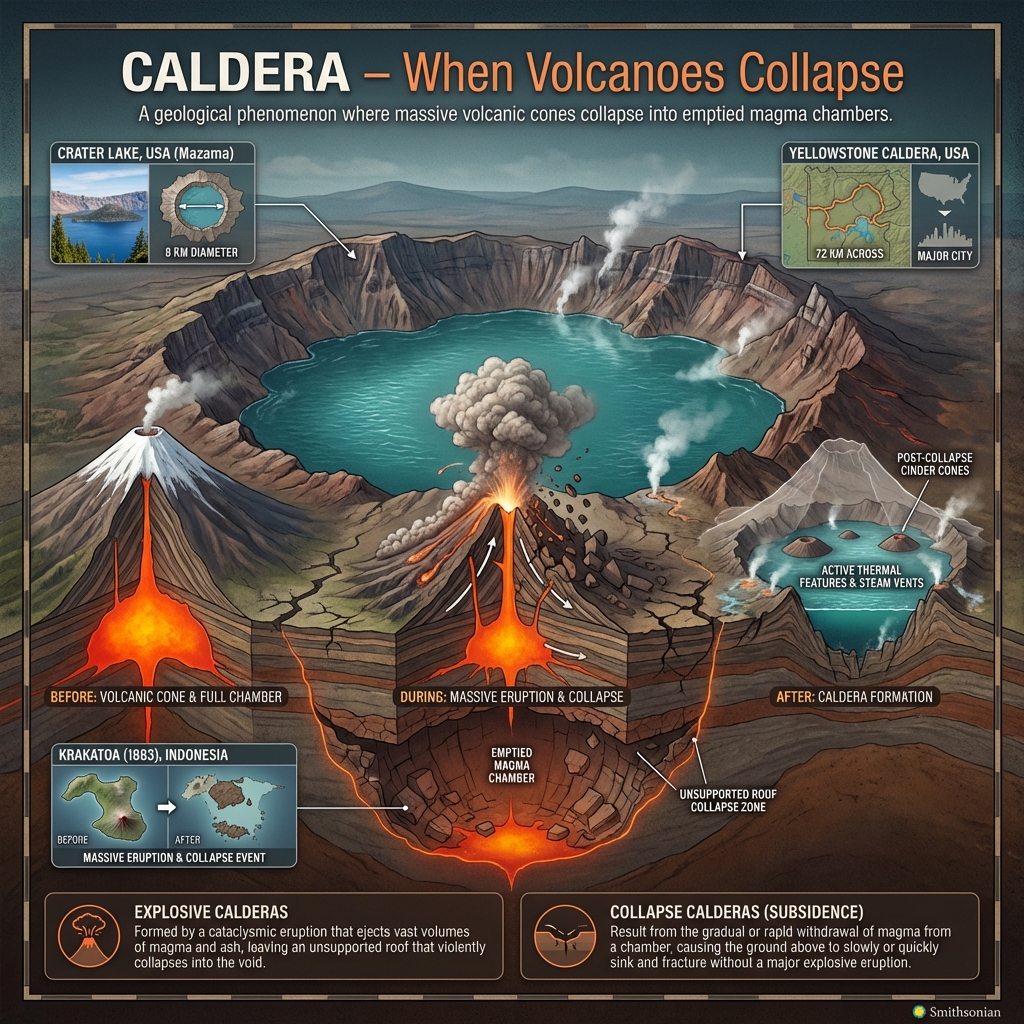
- Caldera Volcanic Collapse:
- Volcanic Eruptions & Intrusives:
- Earth's Crust Structure:
- Earth's Core Composition:
- Global Earthquake Zones:
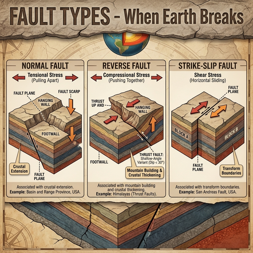
- Earthquake Fault Types:
Mains Practice Questions
- "Explain how the study of Seismic Waves (P and S waves) provides evidence regarding the physical state of the Earth's interior layers."
- "Discuss the theory of Plate Tectonics and explain how it accounts for the formation of the Himalayan Mountain System."
- "How do Intrusive Volcanic Landforms differ from Extrusive Volcanic Landforms? Map their formation with suitable schematics."