Skip to content

Indian Drainage, Climate & Soils

River Systems & Drainage Morphology


Himalayan vs Peninsular Rivers

Himalayan vs Peninsular Rivers
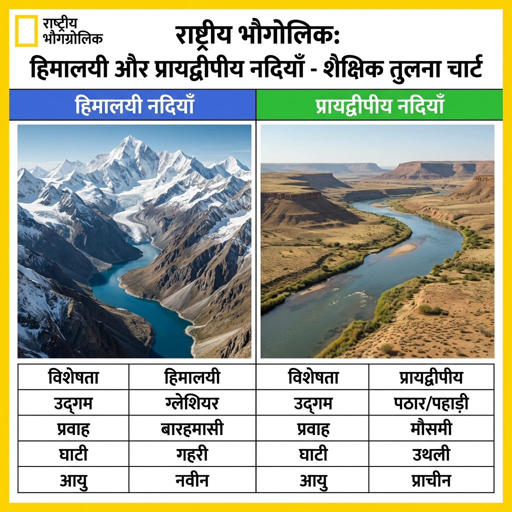
Compare the geological profiles and hydrological patterns of Himalayan and Peninsular river systems.Drainage Typology Comparison:
  • Himalayan River Systems:
    • Hydrology: Perennial flow, fed by both glacial snowmelt and monsoon rainfall.
    • Maturity: Youthful rivers with long courses. Actively perform intense vertical downcutting, forming gorges, V-shaped valleys, and rapids.
    • Genesis: Antecedent drainage (older than the mountain ranges, maintaining their courses by cutting through rising ranges).
  • Peninsular River Systems:
    • Hydrology: Seasonal flow, entirely dependent on monsoon rain.
    • Maturity: Mature rivers flowing through graded valleys with stable, shallow channels. Minimal vertical erosion.
    • Genesis: Superimposed or consequent drainage, mostly flowing eastwards conforming to the geological tilt of the peninsula (except Narmada and Tapti).

Major River Systems & Tributaries

Major River Systems & Tributaries
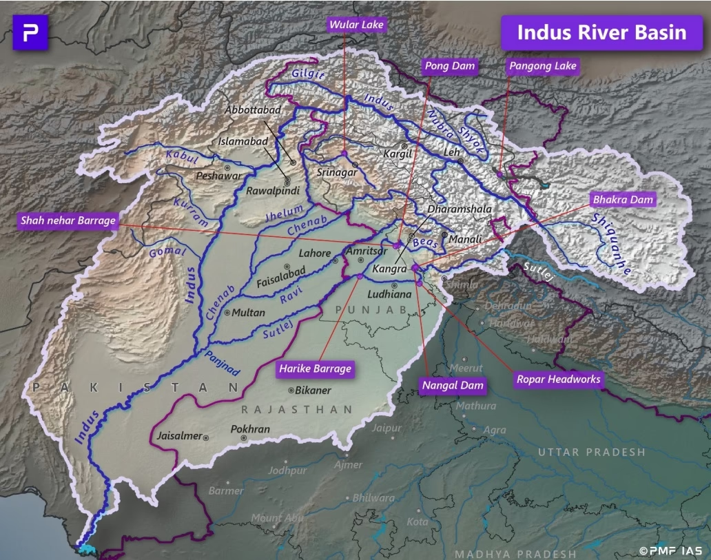
Detail the source, route, and major tributaries of the Indus and Ganga river systems.Indus & Ganga Basins:
  • Indus River System:
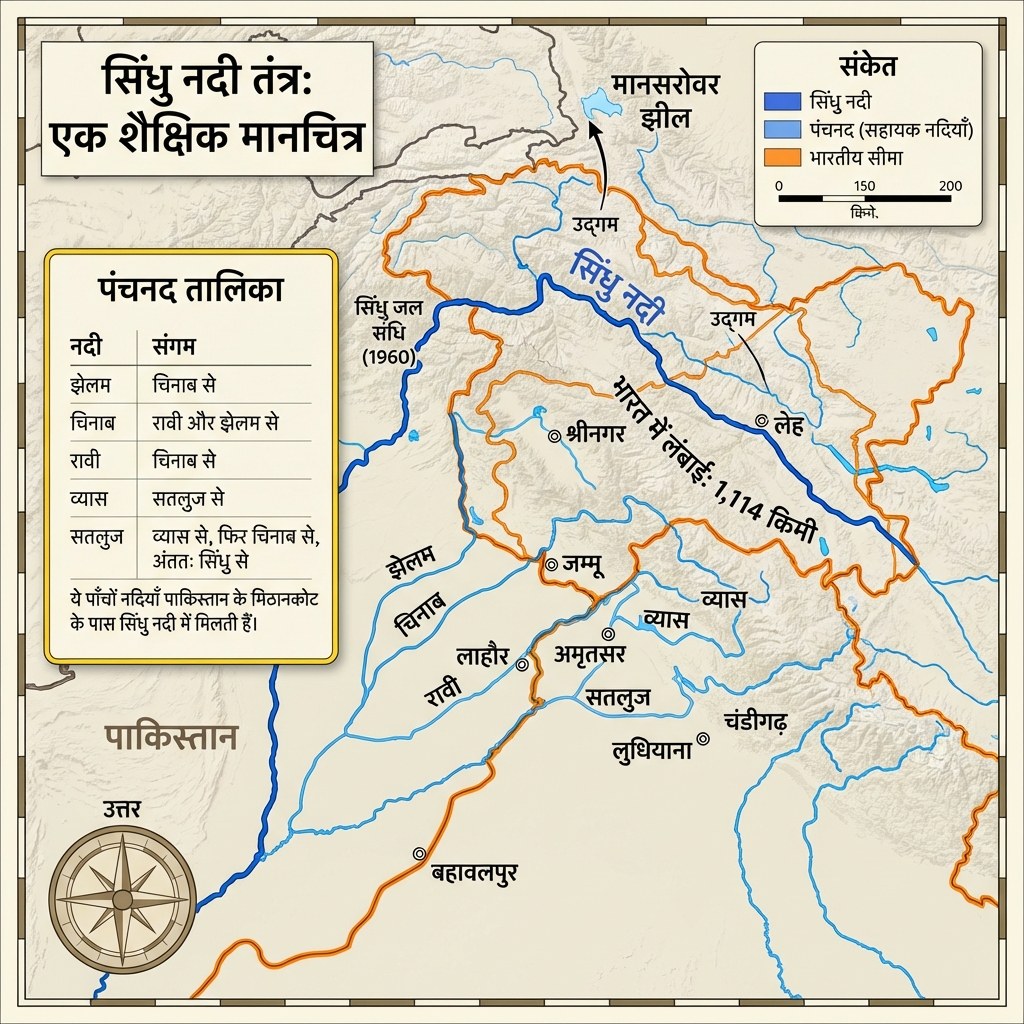
    • Source: Glaciers near Bokhar Chu in Tibet (flowing as Singi Khamban).
    • Key Tributaries: Chenab (largest tributary), Jhelum, Ravi, Beas, and Sutlej.
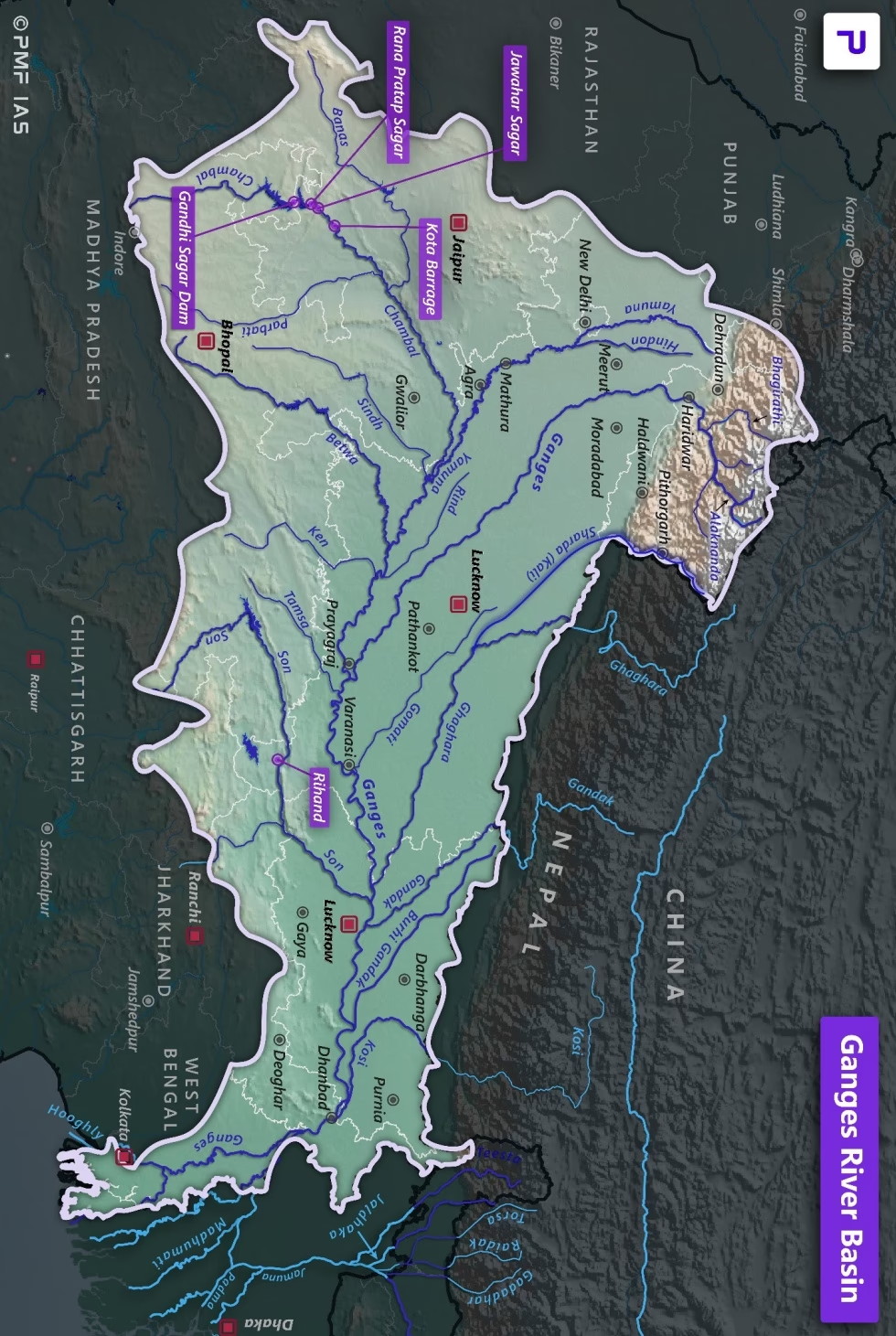
  • Ganga River System:
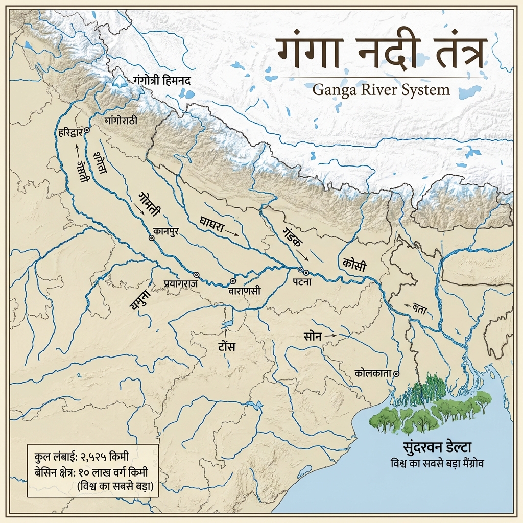
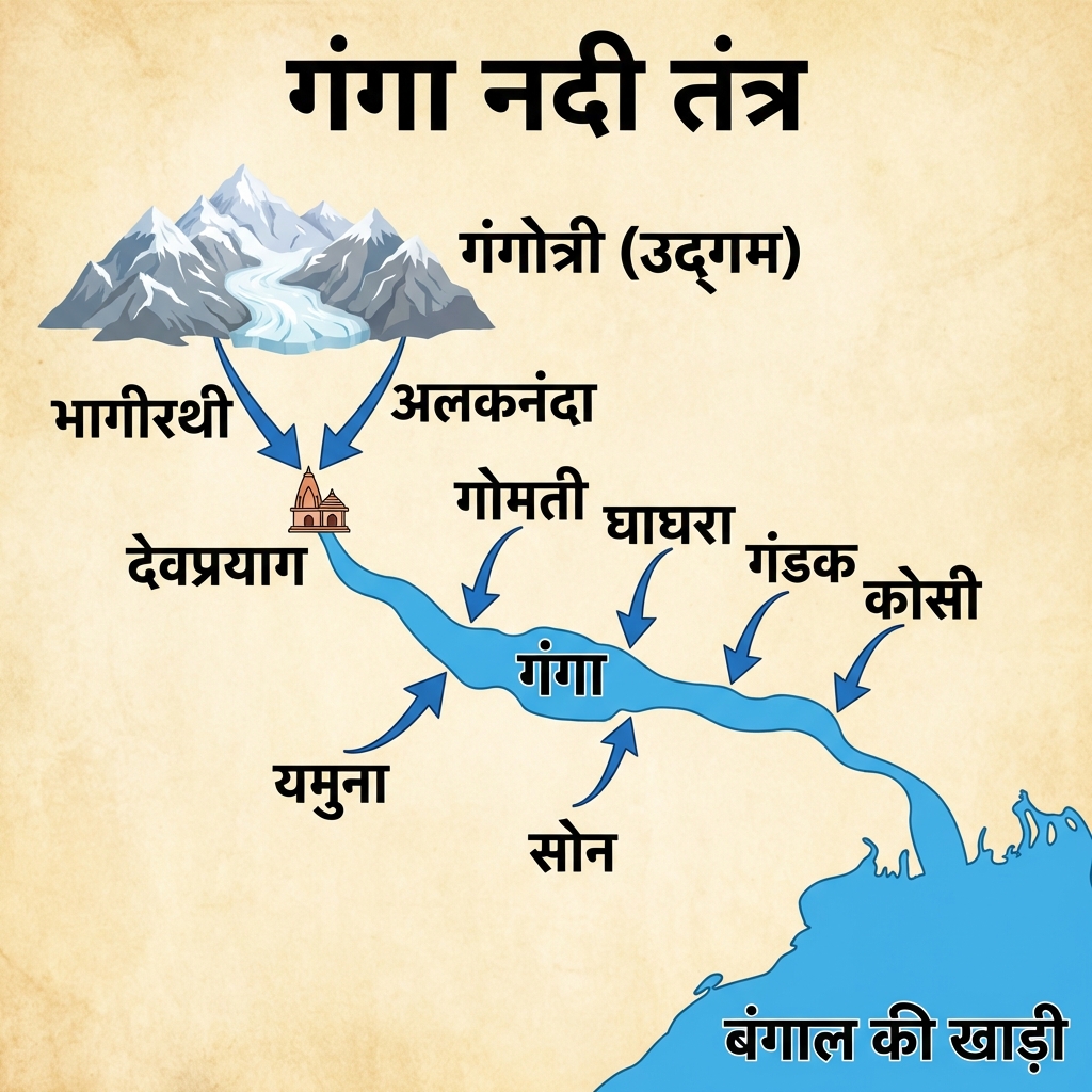
    • Source: Formed at Devprayag by the confluence of Alaknanda and Bhagirathi (originating at Gangotri Glacier).
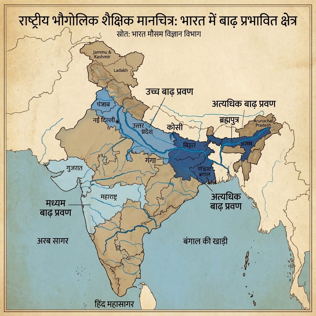
    • Left-Bank Tributaries: Ramganga, Gomti, Ghaghara, Gandak, Kosi ("Sorrow of Bihar"), and Mahananda.
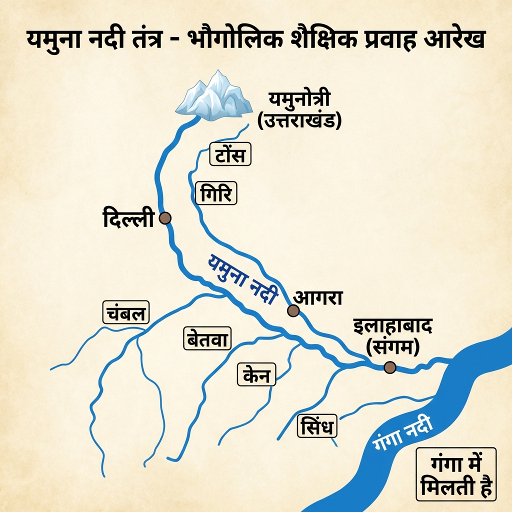
    • Right-Bank Tributaries: Yamuna (largest tributary, joins at Prayagraj) and Son (originating from Amarkantak).
Detail the source and features of the Brahmaputra and Peninsular river systems.Brahmaputra & Peninsular Rivers:
  • Brahmaputra River System:
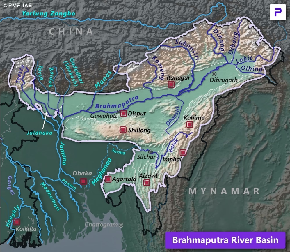
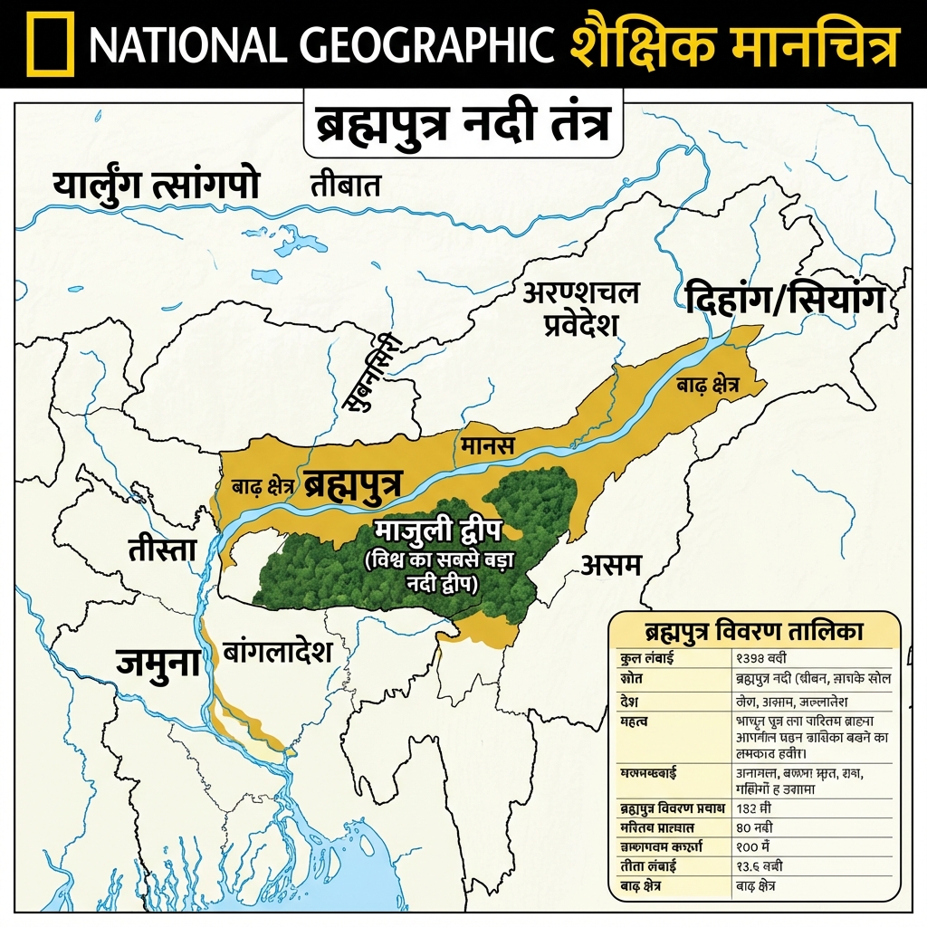
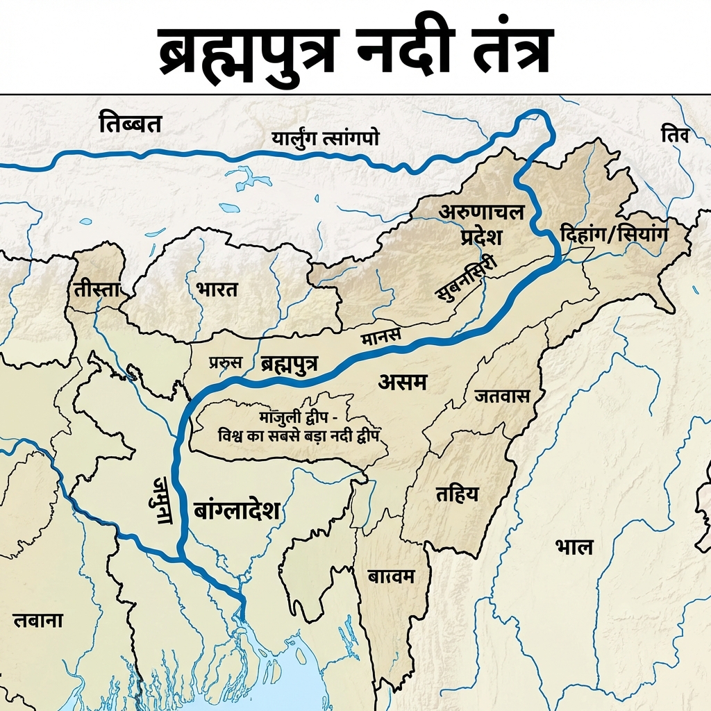
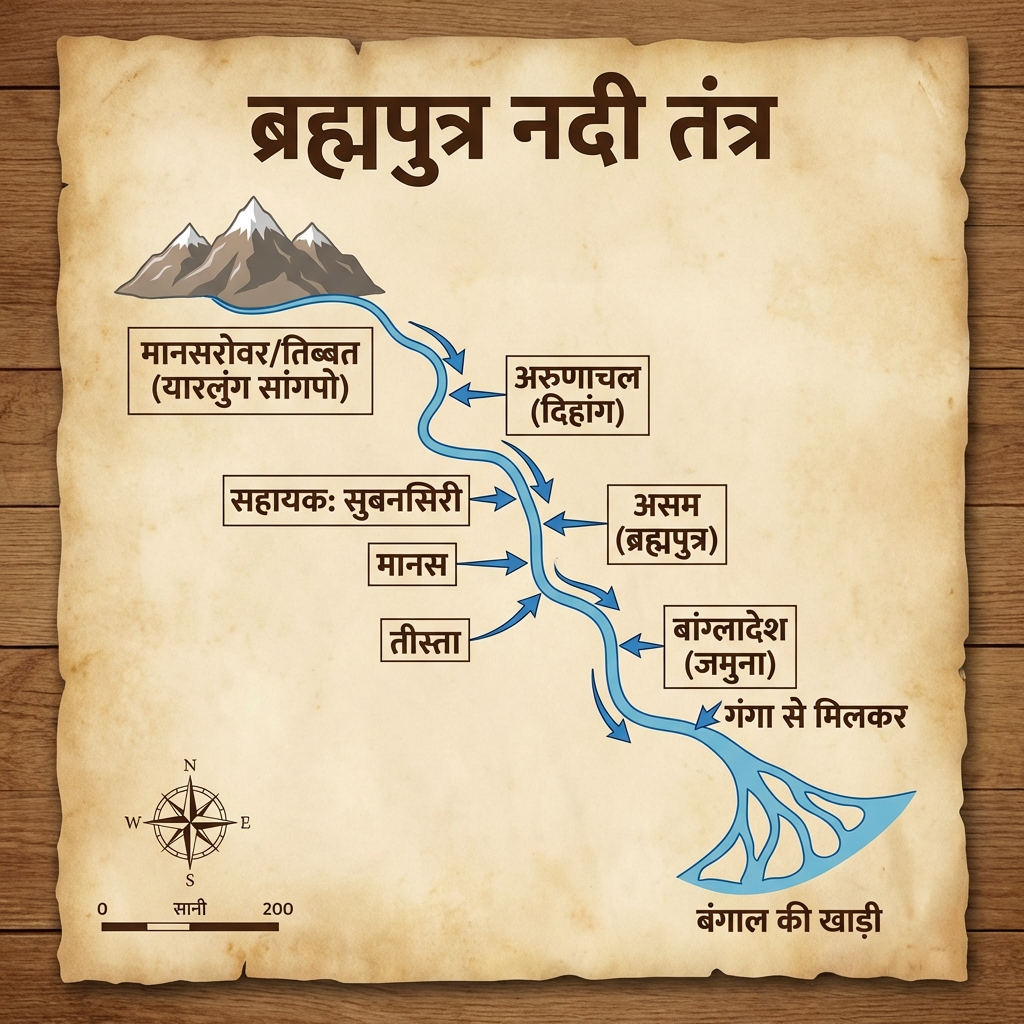
    • Source: Chemayungdung Glacier near Lake Mansarovar in Tibet (known as Tsangpo; enters India at Namcha Barwa as Dihang).
    • Features: Highly prone to flooding and channel migration. Formed Majuli, the world's largest river island. Flows as Jamuna in Bangladesh.
  • Peninsular East-Flowing Rivers:
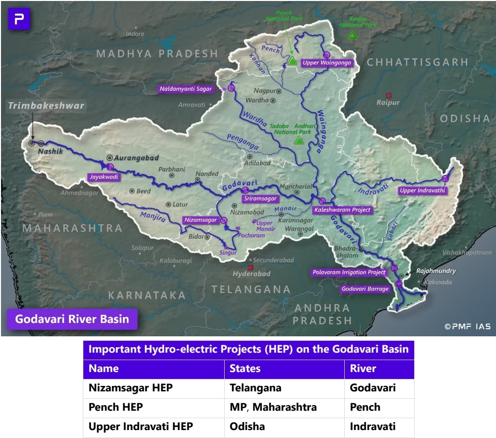
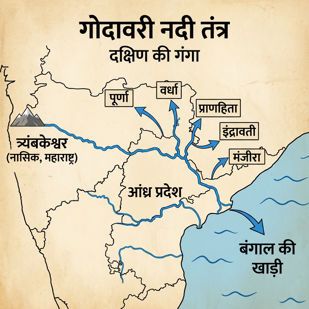
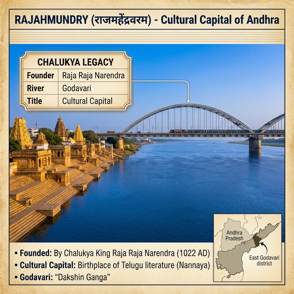
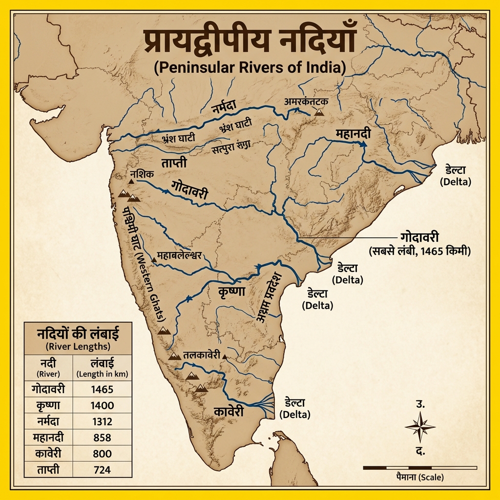
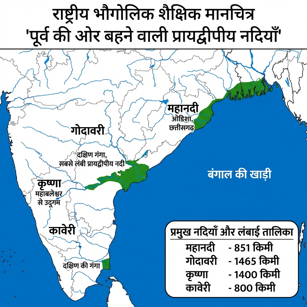
    • Godavari: Bounded as "Dakshin Ganga". Originates at Trimbakeshwar (Maharashtra). Largest Peninsular river. Key tributaries: Pranhita, Indravati, Manjra.
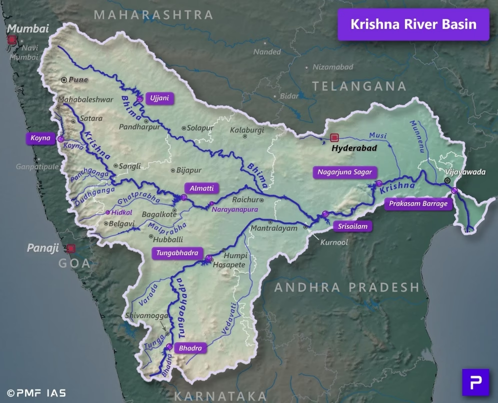
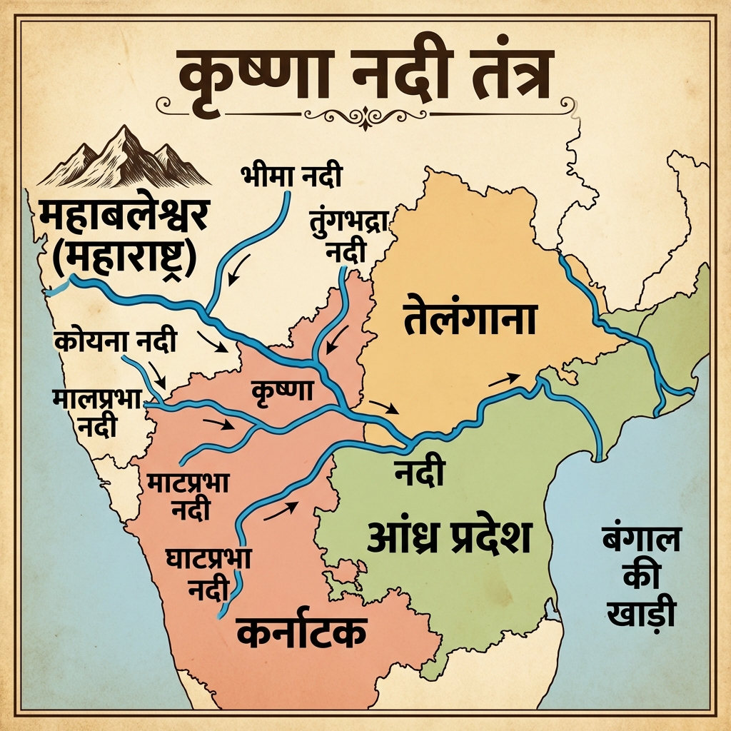
    • Krishna: Originates near Mahabaleshwar (Maharashtra). Tributaries: Tungabhadra, Bhima, Koyna.
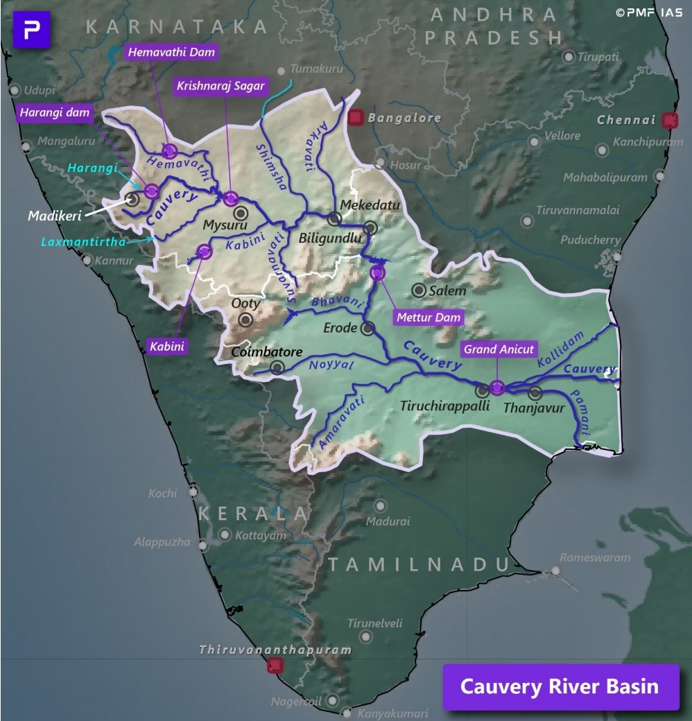
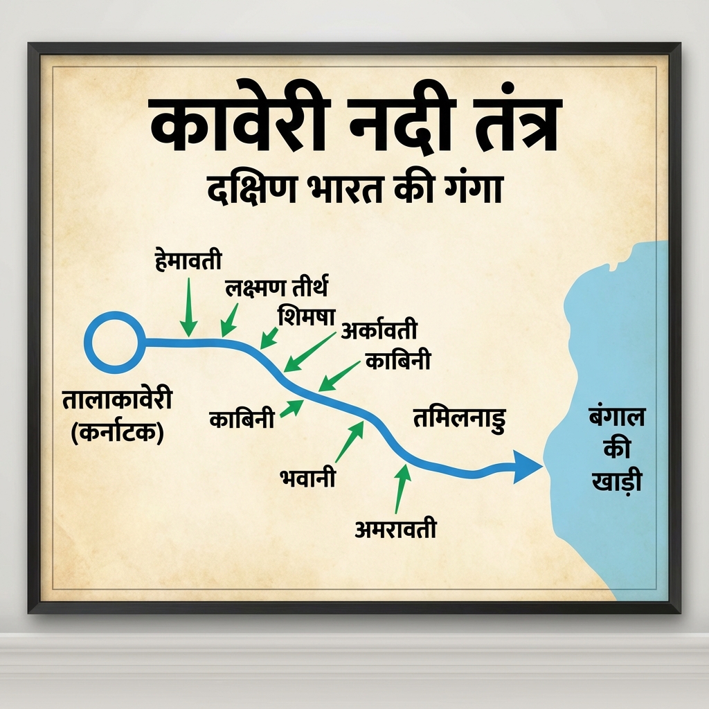
    • Cauvery: Originates in Brahmagiri Hills (Talakaveri, Karnataka). Receives water from both Southwest and Northeast monsoons, rendering it nearly perennial. Tributaries: Kabini, Bhavani, Hemavati.
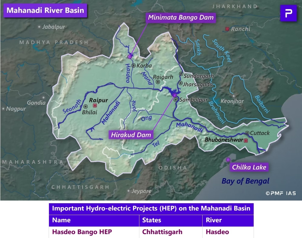
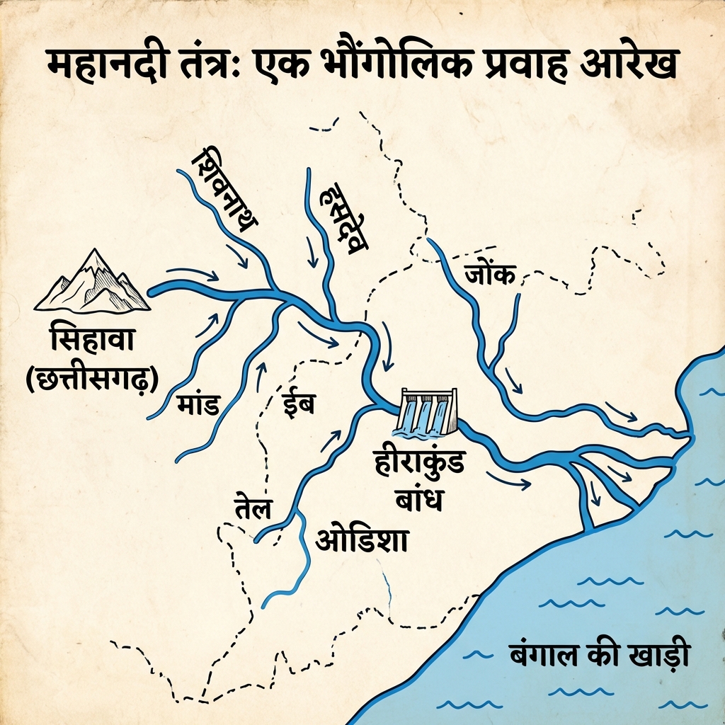
    • Mahanadi: Originates in Sihawa (Chhattisgarh). Tributaries: Seonath, Hasdeo, Ib.
  • Peninsular West-Flowing Rivers (Rift Valley):
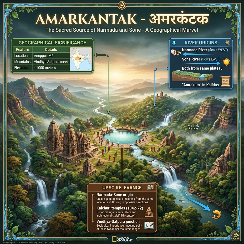
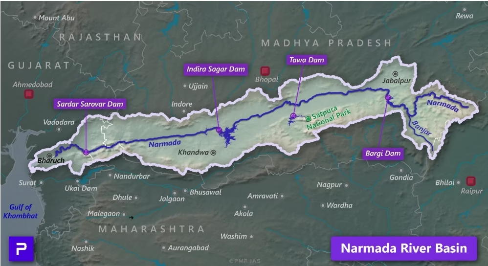
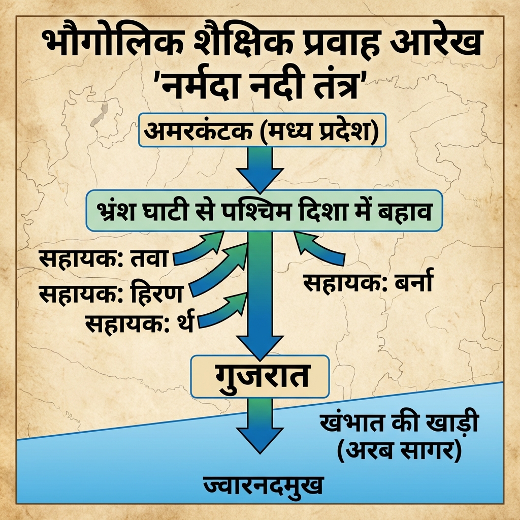
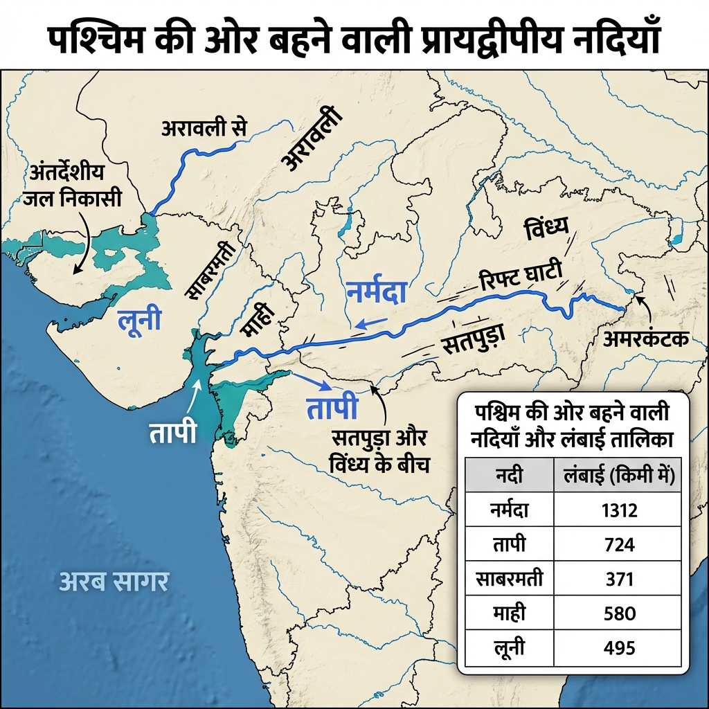
    • Narmada: Originates at Amarkantak Plateau (Madhya Pradesh). Flows through a structural rift valley between Vindhyas and Satpuras. Forms the Dhuandhar Falls. Has no delta due to steep rocky gradient, forming an estuary.
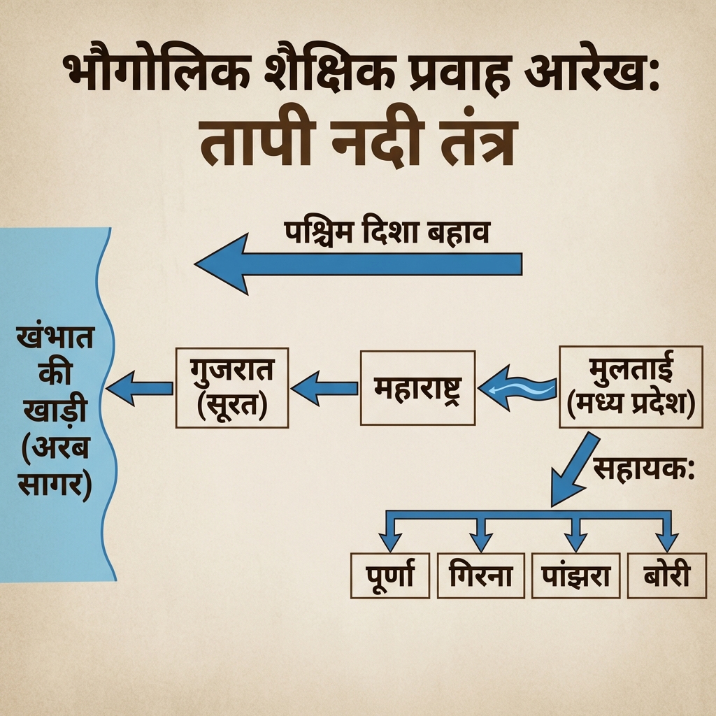
    • Tapti: Originates at Multai (Betul, MP), flowing parallel to Narmada.

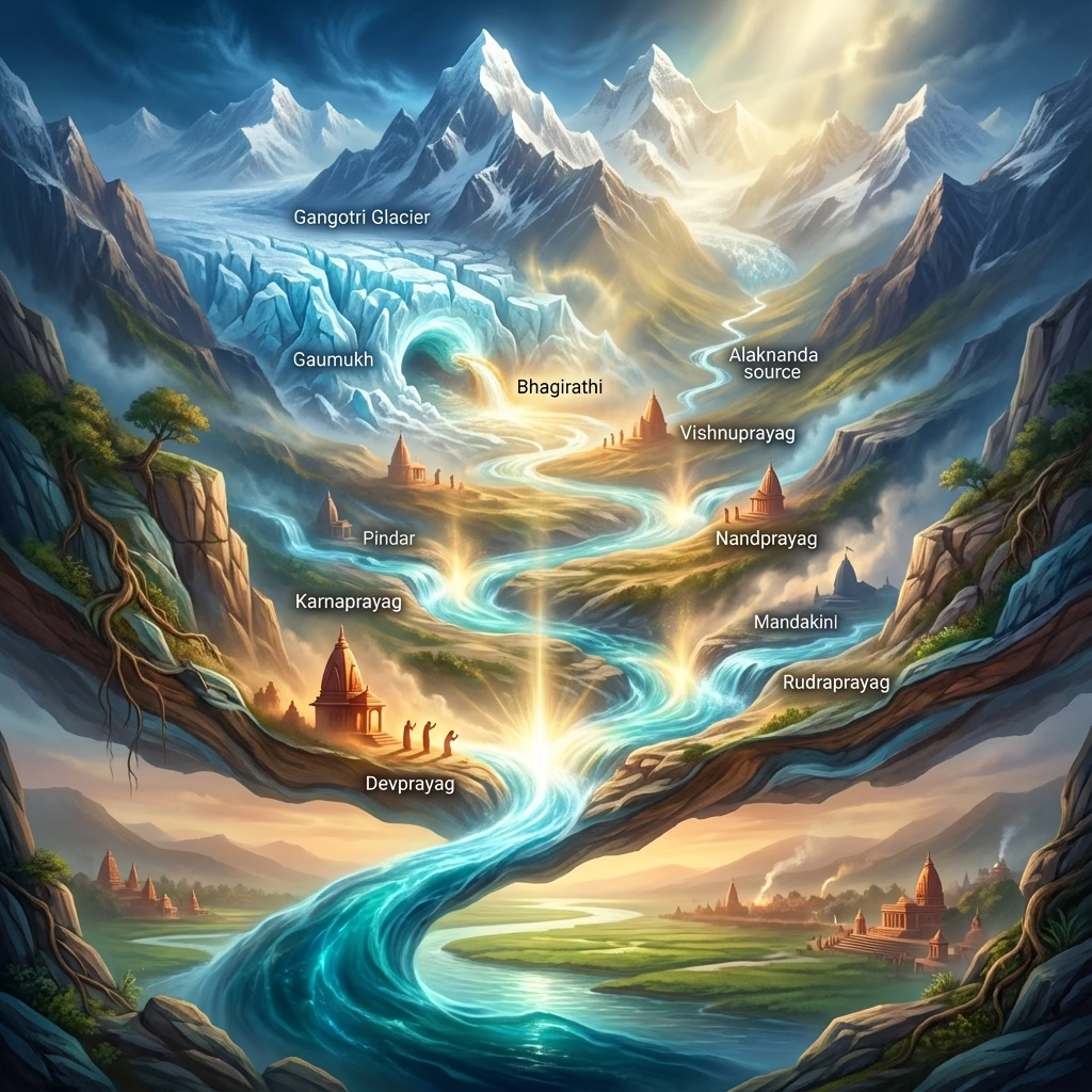
The Panch Prayag Confluences

The Panch Prayag Confluences
List the five sacred confluences (Panch Prayag) of the Alaknanda river from source downstream.Panch Prayag Confluences:
  1. Vishnuprayag: Alaknanda River meets the Dhauliganga River.
  2. Nandprayag: Alaknanda River meets the Nandakini River.
  3. Karnaprayag: Alaknanda River meets the Pindari River.
  4. Rudraprayag: Alaknanda River meets the Mandakini River.
  5. Devprayag: Alaknanda River meets the Bhagirathi River (from this point, the combined stream is named the Ganga).

Monsoon Dynamics & Soil Systems


Indian Monsoon & Climate Extremes

Indian Monsoon & Climate Extremes
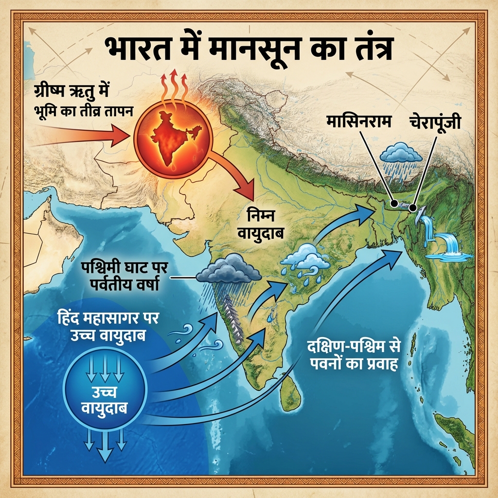
Explain the meteorological mechanism driving the Indian Southwest Monsoon.Monsoon Mechanics:
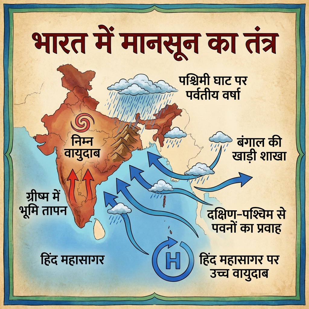
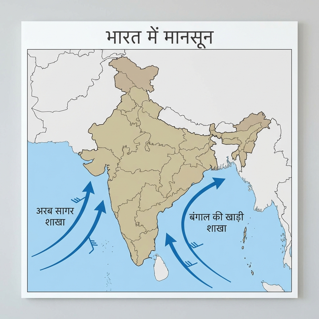
  • Differential Heating: Seasonal thermal contrast between the heating of the Asian landmass (forming an intense low pressure over Tibet) and the cooling of the southern Indian Ocean (high pressure).
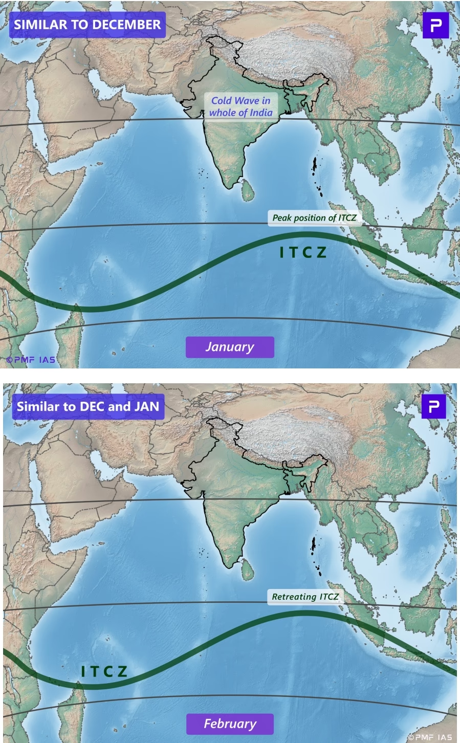
  • ITCZ Shift: Northward migration of the Inter-Tropical Convergence Zone to the foothills of the Himalayas during summer.
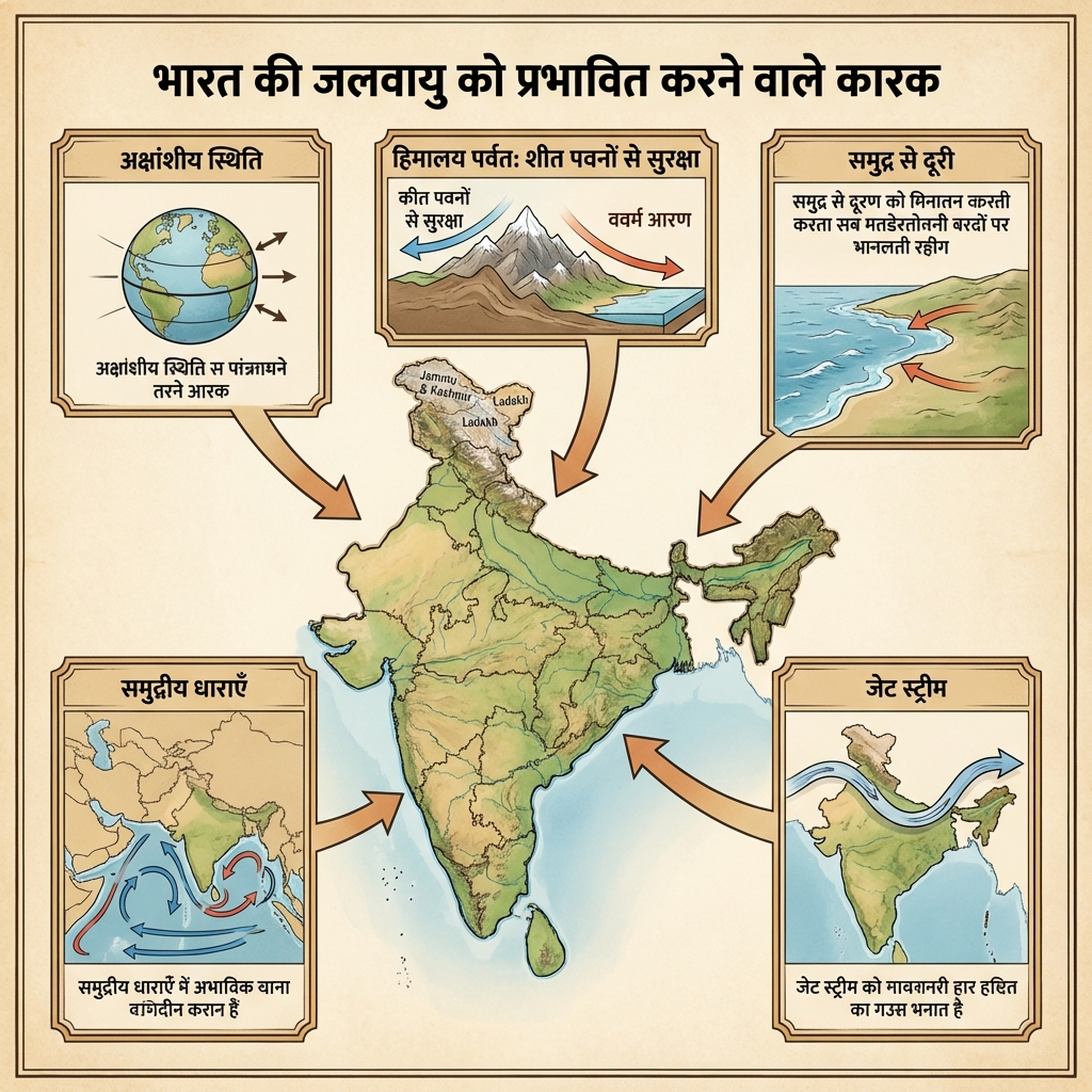
  • Jet Stream Shift: The subtropical westerly jet stream must retreat north of the Himalayas, allowing the Tropical Easterly Jet (TEJ) to establish over the peninsula, pulling the Southwest Monsoon winds.
Describe the extreme precipitation and thermal patterns across India.Climatic Extremes:
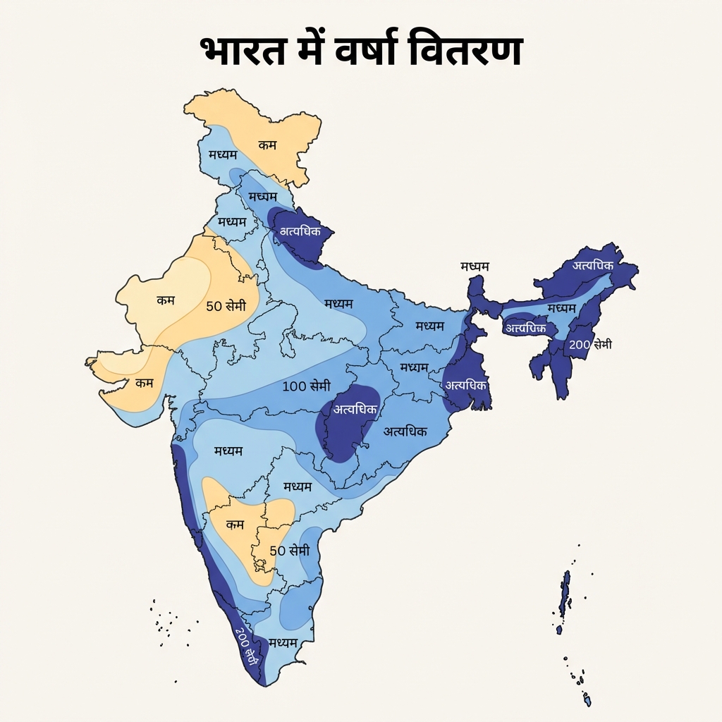
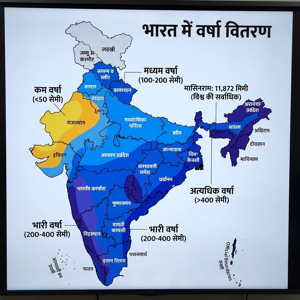
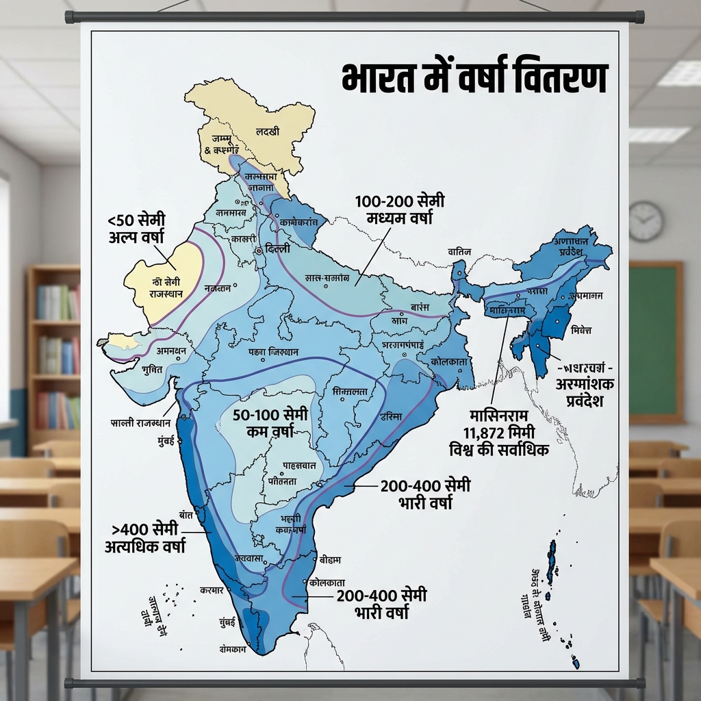
  • Precipitation: Mawsynram (Meghalaya) receives the highest average annual rainfall in the world (~1,200 cm) due to the funneling effect of the Khasi hills. Conversely, parts of the Thar Desert receive $<15\text{ cm}$ rainfall.
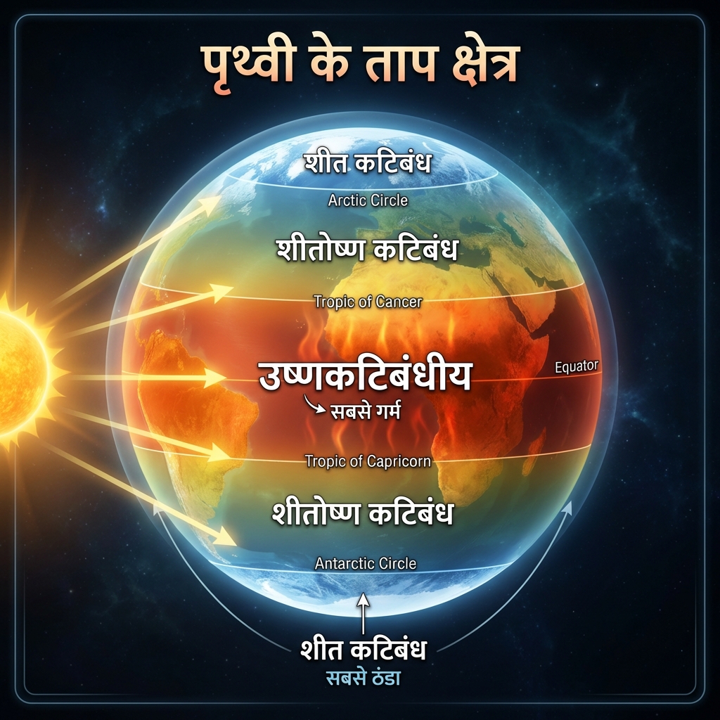
  • Temperature: Drass in Ladakh records temperatures as low as $-45^{\circ}C$ in winter, while locations in Rajasthan (e.g., Phalodi) record summer extremes exceeding $50^{\circ}C$.

Soil Classifications & Soil Health

Soil Classifications & Soil Health
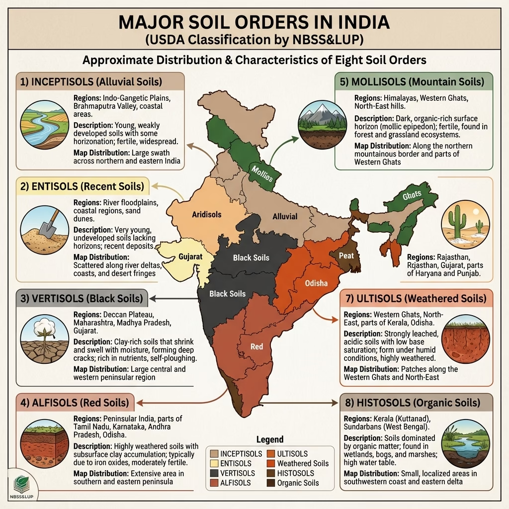
Classify the four major Indian soil groups defined by ICAR and state their profiles.ICAR Soil Database:
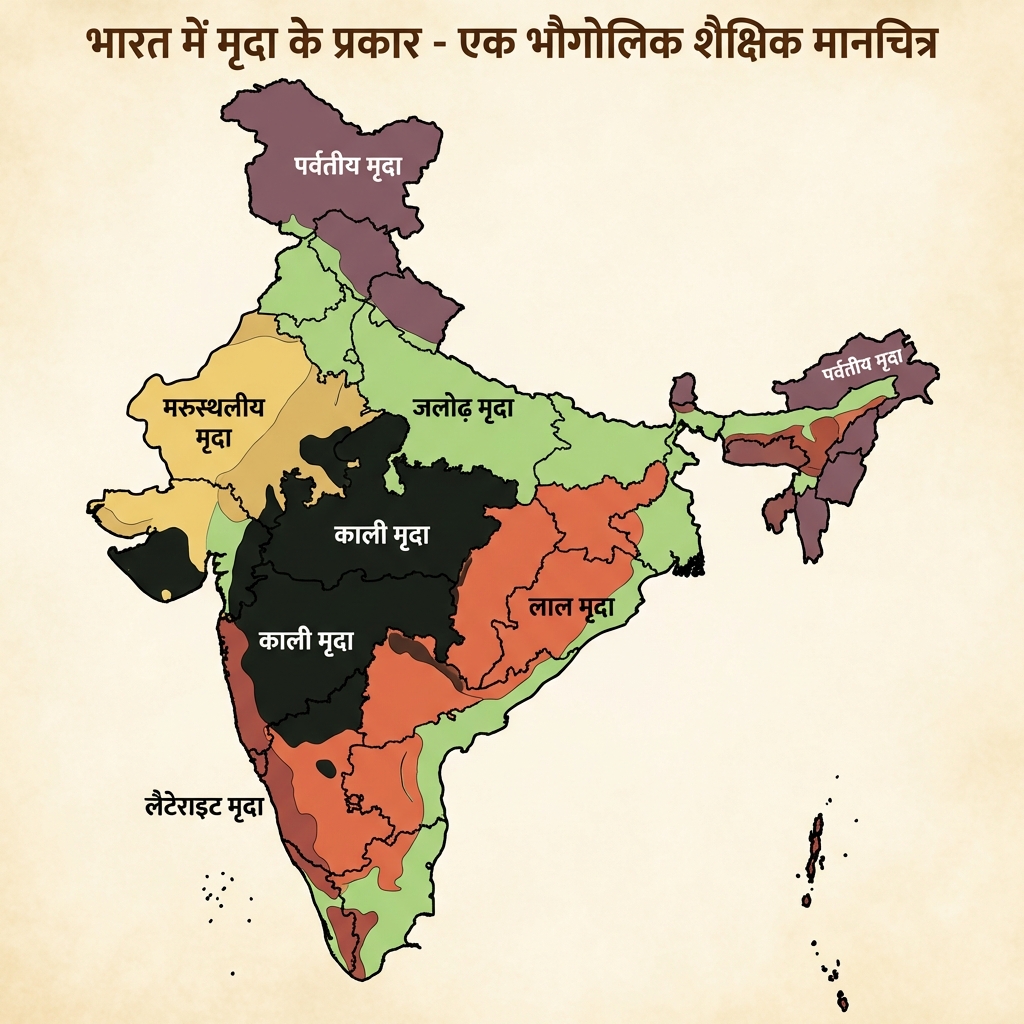
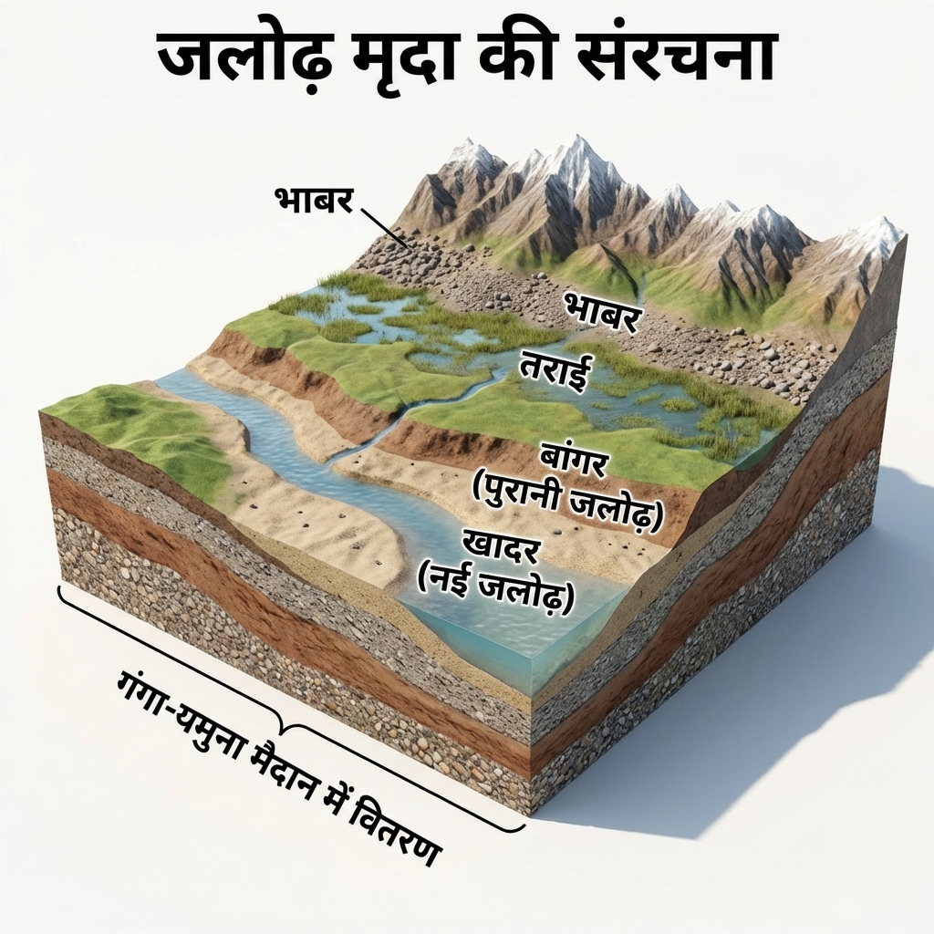
  • Alluvial Soils (43%): Most widespread. Deposited by the Indo-Gangetic rivers. High potash content but poor in phosphorus and nitrogen. Excellent for Wheat, Rice, and Sugarcane.
  • Red Soils (18%): Derived from weathering of crystalline igneous rocks. Red color is due to wide diffusion of iron oxides. Rich in potash, poor in nitrogen and humus. Ideal for millets and oilseeds.
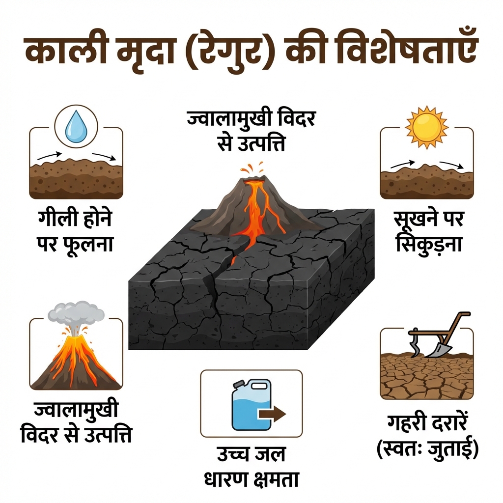
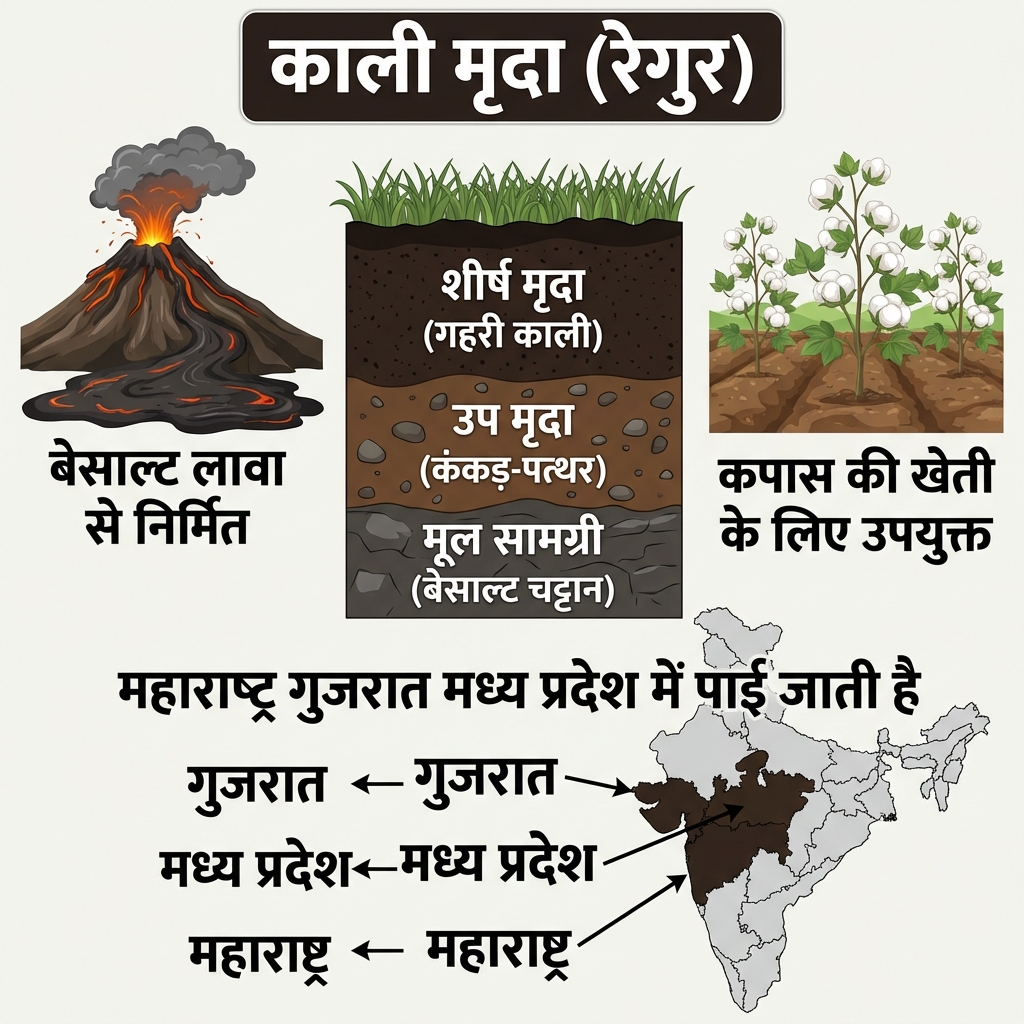
  • Black (Regur) Soils (15%): Volcanic origin (basaltic). Clayey, moisture-retentive, self-ploughing (develops deep cracks when dry, swells when wet). Rich in lime, iron, magnesium; poor in nitrogen. Ideal for Cotton.
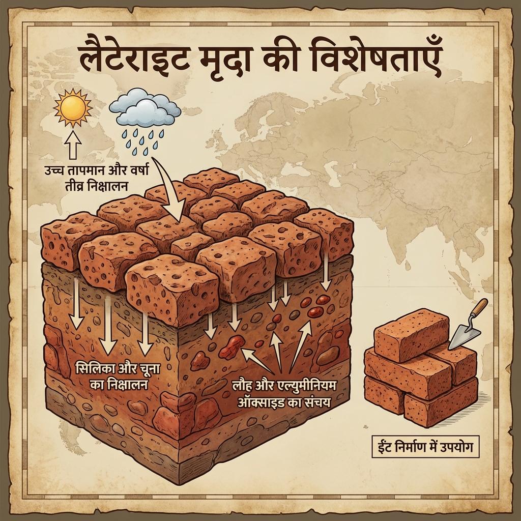
  • Laterite Soils (3.7%): Formed under high temperatures and heavy seasonal rainfall. Highly leached; poor in silica, nitrogen, and organic matter. Rich in iron oxide and aluminum. Excellent for plantation crops (Cashew, Tea, Coffee).
What is the current health status of Indian soils regarding organic carbon and micronutrients?Soil Health Challenges:
  • Soil Organic Carbon (SOC): The majority of agricultural soils in India show critically depleted SOC levels below 0.5% (optimal levels should be $>0.75\%$).
  • Zinc Deficiency: Widespread deficiency of zinc and other micronutrients (boron, iron) is leading to crop yield stagnation and "hidden hunger" in the human population due to nutrient-deficient crops.

High-Yield UPSC Revision Pointers

  • Mahi River: The only major river in India that flows through the Tropic of Cancer twice (first flowing north, then looping south).
  • Luni River: Originates in the Aravalli Range near Ajmer. It is an endorheic river that flows into the Rann of Kutch where it drains into inland sands without reaching the ocean.
  • Perennial Peninsular River: The Cauvery River receives rainfall from the Southwest Monsoon in its upper catchment (Karnataka) and from the Northeast Monsoon in its lower catchment (Tamil Nadu), maintaining a near-constant flow.
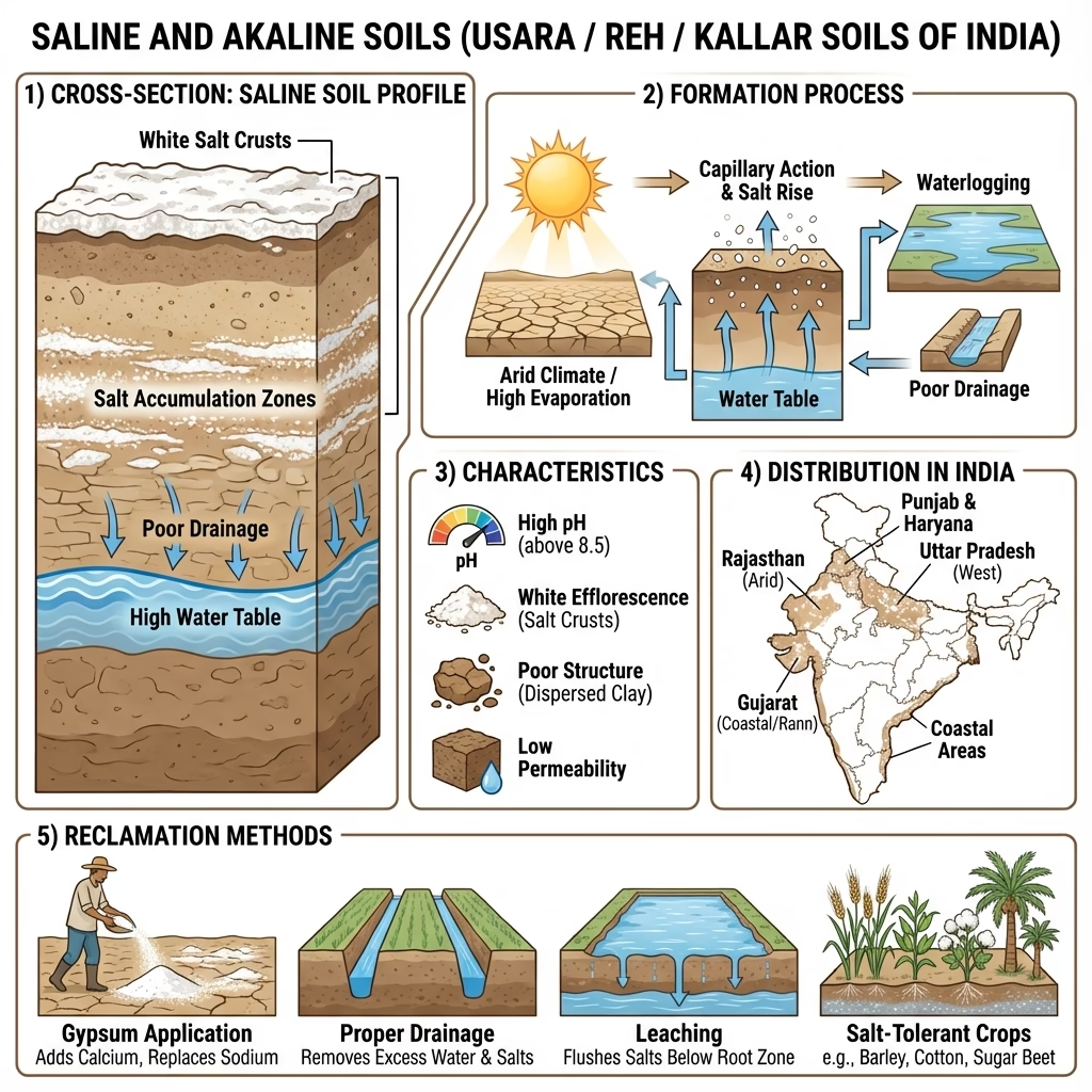
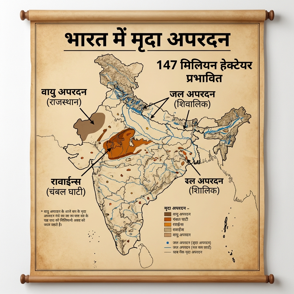
  • Usar & Reh: Local terminologies used in Punjab and Haryana to designate sterile saline-alkaline soil layers brought about by over-irrigation.

Visual & Illustrative Assets


🖼️ Supplemental Asset Directory
  • Comparison: Himalayan vs Peninsular Drainage: Comparison: Himalayan vs Peninsular Drainage
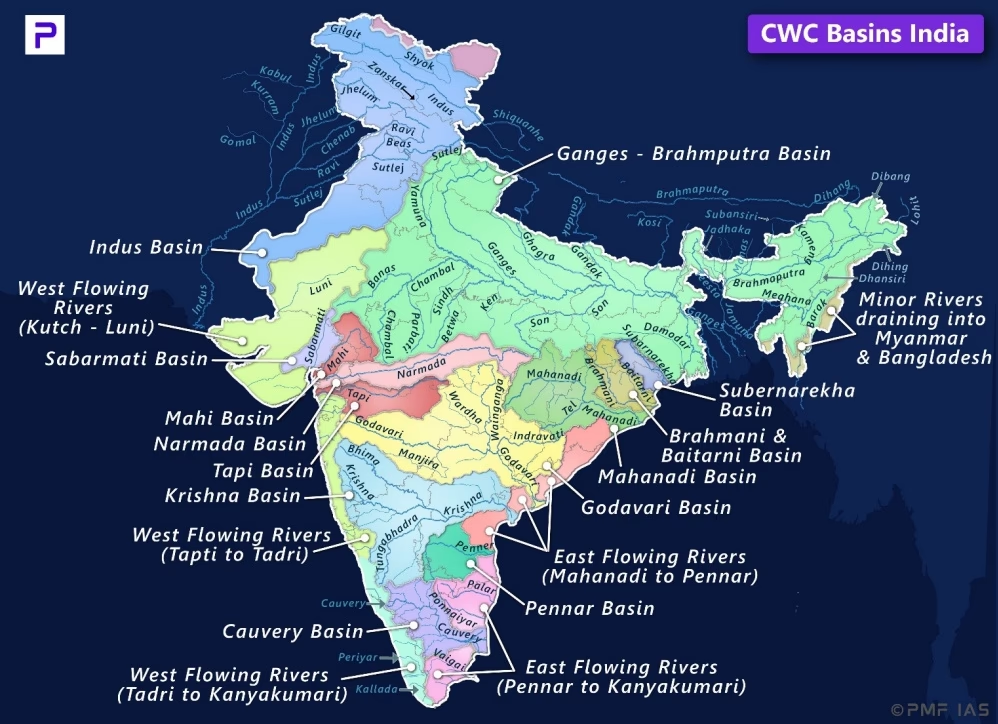
  • Major River Basins of India: Major River Basins of India: Catchment and Flow Dynamics
  • Indus River System (Sindhu Nadi Tantra) Map: Indus River System (Sindhu Nadi Tantra) Map
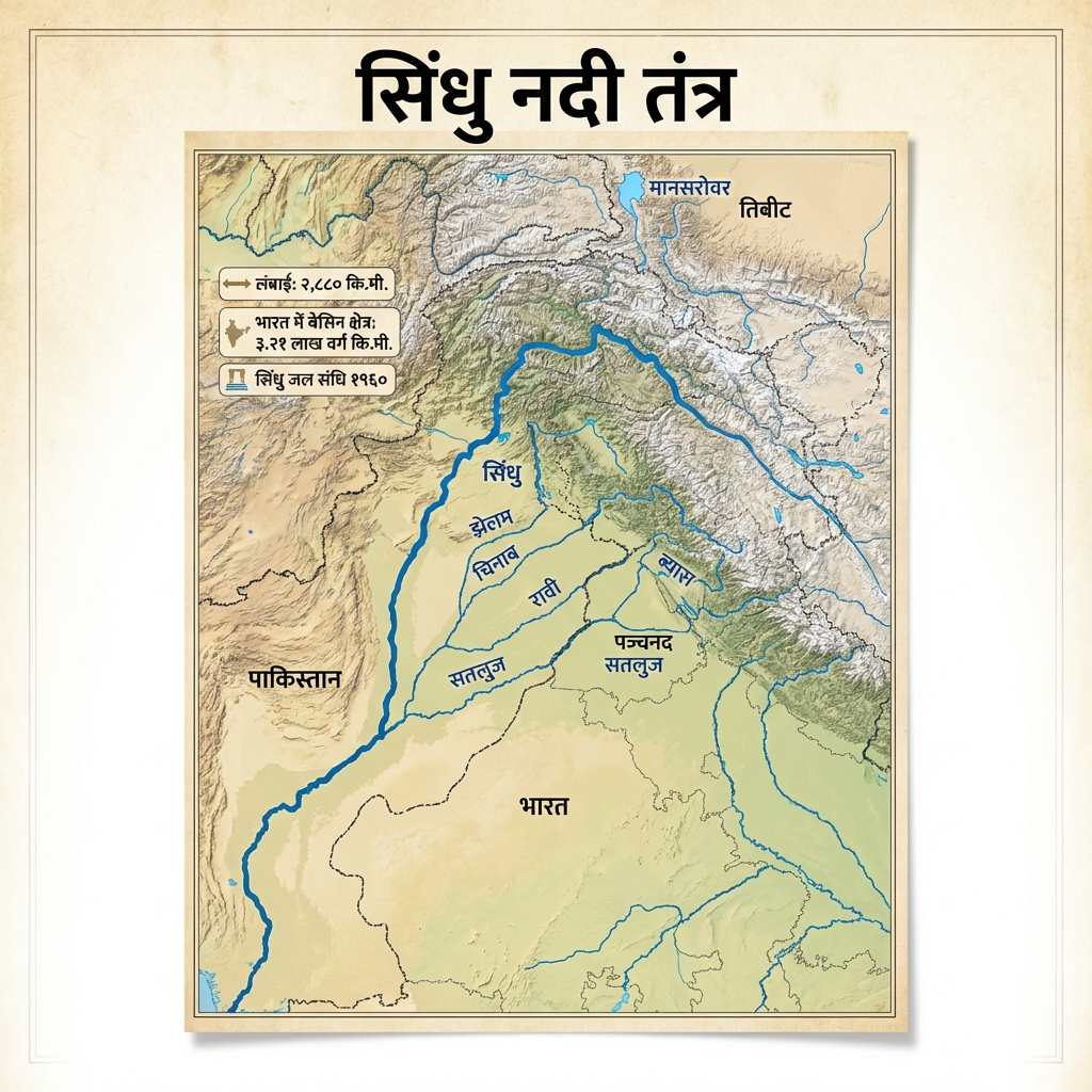
  • Indus River System Map: Indus River System Map
  • Yamuna River Flow and Tributaries: Yamuna River Flow and Tributaries
  • Ganga River System Map: Ganga River System Map
  • Brahmaputra River System Map: Brahmaputra River System Map
  • Godavari River System Map: Godavari River System Map
  • Amarkantak: Source of Narmada River: Amarkantak: Source of Narmada River
  • Narmada River System Map: Narmada River System Map
  • Tapti River Flow and Basin: Tapti River Flow and Basin
  • Krishna River System Map: Krishna River System Map
  • Cauvery River System Map: Cauvery River System Map
  • Mahanadi River System Map: Mahanadi River System Map
  • The Panch Prayag Journey: The Panch Prayag Journey: Sacred Confluences
  • The Indian Monsoon Cycle Summary Map: The Indian Monsoon Cycle: Summary Map
  • Indian Monsoon (Monsoon v3) Mechanism: Indian Monsoon (Monsoon v3) Mechanism
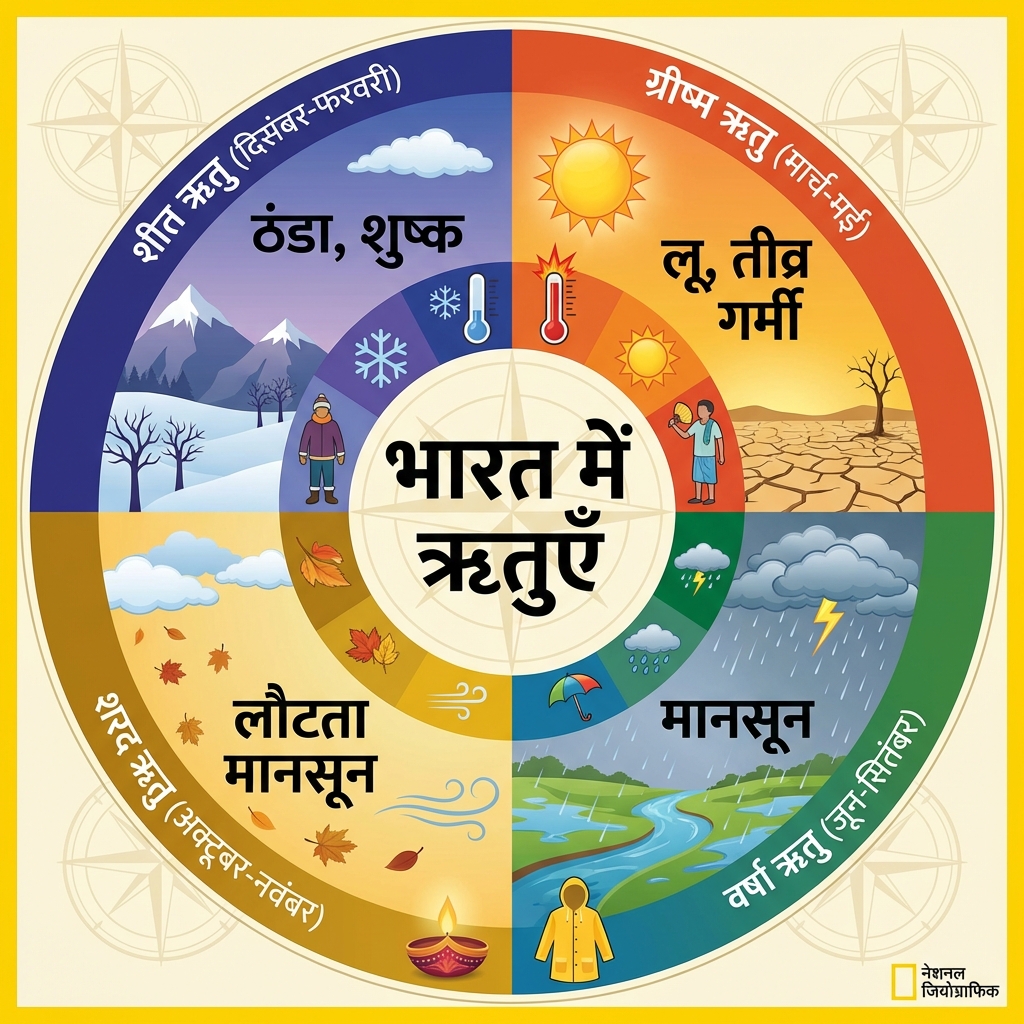
  • Seasons (Rituyen) of India: Seasons (Rituyen) of India
  • Rainfall Distribution (Varsha Vitaran) Map: Rainfall Distribution (Varsha Vitaran) Map
  • Temperature Zones (Taap Kshetra) of India: Temperature Zones (Taap Kshetra) of India
  • Flood Hazard Zones (Badh Kshetra) of India: Flood Hazard Zones (Badh Kshetra) of India
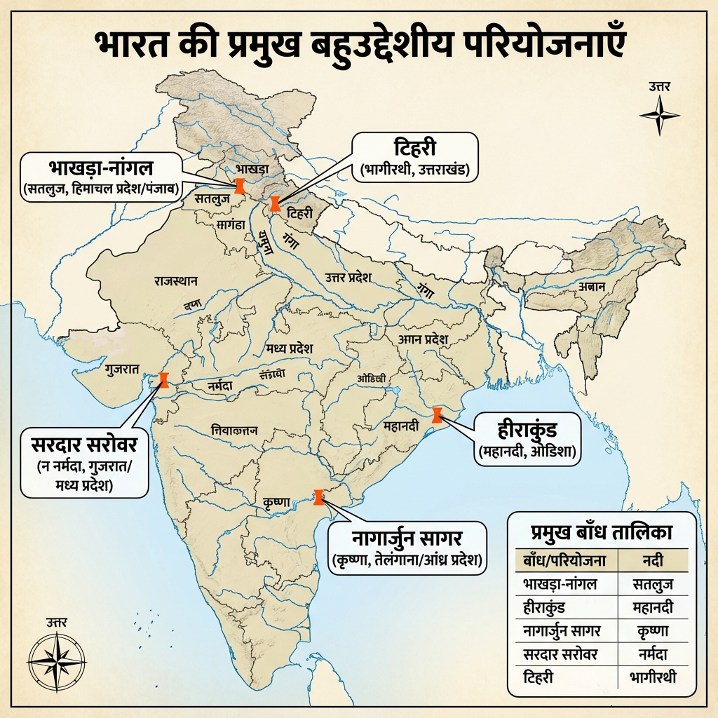
  • Multipurpose Projects (Bahuudeshiya Pariyojnaye) Map: Multipurpose Projects (Bahuudeshiya Pariyojnaye) Map
  • Onset and Withdrawal Dates of the Indian Monsoon: Onset and Withdrawal Dates of the Indian Monsoon

  • Major Soil Orders of India (ICAR): Major Soil Orders of India (ICAR)
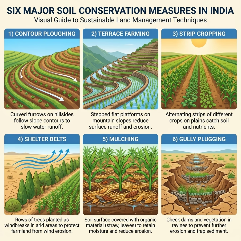
  • Soil Conservation Measures and Techniques: Soil Conservation Measures and Techniques
  • Distribution of Alluvial and Black Soils in India: Distribution of Alluvial and Black Soils in India

  • Saline and Alkaline Soils (Reh/Usar): Saline and Alkaline Soils: Characteristics
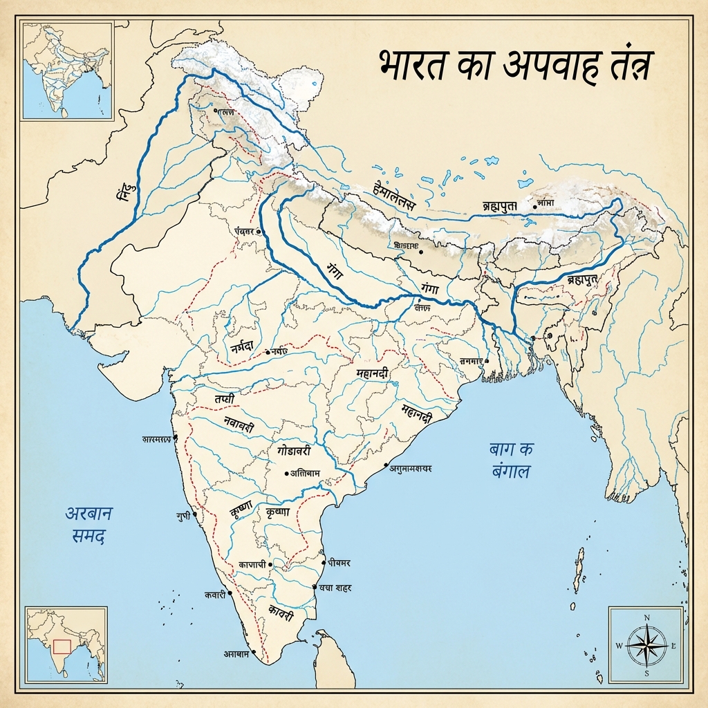
  • India: Major River Systems (Nadi Tantra): India: Major River Systems (Nadi Tantra)
  • Ganga River System (Nadi Tantra) Map: Ganga River System (Nadi Tantra) Map
  • Brahmaputra River System (Nadi Tantra) Map: Brahmaputra River System (Nadi Tantra) Map
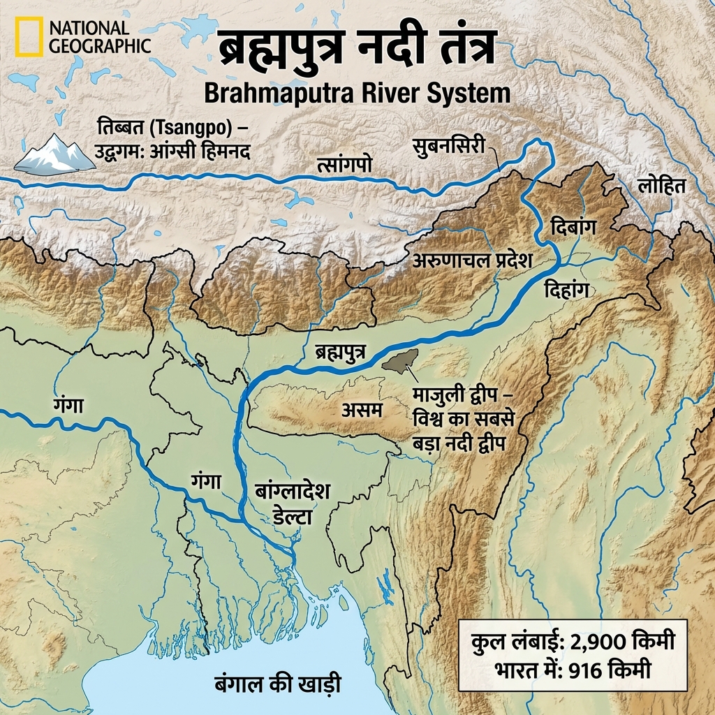
  • Brahmaputra River System v2 Map: Brahmaputra River System v2 Map
  • Indus River System (Sindhu Nadi) v2: Indus River System (Sindhu Nadi) v2
  • Peninsular Rivers (Prayadweepiya Nadiya) Map: Peninsular Rivers (Prayadweepiya Nadiya) Map
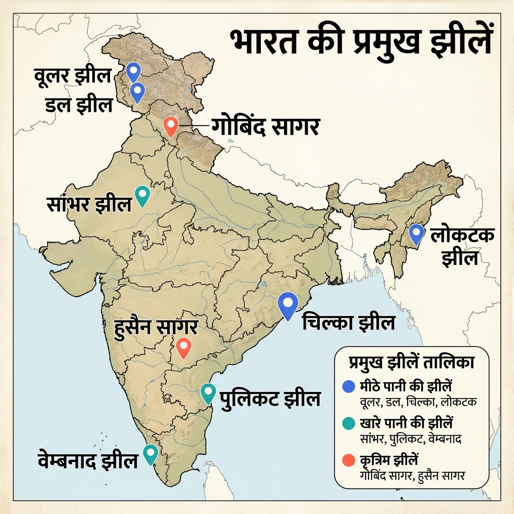
  • Indian Lakes (Bharat Jheelen) Map: Indian Lakes (Bharat Jheelen) Map
  • Himalayan vs Peninsular Rivers: Structural Comparison: Himalayan vs Peninsular Rivers: Structural Comparison
  • River Flow: Narmada Detailed: River Flow: Narmada Detailed
  • River Flow: Mahanadi Detailed: River Flow: Mahanadi Detailed
  • River Flow: Krishna Detailed: River Flow: Krishna Detailed
  • River Flow: Kaveri Detailed: River Flow: Kaveri Detailed
  • River Flow: Godavari Detailed: River Flow: Godavari Detailed
  • East-Flowing Rivers (Purv Nadiya) Map: East-Flowing Rivers (Purv Nadiya) Map
  • West-Flowing Rivers (Paschim Nadiya) Map: West-Flowing Rivers (Paschim Nadiya) Map
  • Monsoon Mechanism (Mansoon Tantra) v2: Monsoon Mechanism (Mansoon Tantra) v2
  • Monsoon Mechanism v3: Monsoon Mechanism v3
  • Climate Factors (Jalvayu Karak) Diagram: Climate Factors (Jalvayu Karak) Diagram
  • Climate Factors v3: Climate Factors v3
  • Rainfall Distribution (Varsha Vitaran) v2: Rainfall Distribution (Varsha Vitaran) v2
  • Rainfall Distribution Minimal: Rainfall Distribution Minimal
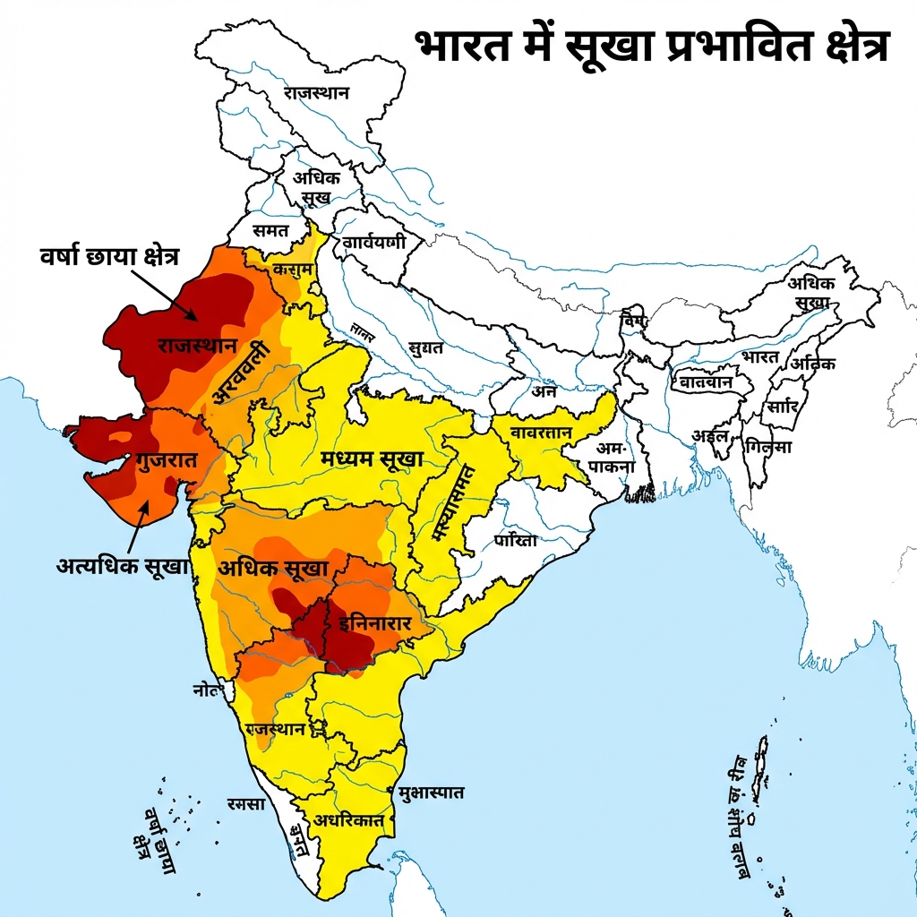
  • Drought Hazard Zones (Sukha Kshetra): Drought Hazard Zones (Sukha Kshetra)
  • Indus System (Sindhu Nadi) v3: Indus System (Sindhu Nadi) v3
  • Brahmaputra v3: Brahmaputra v3
  • River Flow: Godavari (Rajahmundry): River Flow: Godavari (Rajahmundry)
  • River Flow: Kaveri (Thiruvananthapuram Region): River Flow: Kaveri (Thiruvananthapuram Region)
  • River Flow: Brahmaputra Detailed: River Flow: Brahmaputra Detailed
  • River Flow: Ganga Detailed: River Flow: Ganga Detailed
  • Cyclone Hazard v2: Cyclone Hazard v2
  • Cyclone Minimal Mechanics: Cyclone Minimal Mechanics
  • Soil Types (Mrida Prakar) Overview: Soil Types (Mrida Prakar) Overview
  • Alluvial Soil (Jalodh Mrida) Features: Alluvial Soil (Jalodh Mrida) Features
  • Black Soil (Kali Mrida) Characteristics: Black Soil (Kali Mrida) Characteristics
  • Regur/Black Soil (Kali Mrida) v2: Regur/Black Soil (Kali Mrida) v2
  • Laterite Soil (Laterite Mrida) Features: Laterite Soil (Laterite Mrida) Features
  • Soil Erosion (Mrida Apardan) Dynamics: Soil Erosion (Mrida Apardan) Dynamics
Mains Practice Questions


  • "Analyze the factors influencing the Monsoon Mechanism and its impact on Indian agriculture."
  • "Discuss the significance of the River Interlinking Project in addressing regional water stress."
  • "Evaluate the current status of Soil Health in India and its implications for food security."

🎯 UPSC Prelims 2026 Questions & Explanations


Consider the following assertion: In the Pleistocene period either ...Question 1: Consider the following assertion:
In the Pleistocene period either the Yamuna once flowed into the Indus, or the Sutlej flowed into the Yamuna and one major tributary of either had shifted from the Ganga to the Indus or vice versa. Which of the following is/are the basis of the above assertion?
1. The Nadi-Sukta of the Rigveda 2. The explorations of the Sutlej and the Yamuna by Robert Bruce Foote 3. The presence of the same species of dolphins in both the Indus and the Ganga river systems Select the answer using the code given below: (a) 1 only (b) 2 only (c) 1 and 2 (d) 3

Correct Answer: (D)

Key Concepts & Explanation:
Nadi-Sukta lists rivers of the Vedic world — does NOT establish Pleistocene river shifts
To test the analytical and fundamental knowledge
F
India: A History
RR
Partial
Nadi-Sukta Hymn forms part of Rigveda (Mandala-10) — the “River Hymn.” It lists rivers known to the Vedic people from east to west: Ganga, Yamuna, Sarasvati, Shutudri (Sutlej), Parushni (Ravi), Asikni (Chenab), Vitasta (Jhelum) etc.
al
Book by British historian John
https://books.google.so/books?id=0lguM4BrJ4Y\nC&printsec=cop\nyright&utm_source=chatgpt.com#v=onepage&g&f=false
Scholars value the sukta for its empirical geographical markers, which delineate a Vedic horizon spanning the Punjab region and beyond, informing discussions on ancient river courses—particularly the Sarasvati's prehistoric vitality before its aridification—and on the extent of early Vedic geography.
Mainstream interpretations date the hymn to the late Bronze Age, around 1500–1200 BCE. The hymn's poetic theology integrates rivers as cosmic conduits of rta (cosmic order), invoked for protection during fords and floods, thus embodying the Rigveda's fusion of topography, theology, and practical supplication.
https://en.wikipedia.org/wiki/dangles-river-dolphin\nhttps://www.thehindu.com/sci-tech/science/in-dus-and-ganges-river-dolphins-are-two-different-species/article34290646.ece
The Rigveda was composed approximately 1500 BCE — during the Holocene epoch whereas the Pleistocene epoch ended in around 11,700 years ago thus, there is a gap of at least a million years between Pleistocene river shifts and Vedic texts. It shows rivers as they existed in human memory — not as they flowed in prehistory before the Himalayas fully shaped their courses. Robert Bruce Foote - A British geologist (1834–1912), celebrated as the “Father of Indian Prehistory.” His claim to fame: • Discovered India’s first Paleolithic handaxe at Pallavaram, near Madras (Chennai), on 30 May 1863 • Found stone tools at Attirampakkam, Tamil Nadu • Discovered Belum Caves (Andhra Pradesh) in 1884 • Worked primarily in South India and Gujarat — not in Punjab/UP/Yamuna region
He never explored or mapped the Pleistocene drainage dynamics of the Sutlej and Yamuna rivers. His work focused on prehistoric stone tools and archaeology — not on ancient river capture events. Geologists E.H. Pascoe and G.E. Pilgrim studied Siwalik stratigraphy and
Pleistocene drainage changes in the Punjab region.
Same species of freshwater dolphins in both Indus and Ganga river systems
✓ Valid Biogeographic Evidence
Freshwater dolphins in both Indus and Ganga = ancient hydrological connection during Pleistocene
What is the evidence? The South Asian river dolphin — historically classified as Platanista gangetica — exists in both the Ganga river system (India, Nepal, Bangladesh) and the Indus river system (Pakistan).
Why this proves ancient connectivity:
• These dolphins are strictly freshwater species — they cannot survive in marine (salt) water
• The Indus and Ganga river mouths are approximately 4,600 km apart across marine waters
• It is physically impossible for these dolphins to have crossed the ocean to colonise both systems
• The only explanation: the two river systems once shared a common drainage basin — in the Pleistocene, when rivers could move between basins before being separated by tectonic upheaval
Molecular studies show the Ganga and Indus dolphins diverged approximately 550,000 years ago — exactly within the Pleistocene period. One ancestral population colonised both rivers when they were connected, then got separated when river capture events divided the drainage systems. The two river systems hence once shared a common drainage basin — in the Pleistocene, when rivers could move between basins before being separated by tectonic upheaval.
The South Asian river dolphin — historically classified as Platanista gangetica — exists in both the Ganga river system (India, Nepal, Bangladesh) and the Indus river system (Pakistan).
• These dolphins are strictly freshwater species — they cannot survive in marine (salt) water\n• The Indus and Ganga river mouths are approximately 4,600 km apart across marine waters\n• It is physically impossible for these dolphins to have crossed the ocean to colonise both systems.
Therefore, the dolphin evidence is the most scientifically accepted basis for the assertion about Pleistocene river shifts between the Indus and Ganga basins.

Year Asked: Prelims 2026
Identify the river of the Indian sub-continent on the basis of the ...Question 35: Identify the river of the Indian sub-continent on the basis of the following information: 1. It has an antecedent drainage system. 2. It flows through three countries. 3. It originates in the Tibetan Plateau and is an important river for irrigation. 4. It does not form distributaries. Select the answer from the following: (a) Brahmaputra (b) Indus (c) Sute (d) Teesta

Correct Answer: (C)

Key Concepts & Explanation:
The Satluj originates in the 'Raksastal' near Mansarovar at an altitude of 4,555 m in Tibet where it is known as Langchen Khambab. It flows almost parallel to the Indus for about 400km before entering India, and comes out of a gorge at Rupar. It passes through the Shipki La on the Himalayan ranges and enters the Punjab plains. It is an antecedent river. It is a very important tributary as it feeds the canal system of the Bhakra Nangal project. Hence option (c) is the correct answer.
Conceptual
E
F
Page 21, Chapter-3, Drainage System, NCERT
EM
VisionIAS AITS 2026: Test 6339 At which one of the following places do three important rivers of antecedent rivers of India originate; while one of them flows towards east and merges with an important river flowing towards Bay of Bengal, the second river is the largest tributary of the third river which flows towards Arabian Sea? (a) Amarkantak (b) Kailash mountain range (c) Kumaon Himalayas (d) Trimbakeshwar EXPLANATION: (all the options given in UPSC Question could be solved) Kailash mountain range is the correct answer, as the Brahmaputra, Satluj, and Indus rivers originate from this region. The Brahmaputra (also known as Tsangpo in Tibet and Jamuna)
Compl. ete

Year Asked: Prelims 2026
With reference to the climate of Andaman and Nicobar Islands, which...Question 23: With reference to the climate of Andaman and Nicobar Islands, which of the following statements is/are correct?

Correct Answer: (B)

Key Concepts & Explanation:
Statement 1 is correct: The islands have a tropical climate with warm summers and not so chill winters.
To check conceptual understanding
E
F
NCERT Class XI India: Physical Environment, chapter-4.
EM
Vision1AS AITS 2026: Test 6337 Consider the following pairs: Region: Predominant natural vegetation. 1. Rajasthan Plains: Tropical Thorn Forest. 2. Andaman & Nicobar Islands: Tropical Evergreen Forest. 3. Meghalaya Plateau: Temperate Dry Deciduous. How many of the above pairs are correctly matched? EXPLANATION The Andaman & Nicobar Islands are located in the equatorial belt. They receive heavy rainfall (exceeding 250 cm) and high temperatures around. This leads to the growth of dense Tropical Evergreen Forests. These forests are characterized by a multi-layered structure with a thick canopy that prevents sunlight

Year Asked: Prelims 2026
Consider the following statements regarding the Indus, Sutlej, and Brahmaputra...Question 36: Consider the following statements regarding the major river systems of Northern India:
1. The Indus River flows past Leh on its right bank, and the Nimoo Bazgo Dam is an important hydroelectric project constructed on it in Ladakh.
2. The Sutlej River, which rises from Rakas Lake near Mansarovar in Tibet, enters India through the Shipki La pass and is an antecedent river.
3. The Brahmaputra River originates in the Chemayungdung glacier as the Tsangpo, carves a deep gorge near Namcha Barwa, and enters India through Arunachal Pradesh as the Dihang.
Which of the statements given above are correct?
(a) 1 and 2 only
(b) 2 and 3 only
(c) 1 and 3 only
(d) 1, 2 and 3

Correct Answer: (D)

Key Concepts & Explanation:
All statements are correct:
- **Indus River**: A 2,880 km antecedent river rising near Bokhar Chu in Tibet (known as 'Singi Khamban'). In India, it flows through Ladakh, and the town of Leh is situated on its right bank. The Nimoo Bazgo Dam is located on the Indus in Leh.
- **Sutlej River**: Rises from Rakas Lake near Mansarovar as the Longcchen Khabab in Tibet. It is an antecedent river that cuts through the Himalayas, entering India via the Shipki La pass. It feeds the Bhakra-Nangal project canal system.
- **Brahmaputra River**: Originates at the Chemayungdung glacier near Mansarovar in Tibet, where it is called the Tsangpo. It flows eastwards, carves a deep gorge around Namcha Barwa, turns south-southwest to enter India (Arunachal Pradesh) as the Siang or Dihang, and becomes the Brahmaputra after joining the Dibang and Lohit in Assam.

Year Asked: Prelims 2026
High-Yield Rapid Revision Additions
Detail the origin, tributaries, and final confluence of the Barak River.Barak River:
  • Origin: Originates in Manipur.
  • Tributaries: Makku, Trang, Tuivai, Jiri, Sonai, Rukni, Katakhal, and Dhaleswari.
  • Confluence: Flows into Bangladesh, eventually joining the combined waters of the Ganga and Brahmaputra near Bhairab Bazar.
What name is the River Ganga known by in Bangladesh after joining the Brahmaputra?Padma River:
The Ganga is known as the **Padma** in Bangladesh.
Identify the major inland drainage rivers of India.Inland Drainage Rivers:
Luni, Machhu, Rupen, Saraswati, Banas, and Ghaggar.
Which river has the second largest basin in India?Godavari (Dakshin Ganga):
Has the second largest river basin in India after the Ganga.
Identify major west-flowing rivers that flow through rift valleys.West-Flowing Rift Valley Rivers:
Narmada and Tapi.
Explain the allocation of rivers and operational rights under the Indus Waters Treaty (1960).Indus Waters Treaty (1960):
  • Administered by the Indus Wing of the Department of Water Resources.
  • Eastern Rivers (Ravi, Beas, Sutlej): Allocated to India for unrestricted use.
  • Western Rivers (Indus, Jhelum, Chenab): Shared; allocated to Pakistan, but India is permitted domestic, agricultural, and non-consumptive run-of-the-river hydropower use with specified storage designs.
  • Oversight: Monitored by the Permanent Indus Commission (comprising commissioners from both nations).