Indian Transport, Society & Boundaries
Transport Networks & Connectivity Infrastructure
Road & Rail Transport Infrastructure
Road & Rail Transport Infrastructure
| Cue Words | Notes |
|---|---|
| Summarize the scale and key networks of India's road system. | Road Transport Connectivity:
|
| Trace the history and modern development of Indian Railways. | Railways & Cargo Logistics:
|
Maritime, Port-Led Development & Airways
Maritime, Port-Led Development & Airways
| Cue Words | Notes |
|---|---|
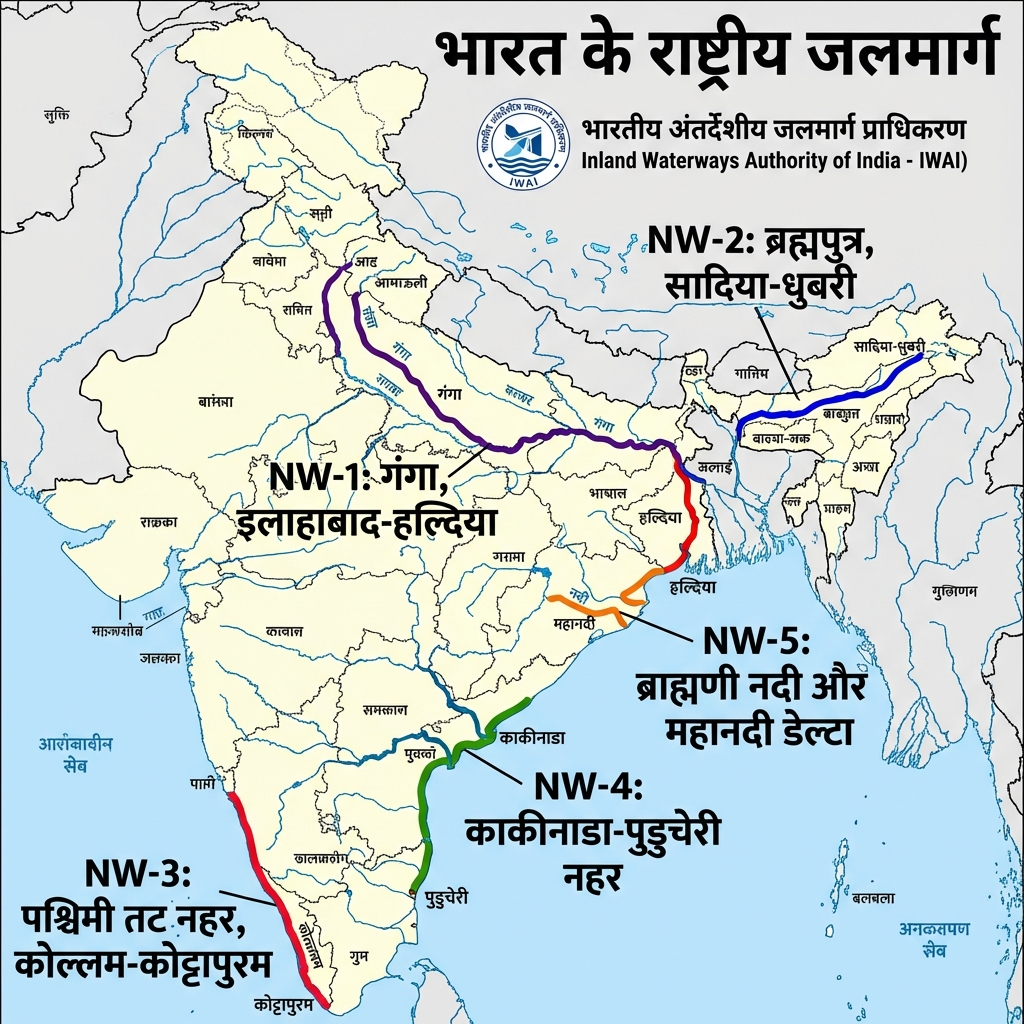
| Identify the longest National Waterway and key Indian ports. | Waterways & Maritime Ports:
|
Demography, Ethnography & Borders
Population Dynamics & Demographic Benchmarks
Population Dynamics & Demographic Benchmarks
| Cue Words | Notes |
|---|---|
| Outline the core demographic benchmarks of India based on Census 2011. | Census 2011 Benchmarks:
|
Ethnography & Major Tribal Communities
Ethnography & Major Tribal Communities
| Cue Words | Notes |
|---|---|
| Name key tribal groups in India and their respective regions. | Indian Ethnography:
|
| Name notable global tribal communities and their environments. | Global Ethnography:
|
International Boundaries & Strategic Frontiers
International Boundaries & Strategic Frontiers
| Cue Words | Notes |
|---|---|
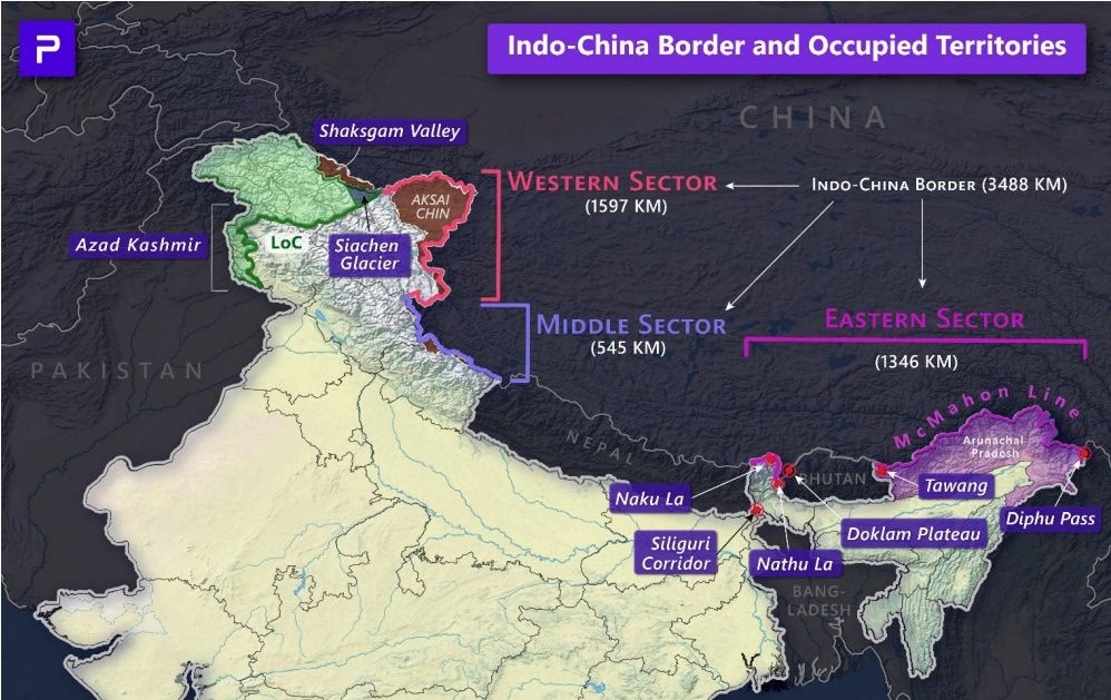
| Detail the strategic boundaries and disputed areas bordering India. | Border Geopolitics:
|
High-Yield UPSC Revision Pointers
- Atal Tunnel: Running under the Rohtang Pass on the Leh-Manali Highway (9.02 km long), it is the world's longest single-tube highway tunnel above an altitude of 10,000 feet.
- Kolkata Metro: Commencing commercial operations in 1984, it was India's first rapid transit system.
- Muga Silk GI Tag: Highly prized golden silk produced exclusively by the silk moth Antheraea assamensis, endemic to Assam.
- Standard Meridian: Bounded at longitude, which passes through Mirzapur (UP) and acts as the baseline for Indian Standard Time.
🚉 Konkan Railway: Engineering Feat
- Konkan Railway: A 741-km railway line built by Konkan Railway Corporation Limited (est. 1990) connecting Roha (Maharashtra) to Thokur near Mangaluru (Karnataka), traversing Maharashtra, Goa, and Karnataka along the geologically challenging Western Ghats/coastal terrain.
- Engineering Challenges: Involves over 2,000 bridges and nearly 100 tunnels (including the Karbude Tunnel, one of India's longest), built across a landslide-prone, high-rainfall, seismically active coastal corridor.
Visual & Illustrative Assets
🖼️ Supplemental Asset Directory
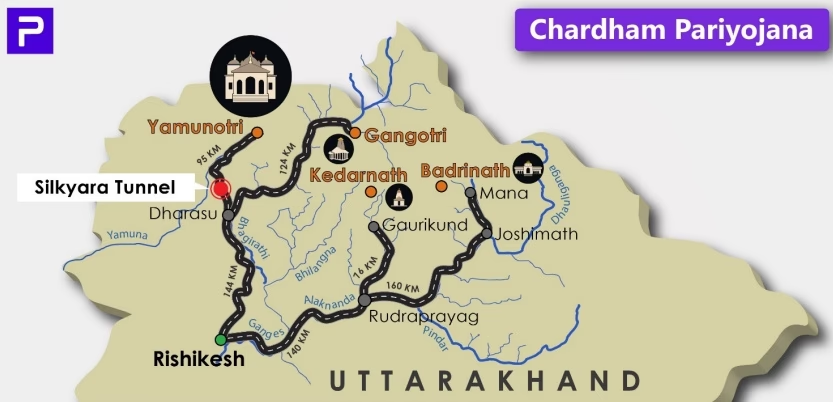
- Char Dham Pariyojana (Strategic Connectivity):
- National Waterways (Bharat Jalmarg) Map:
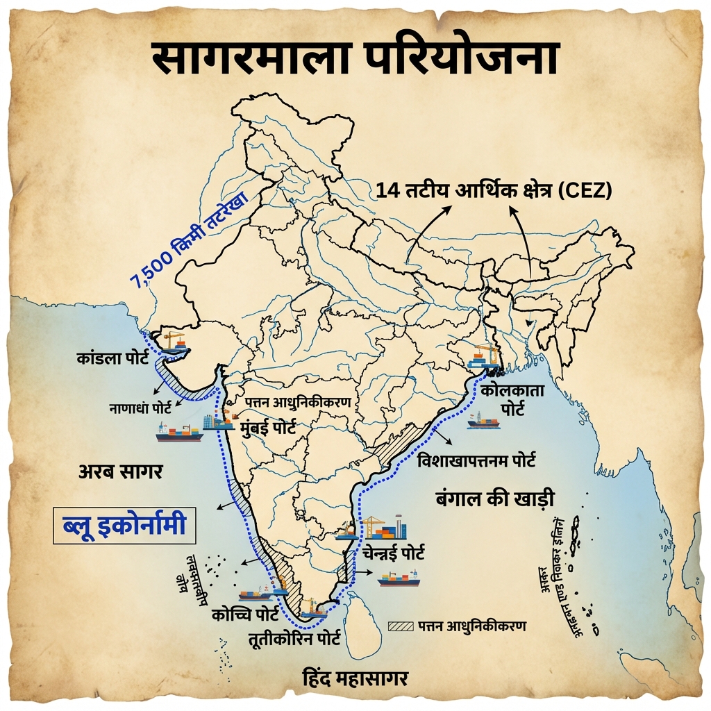
- Sagarmala Project (Port-led Development):
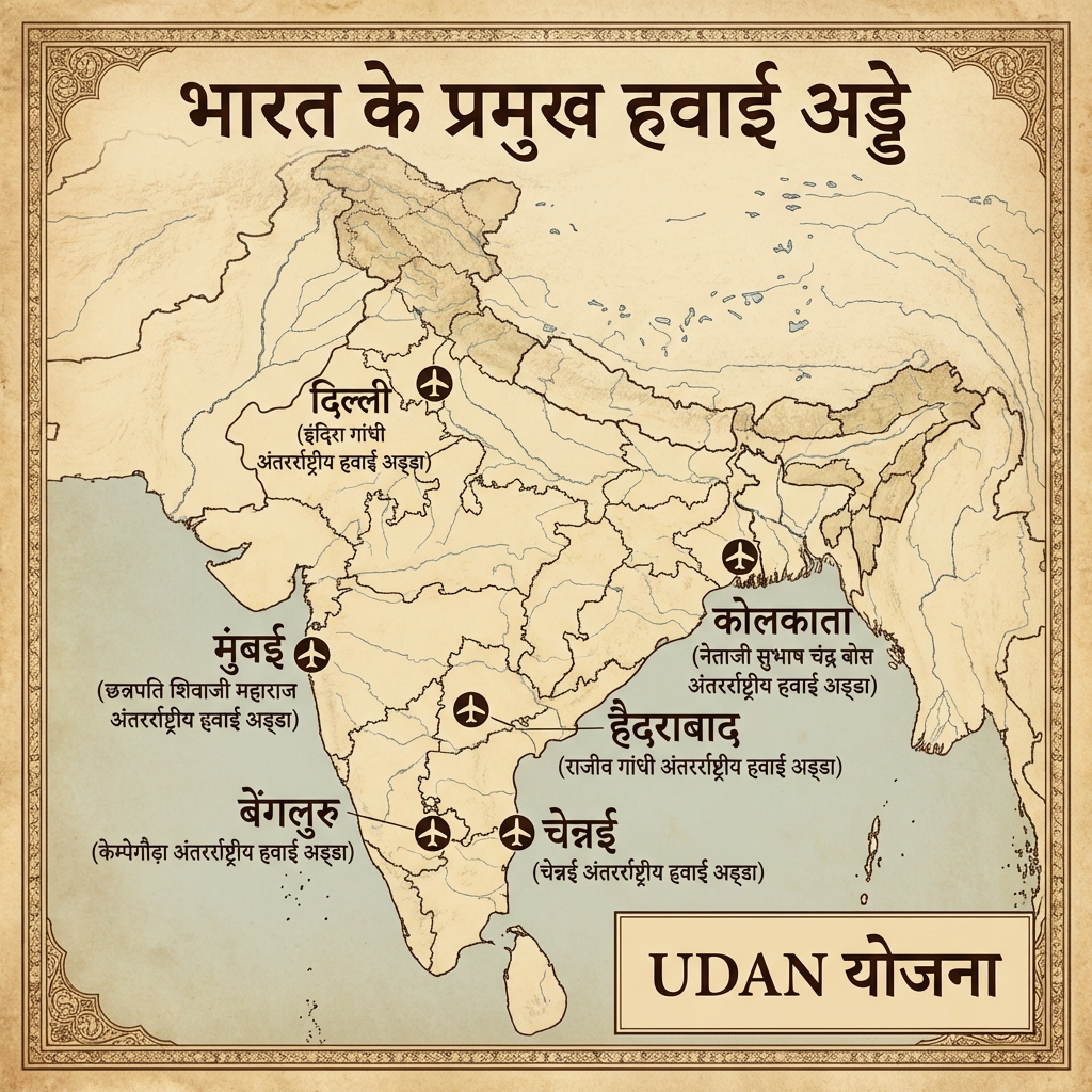
- Major Airports of India:
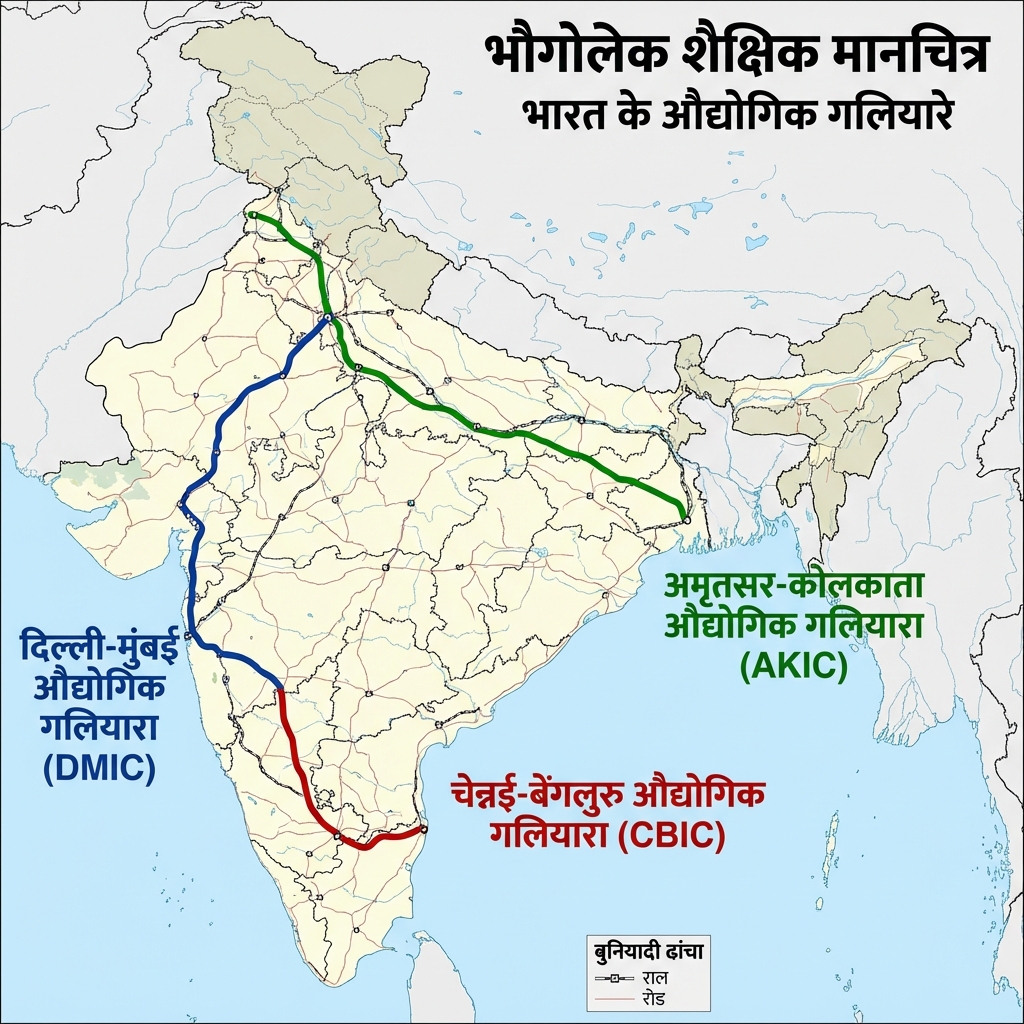
- Industrial Corridors Map:
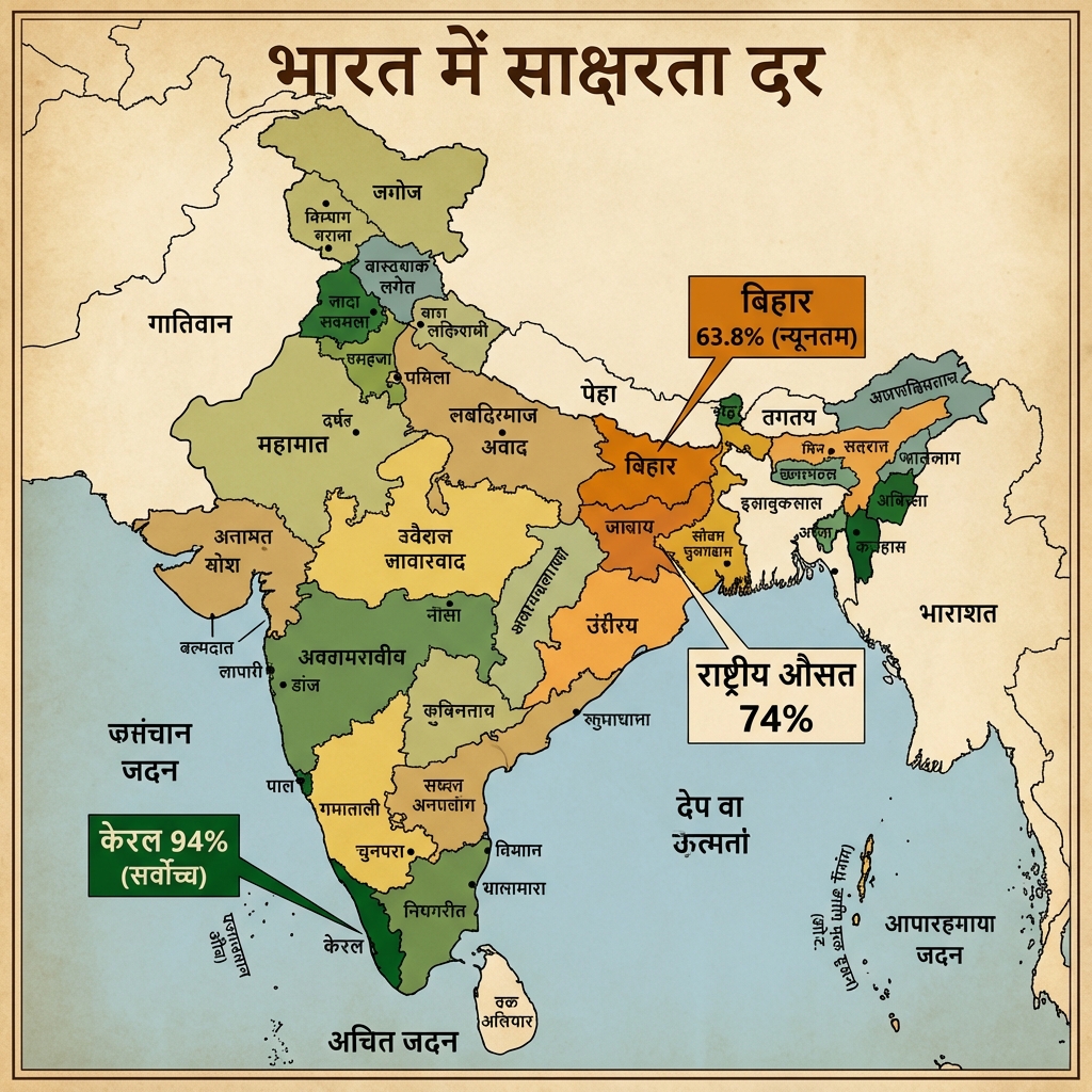
- Literacy Rate (Saksharta Dar) Map:
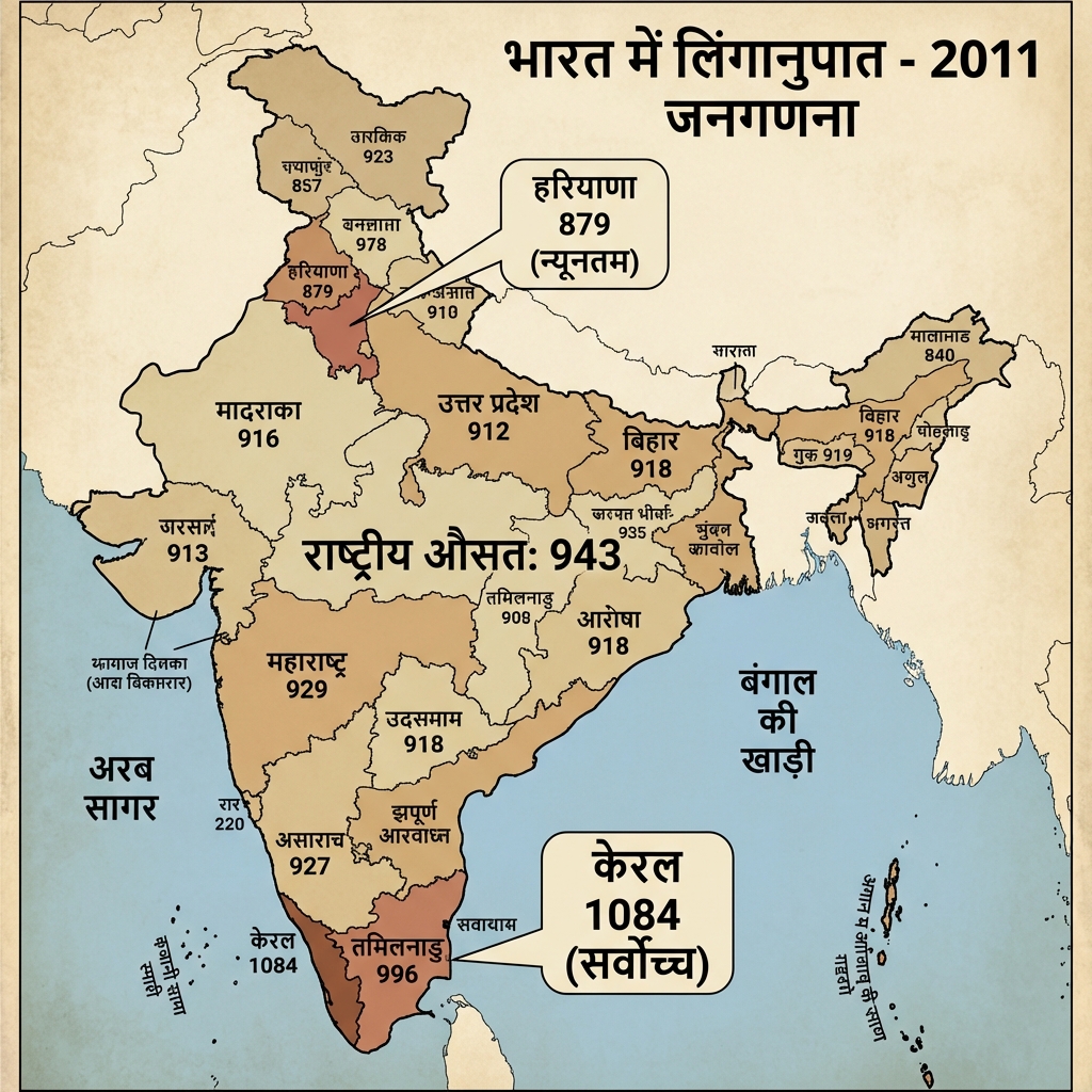
- Sex Ratio (Linganupat) Map:
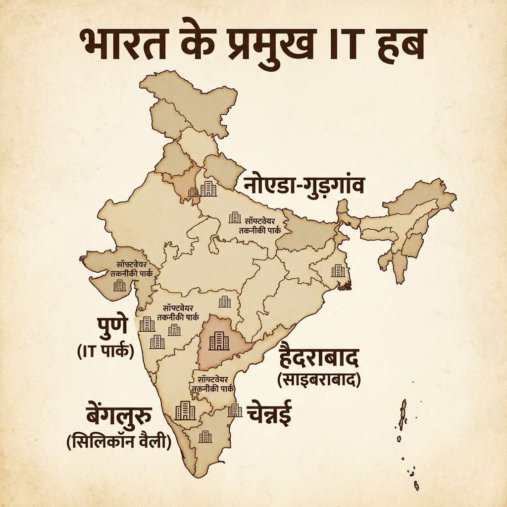
- Information Technology Map:
- Social Geography (Backward Classes Distribution):
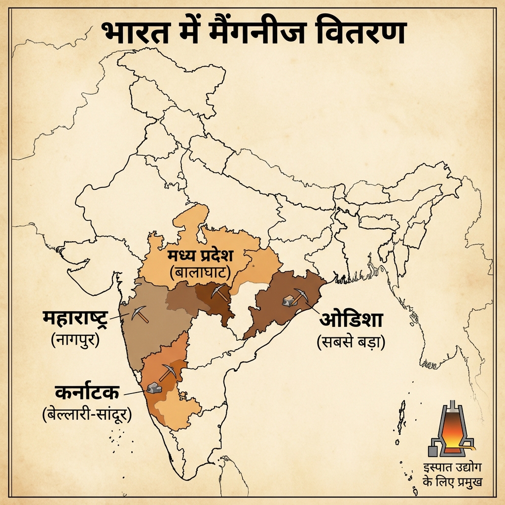
- India's International Boundaries (Historical):
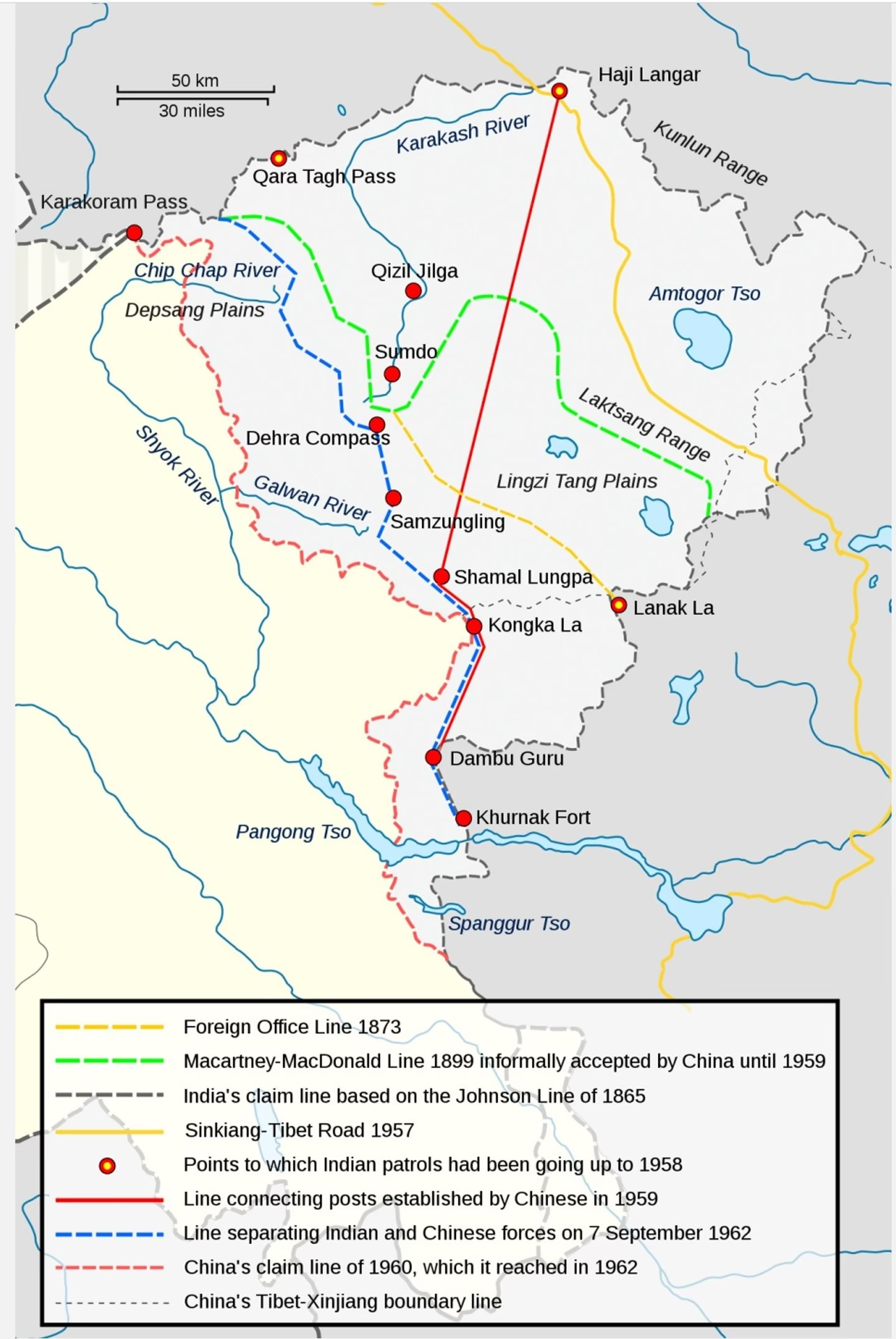
- India Frontiers and Bordering Countries:
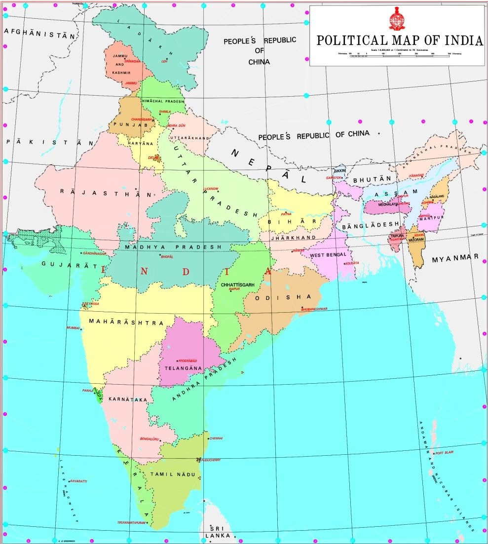
- Strategic Regions (J&K, Ladakh):
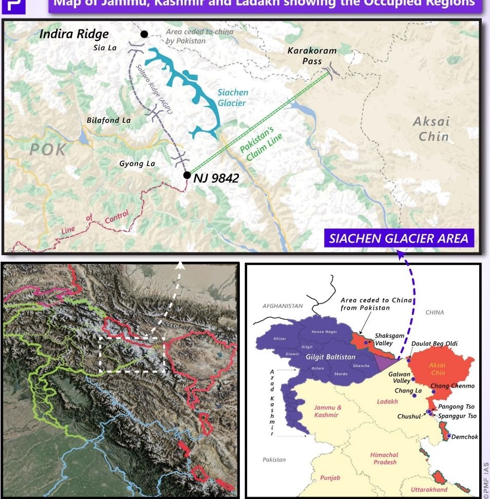
- LAC Sectors Map (Western, Middle, Eastern):
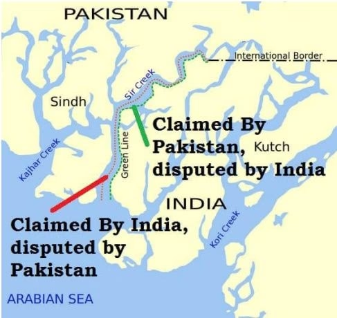
- Sir Creek Disputed Boundary in Kutch:
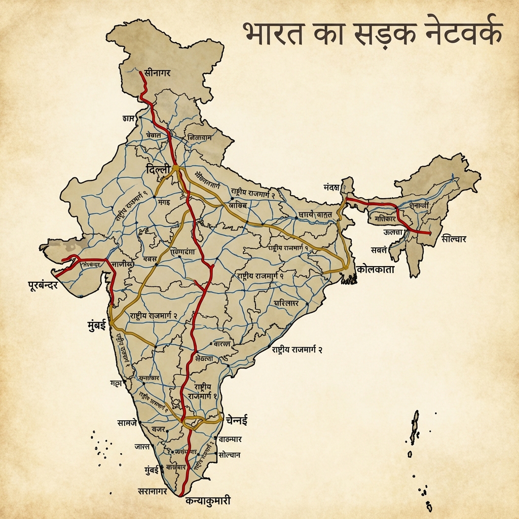
- Indian Road Network Map:
- Indian Railway Network Map:
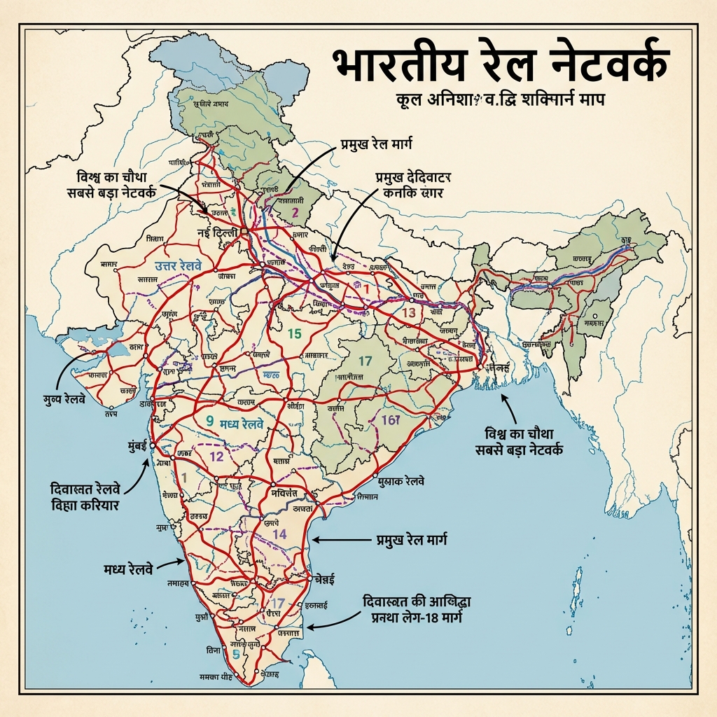
- Railway Zones & Headquarters Map:
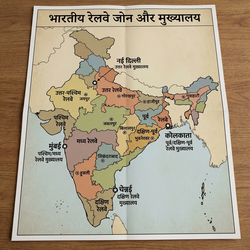
- Major Ports Map:
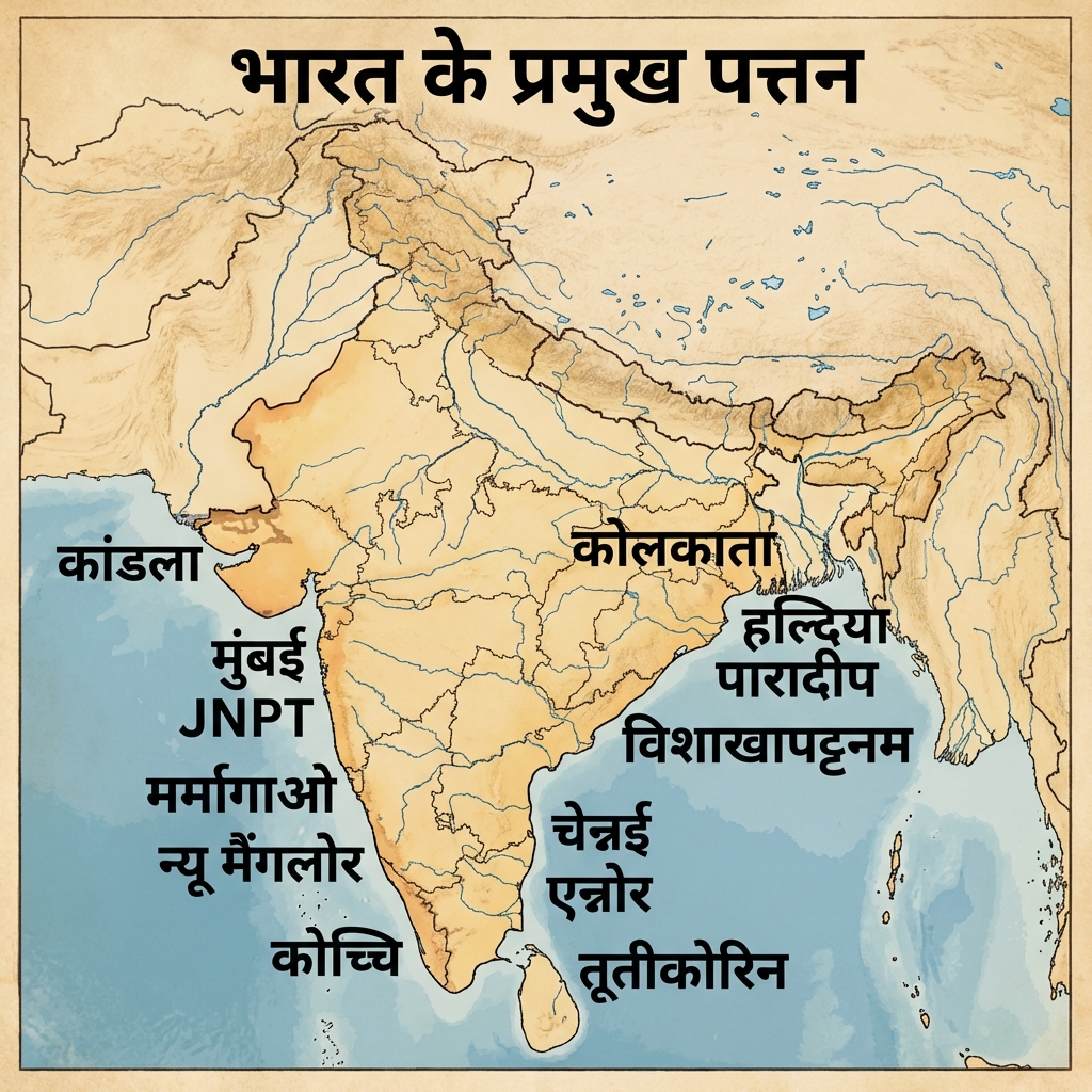
- Pipeline Network of India Map:
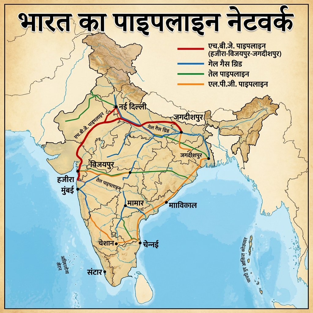
- Telecommunication Network Map:
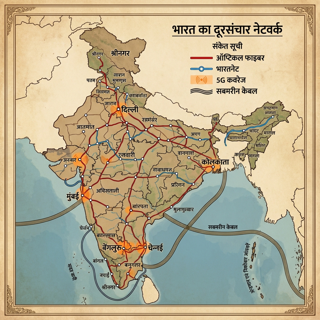
- Population Distribution Map:
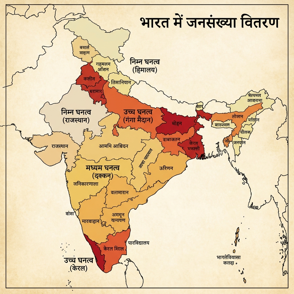
- Population Growth Map:
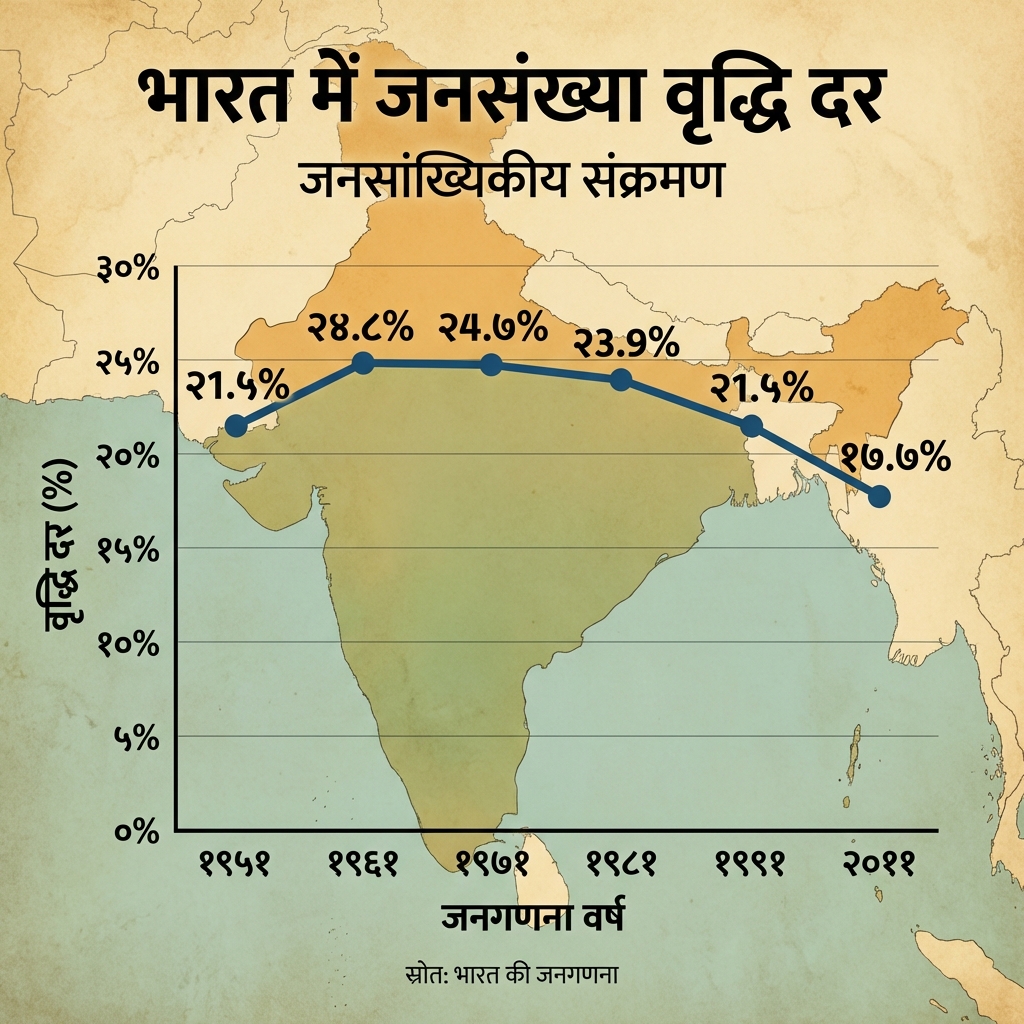
- Language Distribution Map:
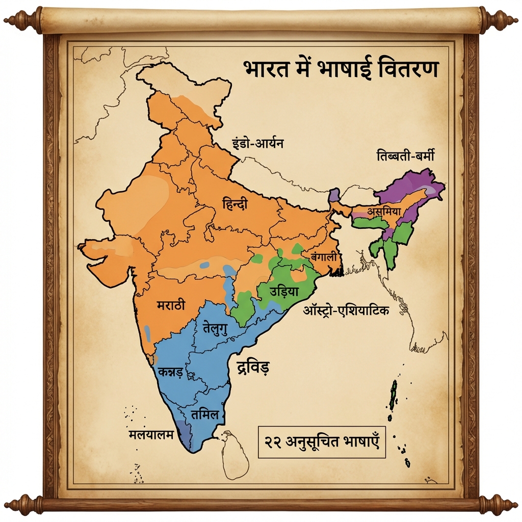
- Religious Distribution Map:
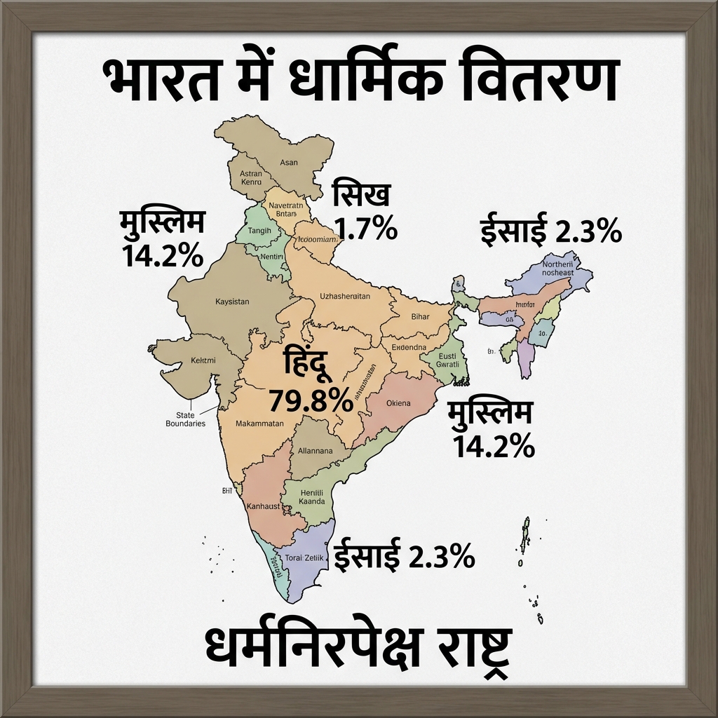
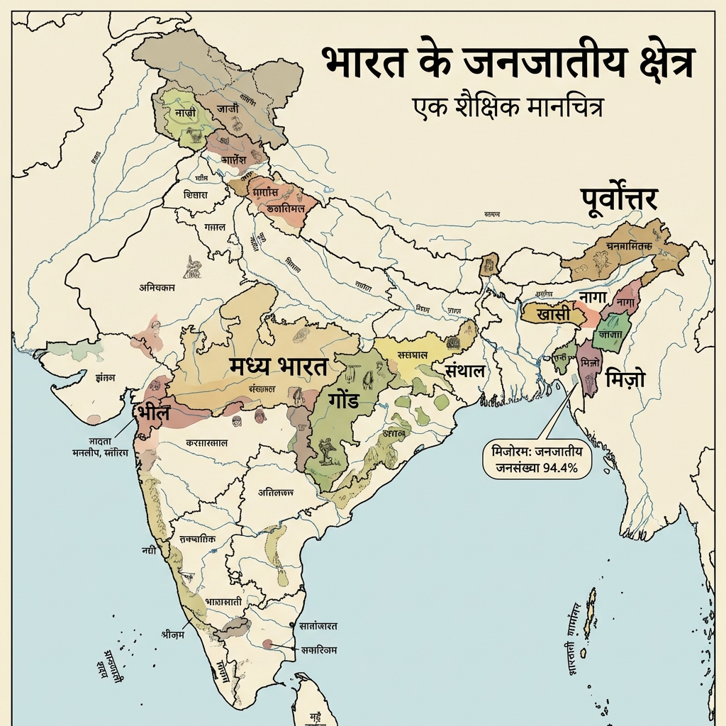
- Tribal Areas Map:
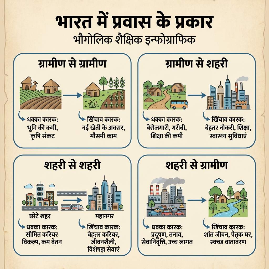
- Migration Types Diagram:
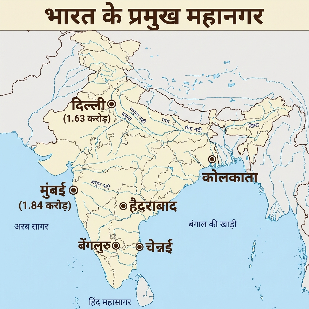
- Major Metropolises Map:
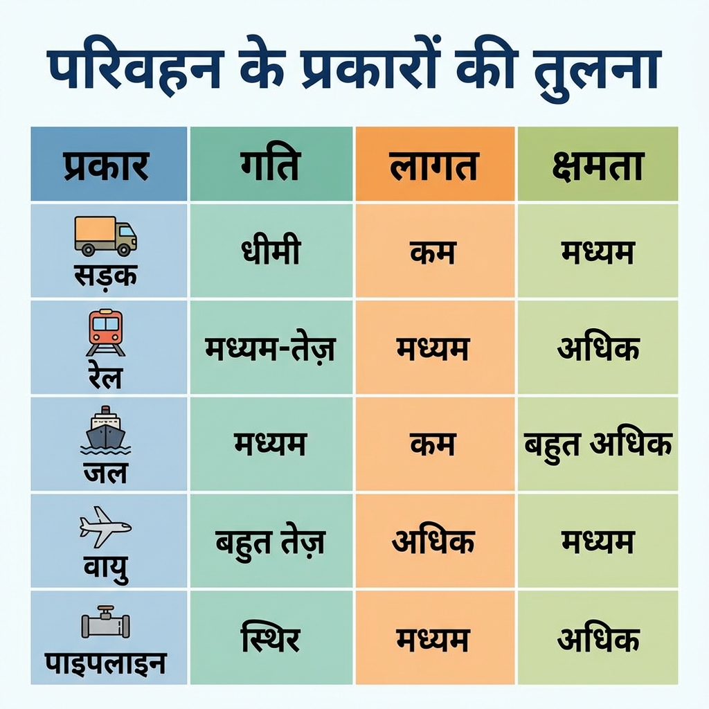
- Transport Modes Comparison:
Mains Practice Questions
- "Analyze the significance of the Sagarmala Project in enhancing India's port-led development."
- Discuss the demographic challenges posed by the Census 2011 data for India's future planning.
- "Examine the role of the Border Roads Organisation (BRO) in maintaining strategic connectivity in high-altitude regions."